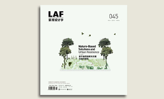
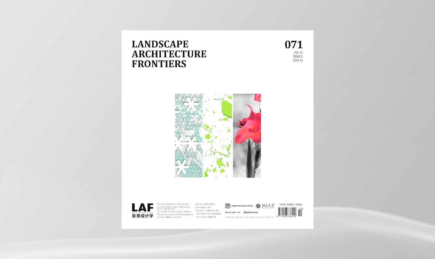
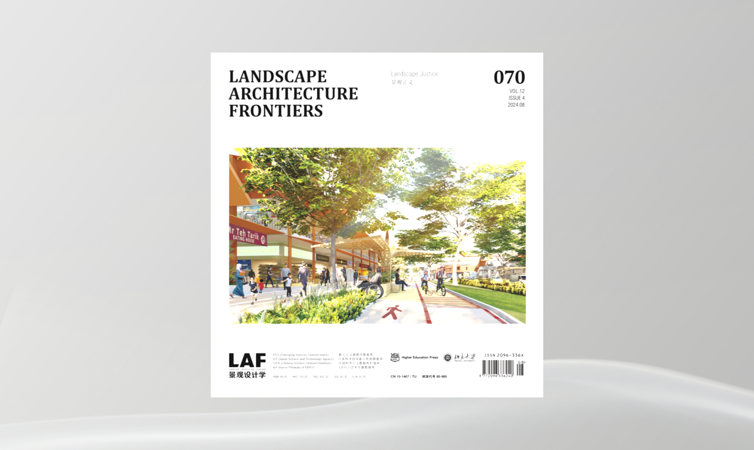
廣州市南沙區(qū)農(nóng)業(yè)區(qū)域海平面上升應(yīng)對(duì)策略
Resilience Strategies to Impacts of Sea Level Rise on the Agricultural Areas in Nansha District of Guangzhou
作者:陳崇賢,夏宇���,楊瀟豪 CHEN Chongxian, XIA Yu, YANG Xiaohao
摘要
海平面上升將造成低地淹沒���、風(fēng)暴潮加劇���、海岸侵蝕等一系列生態(tài)環(huán)境影響。珠江三角洲地區(qū)農(nóng)業(yè)系統(tǒng)發(fā)達(dá)���,洪澇災(zāi)害頻繁���;鑒于粵港澳大灣區(qū)建設(shè)的重要性及其所面臨的海岸災(zāi)害的高風(fēng)險(xiǎn)性,針對(duì)該地區(qū)農(nóng)業(yè)用地受海平面上升和風(fēng)暴潮災(zāi)害影響的研究十分必要���。
本研究以廣州市南沙區(qū)農(nóng)業(yè)區(qū)域?yàn)閷?duì)象���,采用“源-途徑-受體-影響”框架構(gòu)建農(nóng)業(yè)區(qū)域脆弱性評(píng)估模型,以暴露度���、敏感性和適應(yīng)性為基礎(chǔ)構(gòu)建評(píng)估指標(biāo)體系���,并基于ArcGIS平臺(tái)定量化評(píng)估未來海平面上升和風(fēng)暴潮對(duì)研究區(qū)域潛在的淹沒風(fēng)險(xiǎn)、經(jīng)濟(jì)損失及其脆弱性空間分布特征���。結(jié)果表明���,在最低災(zāi)害風(fēng)險(xiǎn)預(yù)景和最高災(zāi)害風(fēng)險(xiǎn)預(yù)景下���,南沙區(qū)農(nóng)業(yè)區(qū)域淹沒面積占比分別為73.38%和87.96%,經(jīng)濟(jì)損失分別為389 738.55萬元和714 049.79萬元���;南沙中部地區(qū)的農(nóng)業(yè)區(qū)域淹沒風(fēng)險(xiǎn)較大���,但北部和南部的農(nóng)業(yè)區(qū)域脆弱性較高���。研究進(jìn)一步提出���,未來可以通過防御、適應(yīng)及遷移等一系列應(yīng)對(duì)策略降低南沙農(nóng)業(yè)區(qū)域的受災(zāi)風(fēng)險(xiǎn)和損失���。
關(guān)鍵詞
海平面上升���;沿海農(nóng)業(yè)區(qū)域;脆弱性評(píng)估���;應(yīng)對(duì)策略���;防御���;適應(yīng);遷移
Abstract
It evinces that sea level rise aggravates low-lying terrain inundation, storm surges, beach erosion, and other ecological damages. The developed agricultural system in the Pearl River Delta is at a high risk to floods; and, in light of the tactical significance of the Guangdong-Hong Kong-Macao Greater Bay Area and its high vulnerability to sea level rise and storm surges, it urgently requires to study their impacts on the agricultural areas in this region.
Taking Nansha District, Guangzhou City, Guangdong Province, China as the study area, this study builds a vulnerability evaluation model of agricultural areas with the Source-Pathway-Receptor-Consequence framework using an indicator system upon exposure, sensibility, and adaptation, and quantitatively predicts the inundation risk level, financial loss, and vulnerability patterns of varied scenarios of sea level rise superimposed with storm surges with the ArcGIS. The main findings include 1) the stimulated proportion of inundated areas in minimum-risk and maximum-risk scenarios is 73.38% and 87.96% respectively, and the estimated financial loss in both scenarios is RMB 3,897.3855 million and 7,140.4979 million, respectively; 2) the central Nansha will suffer from a higher inundation risk, and the northern and southern agricultural parts within the study area have a higher vulnerability to flood disasters. Resilience strategies—through defense, adaptation, or relocation—for each vulnerable zone are then proposed accordingly.
Keywords
Sea Level Rise; Coastal Agricultural Area; Vulnerability Evaluation; Resilience Strategy; Defense; Adaptation; Relocation
小尺度公園對(duì)于城市熱島效應(yīng)的緩解作用——基于南京市中心城區(qū)社區(qū)公園的實(shí)證研究
Mitigation of Urban Heat Island Effect with Small-Scale Parks—An Empirical Study on Community Parks Iin Nanjing, Jiangsu Province
作者:肖逸���,戴斯竹���,趙兵 XIAO Yi, DAI Sizhu, ZHAO Bing
摘要
城市化快速發(fā)展加劇了城市熱島效應(yīng),而城市綠地能夠發(fā)揮重要的微氣候調(diào)節(jié)功能���。為探究小尺度公園的面積與形狀對(duì)熱島效應(yīng)的緩解作用���,本文以江蘇省南京市中心城區(qū)的社區(qū)公園為例,選取2019年Landsat 8-OLI遙感影像數(shù)據(jù)進(jìn)行地表溫度反演���,借助ArcGIS 10.4識(shí)別52個(gè)社區(qū)公園���,并以核建筑密度估計(jì)法對(duì)社區(qū)公園進(jìn)行分類,探討緩解城市熱島效應(yīng)的最佳社區(qū)公園面積閾值和形狀規(guī)律���。結(jié)果表明:1)隨著社區(qū)公園緩沖帶距離的增加���,降溫強(qiáng)度逐漸減弱���,降溫范圍多在0~180m;2)面積���、形狀���、歸一化植被指數(shù)是影響公園降溫強(qiáng)度的重要因素;3)高核建筑密度的社區(qū)公園降溫強(qiáng)度更佳���,且面積閾值(0.848hm2)大于低核建筑密度的社區(qū)公園(0.384hm2);4)社區(qū)公園形狀趨于圓形或正方形時(shí)���,降溫效果顯著���。因此,在城市綠地系統(tǒng)規(guī)劃層面���,建議在高建筑密度區(qū)域合理規(guī)劃小尺度的公園綠地���,精細(xì)化的存量設(shè)計(jì)與管理有助于發(fā)揮城市區(qū)域的最佳生態(tài)效益���,能更好地緩解局部熱島效應(yīng)。
關(guān)鍵詞
社區(qū)公園���;基于自然的解決方案���;城市熱島效應(yīng);微氣候調(diào)節(jié)���;實(shí)證研究
Abstract
Cities have suffered from urban heat island (UHI) effect due to rapid urbanization, which can be effectively adjusted by urban green space. Taking the community parks in central area of Nanjing, Jiangsu Province as an example, this paper explored the size and shape of small-scale parks to mitigate the UHI effect. Land surface temperature was retrieved from Landsat 8-OLI remote-sensing image of 2019. The 52 studied community parks were identified with ArcGIS 10.4, and classified by kernel building density. The threshold-size and optimal shape of community parks to mitigate UHI effect were then discussed. The results showed that 1) with the increase of buffer ring distance around the community parks, the cooling intensity decreased and the cooling extent were mostly less than 180 m; 2) the area, shape, and the NDVI of the parks were important factors affecting the cooling intensity; 3) the cooling intensity of community parks under a high kernel building density was better, with a higher threshold-size (0.848 hm2) than that of the low ones (0.384 hm2); and 4) the optimal cooling intensity would occur when the park in a shape of circle or square. In conclusion, it is suggested that small green space should be planned in the areas under a high building density. Through renewal design and refined management measures in the urban green space system planning, giving full play to the ecological benefits of urban green spaces in mitigating the local UHI effect can also be expected.
Keywords
Community Park; Nature-Based Solutions; Urban Heat Island Effect; Microclimate Adjustment; Empirical Study
立體生態(tài)景觀的適應(yīng)性重構(gòu)——山地城市河流護(hù)岸草本植物群落生態(tài)種植
An Adaptive Multi-Layered Ecological Landscape: The Ecological Planting of Herbaceous Communities on River Revetments in Mountainous City
作者:袁嘉���,陳煉,羅嘉琪���,張冠雄���,游奉溢 YUAN Jia, CHEN Lian, LUO Jiaqi, ZHANG Guanxiong, YOU Fengyi
摘要
植物群落是為山地城市河岸景觀提供固岸護(hù)岸、泥沙攔截���、水體凈化���、生態(tài)緩沖���、生物多樣性保育及景觀美化等復(fù)合生態(tài)功能的重要載體。山地城市水文過程復(fù)雜多變���,對(duì)河岸景觀中植物群落的結(jié)構(gòu)���、功能和生態(tài)過程形成逆境脅迫。研究基于重慶市九龍外灘河流護(hù)岸的修復(fù)實(shí)踐���,提出了以順應(yīng)水文特征的分帶分段優(yōu)化種植和多層擬自然野花草甸配置為主體的河岸草本植物群落生態(tài)種植技術(shù)框架���,進(jìn)而闡述了山地城市河流護(hù)岸草本植物景觀的生態(tài)種植設(shè)計(jì)與實(shí)踐的原則與模式,最后評(píng)估了草本植物群落所發(fā)揮的生態(tài)效益���,發(fā)現(xiàn)草本群落能夠應(yīng)對(duì)夏季山地河流的陡漲陡落與高溫干旱的交替作用,以及暴雨徑流沖刷等復(fù)雜山地城市水文條件���。研究可為長(zhǎng)江干流河岸景觀優(yōu)化提供科學(xué)參考���,為長(zhǎng)江生態(tài)大保護(hù)與長(zhǎng)江上游重要生態(tài)屏障建設(shè)提供實(shí)踐應(yīng)用范式���。
關(guān)鍵詞
草本植物群落;河流護(hù)岸���;水文條件���;生態(tài)種植;適應(yīng)性���;山地城市
Abstract
Plant communities in mountainous cities play significant roles in revetment protection, sediment interception, water purification, ecological buffer, biodiversity conservation, and landscape quality improvement. Meanwhile, the local complex hydrologic conditions may pose adversity stress to the structure, function, and ecological process of these plant communities. This paper introduces the restoration practices of river revetments in the Jiulong Waitan section of Chongqing employing ecological planting strategies. First, a technical framework was proposed for the re-establishment of riparian herbaceous communities as the multi-layered semi-natural meadows that were planted by strips and zones upon hydrologic conditions. Second, principles and modes of these ecological planting practices were elaborated. Third, an evaluation on the communities’ performance indicated that they could adapt to the complex hydrological conditions in mountainous cities, including sharp rise and fall of river level during summer floods, high temperature, and storm runoff. This study may provide a scientific reference for riverfront landscape optimization of the main stream of the Yangtze River, and a paradigm for the ecological conservation and the establishment of ecological barrier for the upper reaches.
Keywords
Herbaceous Communities; River Revetment; Hydrologic Conditions; Ecological Planting; Adaptability; Mountainous Cities
運(yùn)用社交媒體探索基于自然解決方案中的生態(tài)系統(tǒng)服務(wù)感知
Using Social Media to Explore Perceptions of Ecosystem Services by Nature-Based Solution Projects
作者:翟雪竹���,埃卡特·蘭格 ZHAI Xuezhu, Eckart LANGE
摘要
自然濕地在維持區(qū)域水量平衡���、調(diào)節(jié)區(qū)域氣候和維持生物多樣性方面發(fā)揮著至關(guān)重要的作用���。近年來,由于城市的不斷擴(kuò)張���,中國(guó)的自然濕地顯著萎縮���;為了補(bǔ)償損失的自然濕地并降低城市脆弱性和災(zāi)難風(fēng)險(xiǎn)���,包括建設(shè)濕地公園在內(nèi)的眾多基于自然的解決方案被提出。中國(guó)在過去10年中創(chuàng)建了成百上千座濕地公園���,它們有的受自然濕地的啟發(fā)而新建���,有的依托現(xiàn)有濕地生態(tài)系統(tǒng)進(jìn)行建造。目前���,大多數(shù)關(guān)于濕地公園生態(tài)系統(tǒng)服務(wù)的研究都集中在技術(shù)層面���,很少針對(duì)公眾感知展開;亦缺乏公眾對(duì)濕地公園感知方面的研究���。本研究探究了大量來自社交媒體(即新浪微博)的基于時(shí)間和地理粒度的數(shù)據(jù)���,對(duì)微博文本進(jìn)行語義分析,以了解公眾如何感知廣州濕地公園的生態(tài)系統(tǒng)服務(wù)���,并與專業(yè)機(jī)構(gòu)所宣傳的生態(tài)系統(tǒng)服務(wù)進(jìn)行比較,來探尋影響這些感知的因素���。研究結(jié)果表明���,就公眾感知到的和機(jī)構(gòu)宣傳的生態(tài)系統(tǒng)服務(wù)而言���,游憩、美學(xué)和棲息地服務(wù)是感知最頻繁的三種服務(wù)���,且游憩服務(wù)與美學(xué)服務(wù)之間緊密關(guān)聯(lián)���。觀花植物和彩葉喬木是促進(jìn)公眾對(duì)美學(xué)服務(wù)感知的最重要因素,而鳥類是促進(jìn)棲息地服務(wù)感知的關(guān)鍵���。研究結(jié)果能夠幫助更好地管理濕地公園等基于自然解決方案的項(xiàng)目���,使其進(jìn)一步滿足公眾期望。
關(guān)鍵詞
基于自然的解決方案���;濕地公園���;生態(tài)系統(tǒng)服務(wù);感知;社交媒體
Abstract
Natural wetlands play a vital role in maintaining regional water balance, regulating regional climate, and maintaining biodiversity. Due to urban sprawl in China, the loss of natural wetlands has been dramatic. In recent years, nature-based solutions, including wetland parks, have been advocated to compensate for this loss and to reduce vulnerability and disaster risks. As a result, inspired by natural wetlands or building on existing wetland ecosystems, hundreds of wetland parks have been created in China over the last decade. Most research on ecosystem services of wetland parks has to date focused on technical perspectives, with only a few addressing public perception; the public’s perception of wetland parks is not well understood. This research used social media (i.e. Sina Weibo) to access large volumes of data and provide temporal and geographic granularity. A semantic analysis of microblogs was performed to understand how the public perceives the ecosystem services of wetland parks in Guangzhou. This study explored the public’s perceptions and compared these with the ecosystem services as communicated by professional institutions, and probed into the factors that affect these perceptions. The results showed that the top three ecosystem services perceived by both the general public and communicated by institutions are recreation, aesthetics, and refugia / habitat. There is a strong interconnection between the perceptions of recreation and aesthetics services. Flowering plant species and colored-leaf trees are the most important stimuli affecting perceptions of aesthetics services, and birds are key to the perception of refugia / habitat services. These results provide a basis for better aligning management of projects utilizing nature-based solutions, such as wetland parks, with expectations from the public.
Keywords
Nature-Based Solutions; Wetland Park; Ecosystem Services; Perception; Social Media
實(shí)現(xiàn)設(shè)計(jì)目標(biāo)——如何打造有益健康的城市綠地
Keeping Promises—How to Attain the Goal of Designing Health-Supporting Urban Green Space
作者:烏爾莉卡·K·斯蒂多特���,烏爾里克·西德尼斯 Ulrika K. STIGSDOTTER, Ulrik SIDENIUS
摘要
城市綠地在應(yīng)對(duì)城市化帶來的健康挑戰(zhàn)中發(fā)揮著重要作用���。相關(guān)研究結(jié)果表明,城市綠地能夠改善人們的健康與福祉���,輔助自然療愈方法的實(shí)施���。在這一過程中,致力于健康設(shè)計(jì)的景觀設(shè)計(jì)師承擔(dān)著重要職責(zé)���。世界衛(wèi)生組織曾指出���,認(rèn)識(shí)到如何進(jìn)行城市綠地設(shè)計(jì)才能使其真正發(fā)揮積極的健康效益極具意義。為此���,他們開發(fā)制定了各類工具和設(shè)計(jì)指南來指導(dǎo)設(shè)計(jì)���。但對(duì)于設(shè)計(jì)師而言,這些工具較難適用于具體的設(shè)計(jì)實(shí)踐���,相關(guān)指南也缺乏通用性���。
本文提出了基于循證康復(fù)景觀設(shè)計(jì)(EBHDL)的流程模型,以幫助景觀產(chǎn)生積極的健康效益���。模型由哥本哈根大學(xué)自然���、健康與設(shè)計(jì)研究小組開發(fā),已歷時(shí)15年���。在此期間���,研究人員、從業(yè)人士���,以及高校學(xué)生不斷提供實(shí)證數(shù)據(jù)���,使模型日益完善。EBHDL流程模型包含證據(jù)收集���、編程���、設(shè)計(jì)和評(píng)估4個(gè)步驟���,所有步驟都離不開景觀設(shè)計(jì)師的參與。
哥本哈根大學(xué)已將該模型應(yīng)用于納卡地亞?療愈花園和歐拓維亞?健康森林的設(shè)計(jì)工作中���。研究結(jié)果表明���,這兩個(gè)設(shè)計(jì)實(shí)踐的成果均較為可觀,實(shí)現(xiàn)了對(duì)EBHDL流程模型的初步驗(yàn)證���。同時(shí)���,該模型具備跨學(xué)科性、系統(tǒng)性���、透明性和動(dòng)態(tài)性的優(yōu)勢(shì)���,但也存在耗時(shí)長(zhǎng)、成本高等不足���。
關(guān)鍵詞
EBHDL流程模型���;循證設(shè)計(jì)���;健康設(shè)計(jì);人類健康���;景觀設(shè)計(jì);基于自然的解決方案
Abstract
Urban green space is attributed a significant role in addressing health challenges associated with urbanization. This is supported by evidence confirming that urban green space may both promote health and well-being and support nature-based treatments. Landscape architects who design to improving health outcomes have an important task; but one which also come with responsibilities. This is also noted by the World Health Organization, which states that it is vital to understand how to design green space so that it actually delivers the intended positive health outcomes. In order to deal with this situation, various tools and design guidelines have been developed by them. However, considered from a designer’s perspective, these tools are seldom expedient enough to apply in the design process, and the guidelines are often not as generalizable as supposed.
In the current article, the authors present a process model for Evidence-Based Health Design in Landscape Architecture (EBHDL) and suggest that it may be useful as a means to deliver on stated health outcomes. The model has been developed over the last 15 years by the research group Nature, Health & Design at the University of Copenhagen. During this period, the model has been constantly enhanced via input evidence from researchers, practitioners, and university students. The EBHDL process model consists of four steps, all of which the landscape architect may be responsible for: Evidence collection, Programming, Designing, and Evaluation.
The model has been applied in the design of the University of Copenhagen’s therapy garden, Nacadia?, and health-promoting forest, Octovia?. Based on encouraging results from research projects, the first step towards a validation of the EBHDL process model have now been made. The benefits of the model include the fact that it is interdisciplinary, systematic, transparent, and dynamic. A weakness of the model is that it is time-consuming, and thereby also costly.
Keywords
EBHDL Process Model; Evidence-Based Design; Health Design; Human Health; Landscape Architecture; Nature-Based Solutions
以棲息地修復(fù)為導(dǎo)向的濕地公園設(shè)計(jì)方法——以云南省保山市青華濕地為例
Wetland Park Design for Habitat Restoration—Case Study on The Qinghua Wetland in Baoshan, Yunnan Province
作者:張莉���,張杰龍 ZHANG Li, ZHANG Jielong
摘要
濕地公園設(shè)計(jì)需要保護(hù)濕地的生態(tài)系統(tǒng)并進(jìn)行科學(xué)修復(fù)���,但在實(shí)踐中,濕地修復(fù)的相關(guān)生態(tài)原理經(jīng)常未能有效表達(dá)在設(shè)計(jì)方案中���,導(dǎo)致濕地修復(fù)的生態(tài)效益——尤其是生物多樣性及棲息地效益——并不顯著���。本文簡(jiǎn)述了水淹、肥力等影響濕地生態(tài)系統(tǒng)的主導(dǎo)因子���,梳理了濕地生態(tài)系統(tǒng)修復(fù)的基本原理���,采用了以濕地鳥類作為指示物種的濕地評(píng)價(jià)方法���。基于多年實(shí)踐���,筆者總結(jié)了一套以棲息地修復(fù)為導(dǎo)向���,以水文設(shè)計(jì)為基礎(chǔ)的濕地公園規(guī)劃設(shè)計(jì)方法,期望實(shí)現(xiàn)生態(tài)學(xué)基本原理在空間層面的轉(zhuǎn)譯���,來指導(dǎo)景觀設(shè)計(jì)師實(shí)現(xiàn)生態(tài)設(shè)計(jì)的有效落地���。此方法包括7個(gè)步驟:目標(biāo)物種選擇及目標(biāo)設(shè)定-生境類型設(shè)計(jì)及空間布局-地形營(yíng)造-水位設(shè)計(jì)-植物群落構(gòu)建-低干預(yù)的景觀設(shè)計(jì)-預(yù)留讓自然做功的空間。文中以云南省保山市青華濕地為例���,介紹了在每一個(gè)步驟中落實(shí)以棲息地修復(fù)為導(dǎo)向的生態(tài)系統(tǒng)修復(fù)設(shè)計(jì)方法���。
關(guān)鍵詞
生態(tài)修復(fù);濕地修復(fù)���;棲息地修復(fù)���;濕地公園設(shè)計(jì)���;生物多樣性;鳥類棲息地���;青華海國(guó)家濕地公園
Abstract
Wetland park design seeks to protect and restore the wetland ecosystems of sites through scientific approaches. However, in practice, the relevant ecological principles about wetland restoration are often not effectively understood or applied by landscape designers, resulting in compromised ecological benefits after the restoration, especially in biodiversity and habitat benefits. The authors highlighted the main causal factors in wetland—flooding and fertility—and adopted wetland birds as indicator species to simplify the evaluation method. Based on years of practice, the authors summarized a hydrology-based wetland design method for habitat restoration, aiming to translate ecological principles and research findings into design guidelines that can be easily understood and applied by landscape designers to spatial design. This design method includes 7 steps, namely 1) targeted species selection and goal setting; 2) design of habitat types and spatial arrangement; 3) landform design; 4) water level design; 5) plant community building; 6) landscape design with minimal intervention; and 7) spatial design for natural succession. The article then expanded each step using an illustrative design case, the Qinghua Wetland in Baoshan, Yunnan Province.
Keywords
Ecological Restoration; Wetland Restoration; Habitat Restoration; Wetland Park Design; Biodiversity; Bird Habitat; Qinghuahai National Wetland Park
生態(tài)還是自然主義:關(guān)于當(dāng)代種植設(shè)計(jì)的簡(jiǎn)要回顧和一些思考
Ecological or Naturalistic: A Brief Review and Several Thoughts on Contemporary Planting Design
作者:蔡哲銘 Taro Zheming CAI
摘要
自然是文化產(chǎn)物���,同時(shí)也是人類文化景觀的一種富有象征意義的形式。自然對(duì)于景觀設(shè)計(jì)而言至關(guān)重要���,其不僅對(duì)人造環(huán)境中的景觀設(shè)計(jì)實(shí)踐產(chǎn)生了深遠(yuǎn)影響,也影響了教育學(xué)中“景觀”的概念���。本文基于種植設(shè)計(jì)及生態(tài)設(shè)計(jì)方法的視角���,對(duì)美國(guó)當(dāng)代景觀設(shè)計(jì)實(shí)踐進(jìn)行了評(píng)述。文章回顧了在過去20年間���,景觀設(shè)計(jì)領(lǐng)域中部分種植設(shè)計(jì)師及他們的實(shí)踐���,這些實(shí)踐者及其作品展示了景觀設(shè)計(jì)專業(yè)實(shí)踐中種植設(shè)計(jì)和生態(tài)觀念的變化,以及——最重要的是——這些變化如何影響了當(dāng)前的生態(tài)設(shè)計(jì)方法���、景觀美學(xué)和公眾的景觀認(rèn)知���。此外���,本文旨在說明隨著時(shí)間的推移及在不同文化背景下“自然”觀念的轉(zhuǎn)變,以及不同的“自然”觀念衍生出了多種解決環(huán)境問題的方法���。通過這種簡(jiǎn)要回溯���,本文希望為審視當(dāng)代美國(guó)景觀設(shè)計(jì)實(shí)踐與當(dāng)前的生態(tài)議題提供一個(gè)批判性角度,以激發(fā)有關(guān)專業(yè)實(shí)踐未來發(fā)展的討論���。
關(guān)鍵詞
景觀設(shè)計(jì)���;種植設(shè)計(jì);生態(tài)設(shè)計(jì)���;自然主義設(shè)計(jì)���;景觀設(shè)計(jì)專業(yè)實(shí)踐
Abstract
Nature is a cultural construct, and a symbolic form to our cultural landscape. It plays a critical role in the profession of Landscape Architecture, shaping both the practice in the constructed environment as well as the conception of landscape in Pedagogy. This article evaluates contemporary landscape architecture practice in the U.S. through the lens of planting design and ecological design approaches. This retrospect situates selected individuals and their practices in the field of landscape architecture in the past two decades, in parallel with the evolving ecological understanding. These individuals and their works demonstrate the changes in planting design and ecological thinking in the professional practice, and most importantly how these changes contribute to current ecological design methodologies, landscape aesthetics, and public perception of landscape. In addition, the article aims to illustrate a shifting conception of Nature over time and in different cultural context, in which different conceptions of Nature facilitate various approaches to addressing environmental issues. By situating in such context, the article hopes to provide a critical view of contemporary American landscape architecture practice and the current ecological agenda, in order to enable discussions regarding the professional practice in the future.
Keywords
Landscape Architecture; Planting Design; Ecological Design; Naturalistic Design; Landscape Architecture Professional Practice
贛江“S灣”活水岸公園:自然驅(qū)動(dòng)的河流景觀生態(tài)修復(fù)實(shí)踐
The S River Park on the Living Shoreline of the Ganjiang River: A Nature-Based Solution to Ecological Restoration of Riverfront Landscape
作者:張楚晗 ZHANG Chuhan
摘要
河岸是一個(gè)地區(qū)抵御自然災(zāi)害的重要界面,具有顯著的生態(tài)和景觀價(jià)值���,同時(shí)又極具動(dòng)態(tài)性和敏感性���。河岸空間規(guī)劃設(shè)計(jì)只有遵循自然規(guī)律���,才可實(shí)現(xiàn)人與自然和諧共處、最大限度減輕災(zāi)害的目標(biāo)���。
本文以江西省贛江新區(qū)儒樂湖新城“‘S灣’活水岸公園”規(guī)劃為例���,通過獲取項(xiàng)目所在地不同歷史時(shí)期的遙感地圖與水位數(shù)據(jù),分析河流水文特征的變化���,并將其與歷史上的主要河道整治與開發(fā)利用活動(dòng)進(jìn)行對(duì)應(yīng),結(jié)合水沙運(yùn)動(dòng)規(guī)律���,初步厘清了場(chǎng)地河流形態(tài)的演變過程���,進(jìn)而提出基于自然的設(shè)計(jì)方案:通過適當(dāng)?shù)娜斯じ深A(yù),利用河流的自然發(fā)育規(guī)律做功���,復(fù)育被破壞的河流沙洲棲息地���,同時(shí)根據(jù)場(chǎng)地自然條件劃分公園功能區(qū)���,營(yíng)造引人入勝的濱水體驗(yàn)。設(shè)計(jì)方案旨在通過建立新城與贛江季相和水位變化之間的密切關(guān)聯(lián)���,使之更具活力與韌性���。
關(guān)鍵詞
基于自然的解決方案;河流演變���;河岸���;生態(tài)修復(fù);棲息地修復(fù)���;城市韌性
Abstract
Possessing significant ecological and landscape values, river shorelines are regarded as a region’s most important interface to resist natural disasters while they are also extremely dynamic and sensitive. Therefore, it is critical to follow the laws of nature in design and planning of river shorelines to achieve the harmonious coexistence of human and nature free of flood catastrophes.
This article takes the S River Park on the Living Shoreline of the Rule Lake New Town, Ganjiang New District, Jiangxi Province as an example of nature-based design approach: First, by examining remote sensing maps and water level data in different historical periods of the site, the design team learnt the evolving hydrological characteristics of the river; Second, the relations between the river’s evolution and major human interventions in history are clarified and sorted; Last but not the least, guided by the nature laws of water erosion and sedimentation, a nature-based design solution was approached—By catalyzing natural processes with appropriate human interventions, it aims at rehabilitating the damaged sandbar habitats through spontaneous remediation of the river, and creating fascinating riverfront experience out of a rational function zoning of the park based on various natural conditions, thus to make the new town more vibrant and resilient by connecting it with the seasonal waterfront landscape driven by the ebb and flow of the river.
Keywords
Nature-Based Solution; River Evolution; Shoreline; Ecological Restoration; Habitat Rehabilitation; Urban Resilience
順?biāo)鵀椋何錆h長(zhǎng)江主軸濱水公園
Forged by Floods: Wuhan Yangtze Riverfront Park
作者:邁克爾·格羅福���,張韜 Michael GROVE, ZHANG Tao
摘要
中國(guó)武漢長(zhǎng)江主軸濱水公園項(xiàng)目的演變凸顯了全世界眾多濱水城市共同面臨的復(fù)雜問題:城市化、發(fā)展���、韌性危機(jī)和生態(tài)退化���。這一項(xiàng)目也強(qiáng)調(diào)了在解決所有這些經(jīng)常沖突的問題時(shí)���,公共空間為何能成為關(guān)鍵的突破口。
通過對(duì)16km長(zhǎng)的濱水景觀的重新規(guī)劃���,武漢正在實(shí)現(xiàn)與季節(jié)性洪水的共生���,并塑造了依托洪水創(chuàng)建公共空間的新范例。這種與自然協(xié)作而非對(duì)抗的策略讓使用者能夠了解和欣賞復(fù)雜的河流動(dòng)態(tài)���。長(zhǎng)江主軸濱水公園的規(guī)劃方案旨在利用自然過程的力量來培育豐富的區(qū)域生態(tài)���、提升生態(tài)系統(tǒng)服務(wù)、提高公眾健康和增加休閑設(shè)施���。
基于廣泛的公眾參與過程和眾源數(shù)據(jù),重新設(shè)計(jì)的公園保護(hù)了沿河分布的象征著武漢工業(yè)遺產(chǎn)和城市歷史的工業(yè)基礎(chǔ)設(shè)施及其他元素���,強(qiáng)化了這座城市的文化身份���。升級(jí)后的長(zhǎng)江主軸濱水公園力求打造一個(gè)具有社會(huì)包容性���、文化特性和生態(tài)價(jià)值的濱水空間,并展現(xiàn)武漢這座真正與水共生的城市的獨(dú)特魅力���。
關(guān)鍵詞
濱水���;韌性;適應(yīng)性再利用���;生態(tài)���;城市洪澇;公眾參與
Abstract
The evolution of the Yangtze Riverfront Park in Wuhan, China highlights what many waterfront cities around the world are facing with respect to converging forces of urbanism, growth, resiliency, and ecological degradation. This site emphasizes why the public realm is a critical component in addressing all of these often-conflicting issues.
By re-envisioning the 16-kilometer-long riverfront landscape, Wuhan is creating a new paradigm for its parks by embracing flooding as a regular occurrence and a driving force in the shaping of its public realm. This strategy of working with Nature and not against it allows visitors to understand and appreciate the river’s complex dynamics. The proposed development of the Yangtze Riverfront Park aims to harness the power of natural processes to nurture a rich regional ecology, improve ecosystem services, and enhance public health and recreational amenities.
Informed by an extensive public engagement process and crowdsourced data, the redesign of the park reinforces Wuhan’s cultural identity by preserving decommissioned industrial infrastructure and other artifacts along the river that symbolize the city’s industrial legacy and urban history. The vision for an updated Yangtze Riverfront Park strives to create a socially inclusive, culturally relevant, and ecologically meaningful waterfront that emphasizes Wuhan’s identity of living authentically with an ever-changing river.
Keywords
Waterfront; Resilience; Adaptive Reuse; Ecology; Urban Flooding; Outreach and Engagement
基于本土主義的設(shè)計(jì)
Designing by Radical Indigenism
作者:朱莉婭·沃森���,艾弗里·羅伯森���,費(fèi)利克斯·德·羅森 Julia WATSON, Avery ROBERTSON, Félix DE ROSEN
摘要
放眼全球重要農(nóng)業(yè)文化遺產(chǎn)(GIAHS)和基于傳統(tǒng)生態(tài)知識(shí)的基礎(chǔ)設(shè)施(Lo–TEK),其中有眾多能夠與環(huán)境協(xié)同共生的基于自然的系統(tǒng)���。本文指出���,通過將Lo–TEK與高科技系統(tǒng)結(jié)合���,GIAHS能夠?yàn)樵O(shè)計(jì)師提供一套集經(jīng)濟(jì)、生態(tài)���、文化和技術(shù)于一體的創(chuàng)新的工具包���,從而幫助提高景觀的生產(chǎn)力和韌性。盡管城市發(fā)展似乎將不可避免地磨滅其歷史���、本土性���、文化和自然特征,但本文旨在探討城市化如何成為農(nóng)業(yè)文化遺產(chǎn)遷移和再生的媒介���,而非威脅其存在的最大因素���。城市發(fā)展可以摒棄典型的西方模式,不以同質(zhì)化的高科技手段來取代本土多樣性���,轉(zhuǎn)而將本土農(nóng)業(yè)遺產(chǎn)景觀——例如那些被納入GIAHS的景觀——拓展為能夠應(yīng)對(duì)氣候變化的,具備延展性、豐產(chǎn)性和韌性的解決方案與技術(shù)措施���。這需要人類轉(zhuǎn)變對(duì)傳統(tǒng)農(nóng)業(yè)及人與自然關(guān)系的固有認(rèn)知—即從凌駕其上走向共生���。
關(guān)鍵詞
基于自然的技術(shù);全球重要農(nóng)業(yè)文化遺產(chǎn)���;基于傳統(tǒng)生態(tài)知識(shí)的基礎(chǔ)設(shè)施���;氣候變化;新本土主義
Abstract
Looking to Globally Important Agricultural Heritage Systems (GIAHS) sites and traditional ecological knowledge-based infrastructures (Lo–TEK), we find nature-based systems that symbiotically work with the environment. This article suggests that by hybridizing Lo–TEK with high-tech systems, the GIAHS sites could offer designers a toolkit towards economically, ecologically, culturally, and technologically innovative systems that can improve productivity and resilience. Whereas urban development results in the erasure of history, identity, culture and nature, this idea explores how urbanization can be an agent for the migration and reapplication of agricultural heritage systems, rather than their greatest threat. Cities can leap-frog the typical Western model of displacing indigenous diversity for homogenous high-tech. Instead, catalyzing localized, agricultural heritage landscapes like those designated as globally important agricultural heritage systems, as scalable, productive and resilient climate change solutions and technologies. It requires a shift in the thinking about traditional agriculture and about the relationship to Nature, from superior to symbiotic.
Keywords
Nature-Based Technology; GIAHS; Lo–TEK; Climate Change; Radical Indigenism
以大眾為主體的氣候變化適應(yīng)性多視角制圖
Multiperspectival Cartographies for Democratic Climate Adaptation
作者:納欣·瑪塔妮���,托馬斯·霍爾德內(nèi)斯 Nashin MAHTANI, Tomas HOLDERNESS
摘要
印度尼西亞雅加達(dá)市每年都會(huì)經(jīng)歷河水泛濫���、城市內(nèi)澇和沿海洪水。愈發(fā)變化多端的氣候條件使市民頻頻面臨極端氣候事件的威脅���。盡管人們對(duì)于實(shí)時(shí)傳導(dǎo)數(shù)據(jù)的應(yīng)用熱情高漲���,但如果缺乏精心設(shè)計(jì)的數(shù)據(jù)整合平臺(tái),那么這些數(shù)據(jù)將毫無意義���。印度尼西亞災(zāi)害地圖(PetaBencana.id)是一個(gè)免費(fèi)的在線平臺(tái)���,可供居民和應(yīng)急管理人員實(shí)時(shí)繪制洪水地圖���。而后,公眾���、政府和企業(yè)可利用平臺(tái)所提供的地圖來制定相應(yīng)的洪水響應(yīng)決策���。雖然項(xiàng)目的初衷僅是收集實(shí)證信息來模擬洪水狀況,但制圖���、交叉驗(yàn)證���,以及為居民和政府提供洪水信息等過程本身儼然已成為一種有助于減輕洪水影響的數(shù)字元基礎(chǔ)設(shè)施。來自居民的報(bào)告體現(xiàn)了洪水期間的地面實(shí)況���,能夠用于校準(zhǔn)衛(wèi)星等其他傳感器平臺(tái)生成的地圖���。本文演示了如何從這一洪水地圖促生一種能從多結(jié)構(gòu)角度和多尺度協(xié)同繪制城市動(dòng)態(tài)變化的方法,從而拓展城市基礎(chǔ)設(shè)施的管理方式與范圍���,提升其極端事件應(yīng)急能力���。
關(guān)鍵詞
洪水;氣候���;基礎(chǔ)設(shè)施���;適應(yīng);印度尼西亞災(zāi)害地圖
Abstract
Jakarta in Indonesia experiences annual fluvial, pluvial, and coastal flooding. As weather patterns become increasingly unpredictable residents regularly face extreme weather events. While the proliferation of data has been enthusiastically adopted to transform real-time response, data is meaningless without designed platforms of considered assembly. PetaBencana.id (Disaster Map Indonesia) is a free online platform that enables residents and emergency managers to map flooding in real-time. The map is used by the public, government, and business to enhance decision-making in response to flooding. Contrary to the project’s initial aim of collecting empirical information to model flood conditions, the work of mapping, cross-validating, and disseminating flood information for residents and government has become in itself a form of digital meta-infrastructure that helps mitigate the impact of flooding. Resident reports are now the de-facto ground truth for flood information, and are used to calibrate other sensor-platforms (e.g., satellite imagery). This essay reflects on how the map developed a methodology for collaboratively mapping the dynamic fluctuations of the city from multiple textural perspectives and at multiple scales, thereby diversifying the means and scope of participation in urban infrastructure and its response to extreme events.
Keywords
Flood; Climate; Infrastructure; Adaptation; PetaBencana.id
 京公海網(wǎng)安備 110108000058號(hào)
