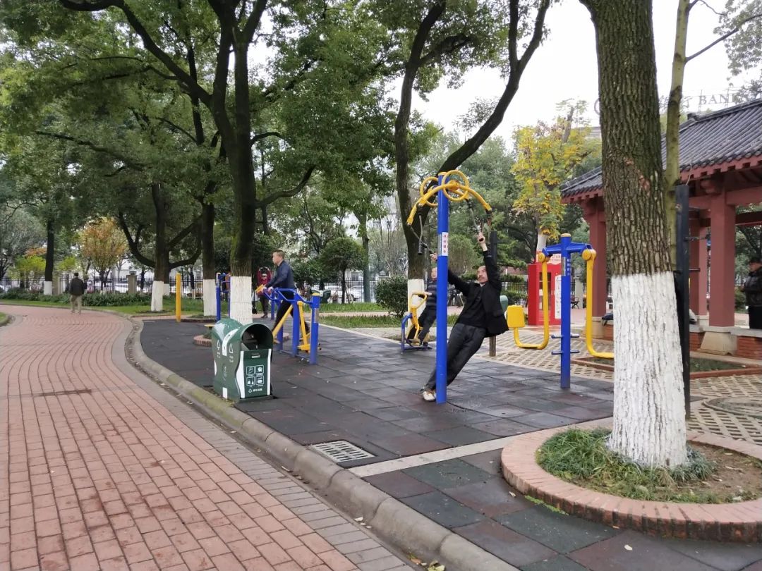
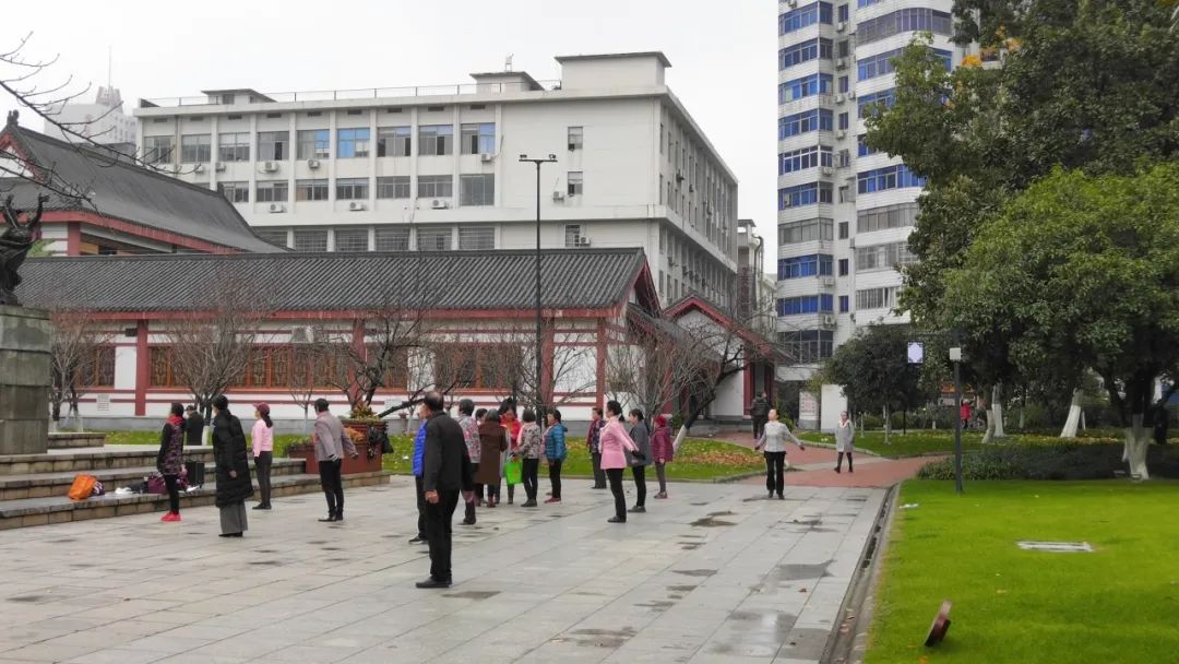
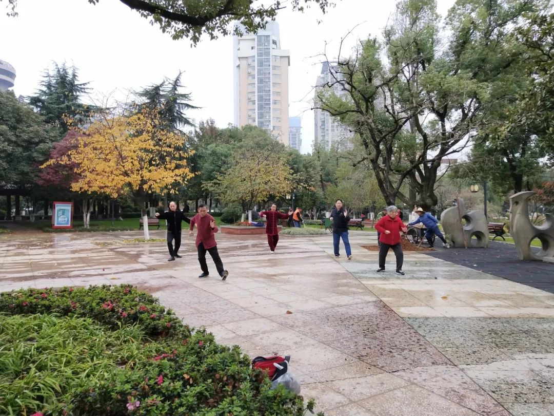
研究發(fā)現(xiàn)�����,長株潭城市群居民的步行體力活動(dòng)軌跡主要分布在綠色基礎(chǔ)設(shè)施的連接廊道和小型場地中
本文以中國長株潭城市群綠色基礎(chǔ)設(shè)施與居民步行體力活動(dòng)的頻率和強(qiáng)度為研究對象����,分析步行體力活動(dòng)的空間分布特征,并運(yùn)用多元線性回歸模型分析城市群綠色基礎(chǔ)設(shè)施對居民步行體力活動(dòng)頻率和強(qiáng)度的影響機(jī)制���。研究發(fā)現(xiàn)���,長株潭城市群居民的步行體力活動(dòng)軌跡主要分布在綠色基礎(chǔ)設(shè)施的連接廊道和小型場地中��。綠色基礎(chǔ)設(shè)施的內(nèi)部環(huán)境�、外部環(huán)境與空間格局均對居民步行體力活動(dòng)存在不同程度的影響��。最后�,本文提出城市群綠色基礎(chǔ)設(shè)施的建設(shè)及更新策略,以期改善居民步行體力活動(dòng)環(huán)境��,充分發(fā)揮城市群綠色基礎(chǔ)設(shè)施的生態(tài)和社會(huì)價(jià)值�����。
關(guān)鍵詞
綠色基礎(chǔ)設(shè)施�����;步行體力活動(dòng)���;影響機(jī)制����;長株潭城市群���;空間格局
中國長株潭城市群綠色基礎(chǔ)設(shè)施對步行體力活動(dòng)的影響機(jī)制研究
Research of the Influence Mechanisms of Green Infrastructure on Walking Physical Activities in Changsha–Zhuzhou–Xiangtan Urban Agglomeration, China
作 者
中南大學(xué)建筑與藝術(shù)學(xué)院
步行體力活動(dòng)是降低慢性疾病發(fā)生率���、改善居民健康和提高生活質(zhì)量的重要途經(jīng)之一�。綠色基礎(chǔ)設(shè)施(green infrastructure���,以下簡稱GI)是一種由自然區(qū)域和其他開放空間組成的相互連接的網(wǎng)絡(luò)及其附帶的工程設(shè)施�。GI的構(gòu)成要素為網(wǎng)絡(luò)中心���、連接廊道和小型場地��,是可供步行體力活動(dòng)的主要場所。現(xiàn)有對GI體系的系統(tǒng)性研究較少探討其對步行體力活動(dòng)的影響�����。相關(guān)研究還需探索GI整體格局與步行體力活動(dòng)的相關(guān)性�,以及進(jìn)一步綜合分析GI對運(yùn)動(dòng)頻率和強(qiáng)度的影響差異和影響機(jī)制。
城市群GI將是保障大部分城鄉(xiāng)居民進(jìn)行步行體力活動(dòng)的基本設(shè)施�。為了進(jìn)一步理解城市群GI和步行體力活動(dòng)之間的關(guān)系,本文對中國長株潭城市群GI和居民步行體力活動(dòng)展開研究�����。通過構(gòu)建多元線性回歸模型進(jìn)行差異分析,探索城市群GI對步行體力活動(dòng)頻率和強(qiáng)度的影響機(jī)制��,并制定有利于促進(jìn)居民步行運(yùn)動(dòng)和健康城市環(huán)境建設(shè)的策略�����,以期提升城市居民福祉���。
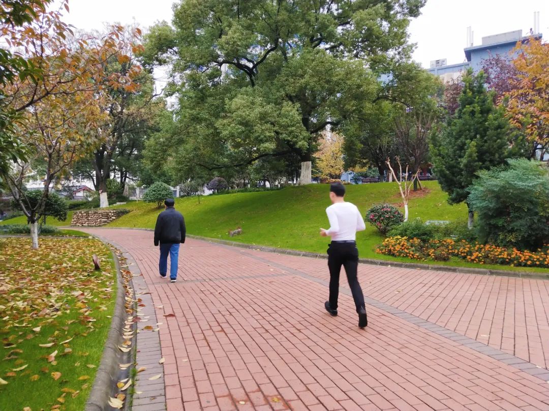
在城市公園中進(jìn)行步行體力活動(dòng)的人們 ? 歐陽浩
本文研究區(qū)域?yàn)楹鲜¢L株潭城市群(長沙市�、株洲市���、湘潭市)的中心城區(qū)���,包括長沙市的天心區(qū)、芙蓉區(qū)�����、開福區(qū)����、雨花區(qū)和岳麓區(qū)�����;株洲市的天元區(qū)����、蘆淞區(qū)�����、石峰區(qū)和荷塘區(qū)����;以及湘潭市的岳塘區(qū)和雨湖區(qū)。
研究所用的步行體力活動(dòng)數(shù)據(jù)來源于“多銳運(yùn)動(dòng)”APP上記錄的2016~2019年的運(yùn)動(dòng)數(shù)據(jù)在數(shù)據(jù)采集期間����,研究區(qū)域的用戶量為3785人。采集到的步行軌跡數(shù)據(jù)的內(nèi)容包含空間位置���、運(yùn)動(dòng)類型、運(yùn)動(dòng)時(shí)長�����、運(yùn)動(dòng)距離、運(yùn)動(dòng)日期和運(yùn)動(dòng)頻率等信息�����。
本研究中的城市用地分類數(shù)據(jù)采用長株潭相關(guān)城市總體規(guī)劃數(shù)據(jù)��。路網(wǎng)數(shù)據(jù)基于由“開放街道地圖”獲取到的數(shù)據(jù)進(jìn)行分類處理�。2016~2020年日平均降水和日平均氣溫?cái)?shù)據(jù)來源于國家氣象信息中心。歸一化植被指數(shù)(NDVI)數(shù)據(jù)來源于USGS網(wǎng)站2019年12月Landsat 8數(shù)據(jù)�。房價(jià)數(shù)據(jù)通過獲取安居客、鏈家和房天下三個(gè)房地產(chǎn)平臺(tái)2016~2019年的月度數(shù)據(jù)�����,并進(jìn)行去重處理后計(jì)算平均值得出���。人口數(shù)據(jù)來源于第七次全國人口普查統(tǒng)計(jì)數(shù)據(jù)���。最終,通過高德地圖爬取2019年12月的各類POI數(shù)據(jù)�����,并進(jìn)行糾偏與清洗。
已被廣泛認(rèn)可和應(yīng)用的GI范圍的劃定方法一般包括確定GI的目標(biāo)和定位�,確定其構(gòu)成要素(即網(wǎng)絡(luò)中心、連接廊道和小型場地)�,以及識(shí)別網(wǎng)絡(luò)格局三個(gè)步驟。
網(wǎng)絡(luò)中心是指較少受到外界干擾��、面積較大的自然棲息地斑塊�����,包括處于原生狀態(tài)的土地���、生態(tài)保護(hù)區(qū)��、郊野公園���、森林、湖泊��、濕地���、農(nóng)田�����、牧場和林地等�����。連接廊道是指線性的�、連接網(wǎng)絡(luò)中心和小型場地的生態(tài)廊道����,主要包括河流和城市道路周邊,以及防護(hù)綠帶等帶狀綠地�����。小型場地是對網(wǎng)絡(luò)中心和連接廊道的補(bǔ)充���,為人們提供兼具生態(tài)和社會(huì)價(jià)值的休閑場地���,主要包括小型城市公園、廣場�、街旁綠地、社區(qū)公園等����。
網(wǎng)格單元?jiǎng)澐?/strong>
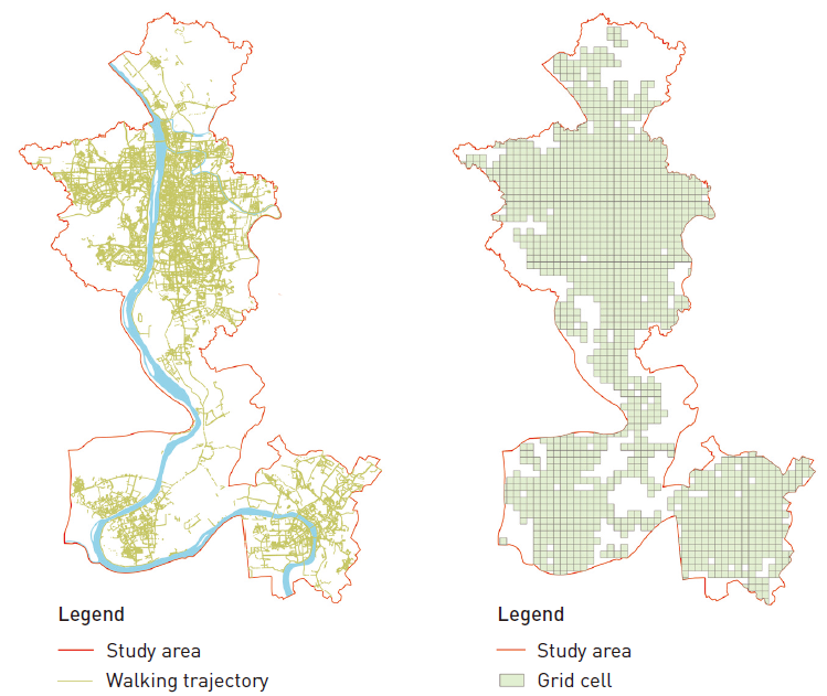
本文中格網(wǎng)尺度的選擇主要依據(jù)人均步行10分鐘的運(yùn)動(dòng)距離(800m)來判定。通過ArcGIS 10.6對研究區(qū)構(gòu)建800m×800m的格網(wǎng)體系,并篩選出1436個(gè)包含城市群GI的網(wǎng)格單元作為研究樣本區(qū)域����。
研究區(qū)居民步行體力活動(dòng)軌跡與網(wǎng)格單元分布圖 ? 李博,歐陽浩�����,劉秋宏
本文參考相關(guān)研究成果結(jié)合研究區(qū)現(xiàn)狀�,從GI的外部環(huán)境、內(nèi)部環(huán)境和景觀格局三個(gè)層面構(gòu)建GI指標(biāo)體系�����,得到分析模型的自變量�����。
外部環(huán)境指標(biāo)包括人口指標(biāo)����,即人口密度、居住密度�����;經(jīng)濟(jì)指標(biāo),即房價(jià)水平����、土地利用混合度��;環(huán)境指標(biāo)��,即日平均氣溫�����、日平均降水�����。內(nèi)部環(huán)境指標(biāo)指GI內(nèi)部的基礎(chǔ)服務(wù)設(shè)施��,即公共廁所�����、停車場地��、城市廣場和公交站點(diǎn)密度����;以及景觀要素�����,包括運(yùn)動(dòng)路徑(步道交叉口數(shù)量��、步道密度)���,水體(水體面積占比、距水體距離)和綠地(NDVI���、綠地面積占比)指標(biāo)�����?��?臻g格局指標(biāo)包括景觀數(shù)量,即斑塊密度(PD)���、最大斑塊面積占比(LPI)����;景觀形狀,即景觀形狀指數(shù)(LSI)��、斑塊邊緣密度(ED)��;景觀斑塊間關(guān)系�����,即斑塊聚合度指數(shù)(AI)�����、斑塊分離指數(shù)(DIVISION)��、斑塊蔓延度指數(shù)(CONTAG)���。步行體力活動(dòng)指標(biāo)體系主要包括步行體力活動(dòng)的頻率和強(qiáng)度,是分析模型的因變量��。
GI指數(shù)計(jì)算與數(shù)據(jù)預(yù)處理
將各項(xiàng)指標(biāo)數(shù)據(jù)轉(zhuǎn)換為柵格數(shù)據(jù)(像素精度為30m)��,通過Fragstats4.0移動(dòng)窗口命令進(jìn)行計(jì)算���,并在ArcGIS軟件中���,分別計(jì)算每個(gè)網(wǎng)格單元內(nèi)所有像素各個(gè)指標(biāo)的平均值�����。本研究采用Z-Scores法對計(jì)算所得網(wǎng)格單元中的平均值進(jìn)行標(biāo)準(zhǔn)化處理�����。
研究運(yùn)用方差膨脹因子對23項(xiàng)指標(biāo)進(jìn)行多重共線性檢驗(yàn)�����,剔除具有顯著共線性的4個(gè)自變量(斑塊密度����、斑塊邊緣密度�����、斑塊分離度指數(shù)和斑塊蔓延度指數(shù))�����,最終得到19項(xiàng)自變量指標(biāo)進(jìn)行后續(xù)分析�����。
本研究利用多元線性回歸模型對19項(xiàng)城市群GI指標(biāo)進(jìn)行差異分析,討論GI外部環(huán)境��、內(nèi)部環(huán)境和空間格局指標(biāo)與步行體力活動(dòng)頻率和強(qiáng)度之間的關(guān)系�����。
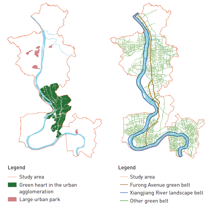
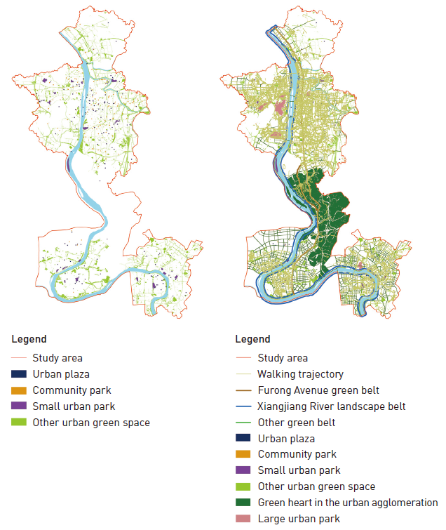
通過對長株潭城市群GI的功能分析和空間識(shí)別���,劃定9類GI空間,占城市群總面積的44%�����。網(wǎng)絡(luò)中心主要包括長株潭城市群綠心和大型城市公園�����。連接廊道的識(shí)別主要包括湘江景觀帶�、芙蓉大道綠帶,以及城市主���、次�、支三級(jí)道路沿線的其他城市道路綠帶。小型場地主要包括小型城市綠地�、城市廣場、社區(qū)公園和小型城市公園�。
城市群GI網(wǎng)絡(luò)中心及連接廊道分布圖 ? 李博,歐陽浩��,劉秋宏
經(jīng)計(jì)算GI內(nèi)部的軌跡數(shù)量與步行體力活動(dòng)軌跡總數(shù)的百分比�,結(jié)果顯示88.3%的步行活動(dòng)發(fā)生在GI內(nèi)部,且集中分布在三個(gè)城市中心城區(qū)的城市綠道�、綠地和公園等區(qū)域。在空間結(jié)構(gòu)上����,連接廊道中有最多的步行軌跡數(shù)量和最大的軌跡總長,而網(wǎng)絡(luò)中心擁有最少的步行軌跡數(shù)量和最短的長度����。從具體類型來看,其他城市道路綠帶和其他城市綠地這兩類中的軌跡數(shù)量和長度均較大�����,城市群綠心�����、大型城市公園的軌跡數(shù)量和長度均較小。
城市群GI小型場地分布圖 ? 李博����,歐陽浩,劉秋宏
通過對1436個(gè)網(wǎng)格單元內(nèi)的指標(biāo)進(jìn)行計(jì)算(最小值��、最大值和平均值)����,并在SPSS軟件中對標(biāo)準(zhǔn)化后的數(shù)據(jù)進(jìn)行回歸分析。多元回歸分析結(jié)果顯示多元線性回歸模型擬合效果較好���,且自變量之間不存在多重共線性��,回歸模型顯著性檢驗(yàn)成立。
部分城市群GI指標(biāo)對步行體力活動(dòng)的頻率或強(qiáng)度均表現(xiàn)出顯著影響(P≤0.05)�,包括居住密度、房價(jià)水平�����、公共廁所密度��、城市廣場密度、公交站點(diǎn)密度�、綠地公園占比、最大斑塊面積占比和斑塊聚合度指數(shù)����,其中公共廁所密度、LPI和步行體力活動(dòng)的頻率與強(qiáng)度呈負(fù)相關(guān)關(guān)系�����。而部分城市群GI指標(biāo)則對步行體力活動(dòng)的頻率或強(qiáng)度影響均不顯著(P>0.05)��,包括人口密度�����、日平均降水��、距水體距離���、NDVI和LSI����。
部分城市群GI指標(biāo)對步行體力活動(dòng)的頻率或強(qiáng)度的影響存在差異����。在外部環(huán)境指標(biāo)中����,LM和日平均氣溫和步行體力活動(dòng)強(qiáng)度具有顯著正相關(guān)關(guān)系�,而對步行體力活動(dòng)頻率影響不顯著;在內(nèi)部環(huán)境指標(biāo)中�,步道密度和步行體力活動(dòng)頻率有顯著正相關(guān)關(guān)系,而水體面積占比和步行體力活動(dòng)強(qiáng)度顯著負(fù)相關(guān)���。
整體而言�����,居住密度���、房價(jià)水平、步道密度對步行體力活動(dòng)頻率的影響最顯著(P≤0.01)�,居住密度、房價(jià)水平���、LM、日平均氣溫���、公共廁所密度�����、城市廣場密度�����、公交站點(diǎn)密度���、步道交叉口數(shù)量�����、綠地面積占比和AI對步行體力活動(dòng)強(qiáng)度的影響最顯著(P≤0.01)��。
步行體力活動(dòng)主要集中在連接廊道和小型場地中����,說明居民更傾向于沿綠道等線性空間或者是在小型城市開放空間中開展步行體力活動(dòng)����。連接廊道可以有效連接各類城市開放空間,適宜的步行尺度使其可以滿足健身鍛煉和休閑游憩的多種需求�。小型場地常見于居住地周邊��,距離居民通勤路線較近����,具備相對完善的基礎(chǔ)設(shè)施和趣味靈活的游線���,從而易于提高居民的步行活動(dòng)體驗(yàn)��。
城市群GI可有效連接各類運(yùn)動(dòng)設(shè)施 ? 歐陽浩
此外�,僅少部分步行體力活動(dòng)軌跡分布在城市群綠心和大型城市公園中(如岳麓山�����、石燕湖等)���。因自然保護(hù)管控政策要求�����,城市群綠心和大型城市公園較少分布在土地開發(fā)強(qiáng)度較大的高密度城市中心區(qū)域��,而更多分布在市郊�、鄉(xiāng)村等區(qū)域����,對于居住在城市中的居民來說,路程中花費(fèi)的時(shí)間較長且游憩設(shè)施較少���,因而出現(xiàn)在網(wǎng)絡(luò)中心的步行體力活動(dòng)較少���。
從外部環(huán)境指標(biāo)來看,回歸分析結(jié)果顯示城市群GI中居住密度和房價(jià)水平與步行體力活動(dòng)的頻率和強(qiáng)度呈正相關(guān)關(guān)系�����。居住密度較高的區(qū)域可能人口數(shù)量更多�,總體出行需求更高,同時(shí)����,這類區(qū)域具有更高的街道連通性、可達(dá)性��,更易于為居民帶來良好的步行運(yùn)動(dòng)體驗(yàn)����。其次,LM與步行體力活動(dòng)的強(qiáng)度呈現(xiàn)正相關(guān)關(guān)系�����,LM越高的區(qū)域往往在步行范圍內(nèi)分布有多種設(shè)施,以便于居民在一次步行活動(dòng)過程中完成多項(xiàng)任務(wù)�;日平均氣溫對居民步行體力活動(dòng)的強(qiáng)度具有顯著正向影響,本研究中步行軌跡數(shù)據(jù)主要集中在春季和秋季�����,較高的溫度可以提高人體感知舒適度���,減少疲憊感�。
城市群GI可以為人們提供多樣的活動(dòng)場所 ? 歐陽浩
從內(nèi)部環(huán)境指標(biāo)中來看��,長株潭城市群GI中城市廣場和公交站點(diǎn)密度與步行體力活動(dòng)的頻率和強(qiáng)度均呈正相關(guān)關(guān)系�����,這表明可以通過適當(dāng)增加城市廣場和公交站點(diǎn)來提高基礎(chǔ)設(shè)施的可達(dá)性����。而公共廁所密度和步行體力活動(dòng)的頻率和強(qiáng)度均呈負(fù)相關(guān)關(guān)系。這與以往相關(guān)研究存在一定的差異����,后續(xù)需要進(jìn)一步細(xì)分研究繼續(xù)探討公共廁所空間配置與步行體力活動(dòng)之間的關(guān)系��。運(yùn)動(dòng)路徑方面�,步道密度和步行活動(dòng)頻率呈正相關(guān)關(guān)系���;步道交叉口數(shù)量和步行活動(dòng)強(qiáng)度呈正相關(guān)關(guān)系,步道交叉口數(shù)量和步道密度往往代表了一個(gè)地區(qū)連通性的強(qiáng)弱�,更好的連通性不僅易于行走,還能有效疏解聚集性人群�����;同時(shí)步道交叉口能有效降低道路交通中的機(jī)動(dòng)車車速����,提高步行環(huán)境的安全性。水體面積占比和步行體力活動(dòng)的強(qiáng)度呈負(fù)相關(guān)關(guān)系����,長株潭城市群GI中的水體主要為面積較大的江河湖泊或水源涵養(yǎng)區(qū),生態(tài)保護(hù)和水源保護(hù)的要求限制了公眾的親水活動(dòng)���,從而在一定程度上限制了步行體力活動(dòng)��。
從景觀格局指標(biāo)來看��,LPI與步行體力活動(dòng)的頻率和強(qiáng)度呈負(fù)相關(guān)關(guān)系�,而AI與步行體力活動(dòng)的頻率和強(qiáng)度呈正相關(guān)關(guān)系,說明城市群核心GI斑塊面積越大����,相應(yīng)的居民步行活動(dòng)的頻率和強(qiáng)度越低;而斑塊間聚合關(guān)系越好��,越能促進(jìn)居民步行活動(dòng)的頻率和強(qiáng)度�����。長株潭GI大型景觀斑塊主要位于城郊�����,遠(yuǎn)離城市核心區(qū)��,可達(dá)性相對較差���,并且因生態(tài)保護(hù)要求在一定程度上限制步行等人為活動(dòng)�。城市群GI中良好的景觀聚合關(guān)系則可以在加強(qiáng)各景觀類型之間的連通性�、保障步行運(yùn)動(dòng)通暢和步行運(yùn)動(dòng)中的可選擇性,從而提高居民進(jìn)行步行體力活動(dòng)的意愿。
從城市群GI對頻率和強(qiáng)度的影響差異來看�,景觀格局指標(biāo)對頻率的影響更顯著,而外部環(huán)境指標(biāo)和內(nèi)部環(huán)境指標(biāo)對強(qiáng)度的影響更顯著�����。這表明城市群GI的景觀空間結(jié)構(gòu)和內(nèi)部景觀連接關(guān)系會(huì)直接影響居民步行體力活動(dòng)的頻率�����,原因可能在于頻率代表了居民進(jìn)行周期性步行體力活動(dòng)的意向��,而連接性更強(qiáng)���、聚合度更高的GI斑塊通常具有更有序、更穩(wěn)定的景觀系統(tǒng)為步行提供有利的城市群環(huán)境�����。強(qiáng)度表示居民進(jìn)行步行體力活動(dòng)持續(xù)的時(shí)間和運(yùn)動(dòng)狀態(tài)�����,豐富的土地利用和基礎(chǔ)設(shè)施類型�,以及適宜的環(huán)境溫度和降水能有效滿足居民在長時(shí)間、長距離運(yùn)動(dòng)中對景觀多樣化的需求,降低高負(fù)荷運(yùn)動(dòng)的疲憊感�����,提升高強(qiáng)度活動(dòng)的體驗(yàn)感���。
基于GI相關(guān)理論���,本研究識(shí)別并構(gòu)建了長株潭城市群GI體系,探討了在長株潭城市群GI中步行體力活動(dòng)的空間分布和各項(xiàng)GI指標(biāo)對步行體力活動(dòng)頻率和強(qiáng)度的影響差異�����。
依據(jù)本文研究結(jié)果���,研究團(tuán)隊(duì)提出三項(xiàng)城市群GI建設(shè)策略���。在外部環(huán)境方面,打造與公園�、步行綠道和其他綠地臨近的多業(yè)態(tài)、功能型住區(qū)環(huán)境�����,可以整體增強(qiáng)居民步行體力活動(dòng)強(qiáng)度。在內(nèi)部環(huán)境方面�,增加GI中城市廣場、公交站點(diǎn)等設(shè)施的數(shù)量�,構(gòu)建相對集中的人行步道網(wǎng)絡(luò),并適當(dāng)增加步道交叉口數(shù)量���,可有效提升居民進(jìn)行步行體力活動(dòng)的頻率��。在空間格局方面�,在保障生態(tài)功能的前提下適當(dāng)控制大型綠地面積����,增加可步行的中小型綠地面積和數(shù)量���,合理規(guī)劃連接各類GI的步行綠道系統(tǒng)���,可以保證步行運(yùn)動(dòng)過程的連續(xù)性,進(jìn)而全面提升步行體力活動(dòng)的頻率和強(qiáng)度��。
受采集到的數(shù)據(jù)所限���,本研究還存在一些不足�。首先,多銳APP的主要用戶是青年和中年人����,因此本文未能體現(xiàn)城市群GI對未成年人和老年人步行體力活動(dòng)的影響,未來將進(jìn)一步采集這兩類人群的步行體力活動(dòng)數(shù)據(jù)開展專項(xiàng)研究�。其次,本研究僅使用客觀環(huán)境要素作為自變量來研究GI與步行體力活動(dòng)的關(guān)系���,缺少對居民環(huán)境感知���、心理感受等主觀因素的探討,后續(xù)將進(jìn)一步拓展這方面的研究��。
[1] Liu, J., Chen, Z., Yang, F., He, X., Chen, W., & Deng, S. (2014). Current situation and strategies to chronic diseases of the elderly in China. China & Foreign Medical Treatment, 33(23), 194-195, 198.
[2] World Health Organization. (2014). Global status report on noncommunicable diseases 2014.
[3] Caspersen, C. J., Powell, K. E., & Christenson, G. M. (1985). Physical activity, exercise, and physical fitness: Definitions and distinctions for health-related research. Public Health Reports, 100(2), 126-131.
[4] Wu, Z., Wang, Z., & Song, Y. (2018). The meta analysis on the built environment’s influence on the physical activity of the elderly. Journal of Shanghai University of Sport, 42(1), 64-71, 78.
[5] Chen, C., Hailili, T., & Chen, Y. (2018). Built environment's influence on obesity of the older women and its planning responses. Human Geography, 33(4), 76-81.
[6] Beaulieu, K., Hopkins, M., Blundell, J., & Finlayson, G. (2018). Homeostatic and non-homeostatic appetite control along the spectrum of physical activity levels: An updated perspective. Physiology & Behavior, (192), 23-29.
[7] Edholm, O. G., Adam, J. M., Healy, M. J., Wolff, H.S., Goldsmith, R., & Best, T. W. (1970). Food intake and energy expenditure of army recruits. British Journal of Nutrition, (24), 1091-1107.
[8] Mayer, J., Roy, P., & Mitra, K. P. (1956). Relation between caloric intake, body weight, and physical work: Studies in an industrial male population in West Bengal. The American Journal of Clinical Nutrition, 4(2), 169-175.
[9] Frank, L. D., Sallis, J. F., Conway, T. L., Chapman, J. E., Saelens, B. E., & Bachman, W. (2006). Many pathways from land use to health: Associations between neighborhood walkability and active transportation, body mass index, and air quality. Journal of the American Planning Association, 72(1), 75-87.
[10] Giles-Corti, B., Vernez-Moudon, A., Reis, R., Turrell, G., Dannenberg, A. L., Badland, H., Foster, S., Lowe, M., Sallis, J. F., Stevenson, M., & Owen, N. (2016). City planning and population health: A global challenge. Lancet, (388), 2912-2924.
[11] Tainio, M., Andersen, Z. J., Nieuwenhuijsen, M. J., Hu, L., de Nazelle, A., An, R., Garcia, L. M. T., Goenka, S., Zapata-Diomedi, B., Bull, F., & de Sá, T. H. (2021). Air pollution, physical activity and health: A mapping review of the evidence. Environment International, (147), 105954.
[12] Tyrv?inen, L., Ojala, A., Korpela, K., Lanki, T., Tsunetsugu, Y., & Kagawa, T. (2014). The influence of urban green environments on stress relief measures: A field experiment. Journal of Environmental Psychology, (38), 1-9.
[13] Li, K. (2009). Green infrastructure: Concept, theory and practice. Chinese Landscape Architecture, 25(10), 88-90.
[14] Benedict, M. A., & McMahon, E. (2006). Green Infrastructure: Linking Landscapes and Communities. Island Press.
[15] Zhang, Y., Yu, B., & Che, S. (2014). The comparison and blending of green infrastructure and low impact development. Chinese Landscape Architecture, 30(3), 49-53.
[16] Ding, J., & Wang, M. (2016). The planning of the green infrastructure in the country with water network—A case study of the west area of Lili Town. Chinese Landscape Architecture, 32(1), 98-102.
[17] Zhang, Q. (2009). Exploration on the protection and utilization mode of urban green heart area—Case study of the green heart planning of Changsha–Zhuzhou–Xiangtan urban agglomeration, China. Paper Collection for 2009 International Forum on Urban Development and Planning, 16-18, 45.
[18] Ferreira, J. C., Monteiro, R., & Silva, V. R. (2021). Planning a green infrastructure network from theory to practice: The case study of Setúbal, Portugal. Sustainability, 13(15), 8432.
[19] National Recreation and Park Association. (2016). NRPA Americans’ Engagement with Parks Survey.
[20] Coombes, E,. Jones, A. P., Hillsdon, M. (2010). The relationship of physical activity and overweight to objectively measured green space accessibility and use. Social Science & Medicine, (70), 816-822.
[21] Sallis, J., Bauman, A., & Pratt, M. (1998). Environmental and policy interventions to promote physical activity. American Journal of Preventive Medicine, 15(4), 379-397.
[22] Astell-Burt, T., Feng, X., & Kolt, G. S. (2014). Green space is associated with walking and moderate-to-vigorous physical activity (MVPA) in middle-to-older-aged adults: Findings from 203883 Australians in the 45 and up study. British Journal of Sports Medicine, (48), 404-406.
[23] Owen, N., Humpel, N., Leslie, E., Bauman, A. & Sallis, J. F. (2004). Understanding environmental influences on walking: Review and research agenda. American Journal of Preventive Medicine, 27(1), 1-76.
[24] Coutts, C., Chapin, T., Horner, M., & Taylor, C. (2013). County-level effects of green space access on physical activity. Journal of Physical Activity and Health, (10), 232-240.
[25] Li, F., Fisher, K., Brownson, R., & Bosworth, M. (2005). Multilevel modelling of built environment characteristics related to neighborhood walking activity in older adults. Journal of Epidemiology and Community Health, (59), 558-564.
[26] Akpinar, A., & Cankurt, M. (2017). How are characteristics of urban green space related to levels of physical activity: Examining the links. Indoor and Built Environment, 26(8), 1091-1101.
[27] Schipperijn, J., Cerin, E., Adams, M. A., Reis, R., Smith, G., Cain, K., Christiansen, L. B., van Dyck, D., Gidlow, C., Frank, L. D., Mitá?, J., Pratt, M., Salvo, D., Schofield, G., & Sallis, J. F. (2017). Access to parks and physical activity: An eight country comparison. Urban Forestry & Urban Greening, (27), 253-263.
[28] Fu, X. (2015). Green infrastructure planning and the enlightenment to our country. Urban Development Studies, 22(4), 52-58.
[29] Kim, G., & Miller, P. A. (2019). The impact of green infrastructure on human health and well-being: The example of the Huckleberry Trail and the Heritage Community Park and Natural Area in Blacksburg, Virginia. Sustainable Cities and Society, (48), 101562.
[30] Lu, D. (2015). Function orientation and coordinating development of subregions within the Jing-Jin-Ji urban agglomeration. Progress in Geography, 34(3), 265-270.
[31] Research group of China Development Research Foundation. (2022). Report on the integration of urban agglomerations in China. China Economic Report, (5), 109-119.
[32] Peng, Z., Wu, Y., Wu, T., & Xiao, Y. (2008). Conception and suggestion about frame of green space system in Chang-Zhu-Tan urban cluster region. Journal of Anhui Agricultural Sciences, 36(3), 1043-1045.
[33] Dong, X., Liang, Y., Hou, B., & Chen, L. (2021). Research on greenway route selection method of urban agglomeration based on resource and environment assessment system: Taking Beijing-Tianjin-Hebei urban agglomeration as an example. Urban Development Studies, 28(12), 118-127.
[34] Wang, F., & Wang, K. (2019). Connectivity and distribution pattern of regional greenways and ecological recreation spaces in the Pearl River Delta urban agglomeration. Progress in Geography, 38(3), 428-440.
[35] Jiao, S., Wei, C., Liu, S., He, S., & Guan, C. (2009). The protective development strategies of green heart in the urban agglomeration in Chang-Zhu-Tan urban agglomeration. Economic Geography, 29(10), 1716-1719, 1742.
[36] Li, B., & Gan, T. (2019). Construction of water security pattern of Changsha-Zhuzhou-Xiangtan urban agglomeration based on ArcGIS and GAP analysis. Water Resources Protection, 35(4), 80-88.
[37] Wang, J., Yuan, Y., Zhang, X., & Wang, Z. (2018). Comprehensive evaluation of the urban green space in the Beijing-Tianjin-Hebei urban agglomeration. Urban and Environmental Studies, (1), 55-65.
[38] Ao, Y., Wang, Z., Zhao, Y., Jiang, L., & Zhang, M. (2022). Effect of green space landscape elements on temperature under different urbanization levels: A case study of Guanzhong Plain urban agglomeration. Chinese Journal of Ecology, 1-15.
[39] Yang, F., Duan, N., Xu, Y., & Tao, Y. (2019). Smart planning and cross regional interaction: Dilemma and planning response of regional green space protection. Planners, 35(21), 52-58.
[40] Zhang, Y., Liu, Z., Wang, J., & Shao, D. (2020). Analysis of regional differences in urban park green space per capita of urban agglomerations in China from 1996 to 2016. Huazhong Architecture, 38(5), 65-70.
[41] Andersson, E., Barthel, S., Borgstr?m, S., Colding, J., Elmqvist, T., Folke, C., & Gren, ?. (2014). Reconnecting cities to the biosphere: Stewardship of green infrastructure and urban ecosystem services. AMBIO, 43(4), 445-453.
[42] Chen, Y., Zhou, G., Wang, H., Cui, S., Bi, F., & Yu, X. (2023). The evolution characteristics and enhancement paths of the economy-society-ecology coordinated development level of Changsha-Zhuzhou-Xiangtan urban agglomeration. Tropical Geography, 43(3), 519-531.
[43] Changsha Municipal Bureau of Natural Resources and Planning. (2014). Urban Comprehensive Planning of Changsha (2003–2020) (Revised in 2014).
[44] Xiangtan Municipal Bureau of Natural Resources and Planning. (2017). Urban Comprehensive Planning of Xiangtan (2010–2020) (Revised in 2017).
[45] Zhuzhou Municipal Bureau of Natural Resources and Planning. (2017). Urban Comprehensive Planning of Zhuzhou (2006–2020) (Revised in 2017).
[46] Li, W., & Li, J. (2017). Identification and optimization of small and medium-sized green infrastructure based on GIS: A case study of Nanxi Wetland Ecological Tourist Area in Xuancheng, Anhui Province. Journal of Hefei University of Technology (Social Sciences), 31(3), 128-134.
[47] Cai, Y., Wen, Z., & Lei, M. (2016). Green infrastructure system planning strategy for “sponge city” development. Planners, 32(12), 12-18.
[48] Fu, X., & Wu, R. (2009). Introduction to green infrastructure assessment (GIA)—A case study of Maryland, USA. Chinese Landscape Architecture, 25(9), 41-45.
[49] Yang, J., Qi, Z., & Peng, S. (2022). Construction of multi-level green infrastructure network in Changsha City. Journal of Chinese Urban Forestry, 20(2), 36-42.
[50] Wu, W., & Fu, X. (2009). The concept of green infrastructure and review of its research development. Urban Planning International, 24(5), 67-71.
[51] Gong, C., Wu, H., & Hu, C. (2022). Ecological function optimization strategy of urban public open space based on green infrastructure network: A case study of central Nanjing. New Architecture, (1), 49-54.
[52] Wickham, J. D., Riitters, K. H., Wade, T. G., & Vogt, P. (2010). A national assessment of green infrastructure and change for the conterminous United States using morphological image processing. Landscape and Urban Planning, 94(3-4), 186-195.
[53] Ai, J., Yu, K., Zeng, Z., Yang, L., Liu, Y., & Liu, J. (2022). Assessing the dynamic landscape ecological risk and its driving forces in an island city based on optimal spatial scales: Haitan Island, China. Ecological Indicators, (137), 108771.
[54] Jin, Y., Li, A., Bian, J., Nan, X., Lei, G., & Muhammad, K. (2021). Spatiotemporal analysis of ecological vulnerability along Bangladesh-China-India-Myanmar economic corridor through a grid level prototype model. Ecological Indicators, (120), 106933.
[55] García-Llamas, P., Calvo, L., De la Cruz, M., & Suárez-Seoane, S. (2018). Landscape heterogeneity as a surrogate of biodiversity in mountain systems: What is the most appropriate spatial analytical unit? Ecological Indicators, (85), 285-294.
[56] Yang, L., Yu, B., Liang, P., Tang, X., & Li, J. (2022). Crowdsourced data for physical activity-built environment research: Applying Strava data in Chengdu, China. Frontiers in Public Health, (10), 883177.
[57] Liu, Y., Hu, J., Wang, W., & Luo, C. (2022). Effects of urban park environment on recreational jogging activity based on trajectory data: A case of Chongqing, China. Urban Forestry & Urban Greening, (67), 127443.
[58] Zhong, Q., Li, B., & Chen, Y. (2022). How do different urban footpath environments affect the jogging preferences of residents of different genders? Empirical research based on trajectory data. International Journal of Environmental Research and Public Health, (19), 14372.
[59] Chen, W., Xiao, D., & Li, X. (2002). Classification, application, and creation of landscape indices. Chinese Journal of Applied Ecology, 13(1), 121-125.
[60] Moore, S., & Kestens, Y. (2011). Neighbourhood environmental correlates of perceived park proximity in Montreal. Canadian Journal of Public Health, 102(3), 176-179.
[61] Arifwidodo, S. D., Chandrasiri, O., Rasri, N., Sirawarong, W., Rattanawichit, P., & Sangyuan, N. (2022). Association between park visitation and physical activity among adults in Bangkok, Thailand. Sustainability, 14(19), 12938.
[62] Wang, Z., Ettema, D., & Helbich, M. (2021). Objective environmental exposures correlate differently with recreational and transportation walking: A cross-sectional national study in the Netherlands. Environmental Research, (194), 110591.
[63] Wang, H., Dai, X., Wu, J., Wu, X., & Nie, X. (2019). Influence of urban green open space on residents’ physical activity in China. BMC Public Health, (19), 1093.
[64] Li, X., Hong, Z., Yuan, Y., Zhao, L., & Xu, M. (2015). Research on residence outdoor space suitable for elders and children’s activities. Urban Development Studies, 22(5), 104-111.
[65] Acar, H., Yavuz, A., Ero?lu, E., Acar, C., Sancar, C., & De?ermenci, A. S. (2021). Analysis of activity, space and user relations in urban squares. Indoor and Built Environment, 30(9), 1466-1485.
[66] Qin, B., & Zhang, Y. (2019). The effects of urban built environment on residents’ physical activity: A study on neighborhood survey in Beijing. Urban Development Studies, 26(3), 65-71.
[67] Wang, H., & Yang, Y. (2019). Neighbourhood walkability: A review and bibliometric analysis. Cities, (93). 43-61.
[68] Xue, H., Cheng, X., Jia, P., & Wang, Y. (2020). Road network intersection density and childhood obesity risk in the US: A national longitudinal study. Public Health, (178), 31-37.
[69] Cai, Z., Fang, C., Zhao, H., Zhang, X., & Zhang, Q. (2022). A review and future research framework on association between blue space and physical activity. Journal of Environmental and Occupational Medicine, 39(10), 1165-1171.
[70] Aliyas, Z. (2020). A qualitative study of park-based physical activity among adults. Journal of Public Health, (28), 623-632.
[71] Poppe, L., Deforche, B., Van Cauwenberg, J., Brondeel, R., Mertens, L., Van de Weghe, N., Benoit, S., Veitch, J., & Van Dyck, D. (2022). The association between the number of parks near home and levels of physical activity among community-dwelling older adults: A longitudinal study. Cities, (130), 103931.
[72] Ma, L., Bo, J., Li, X., Fang, F., & Cheng, W. (2019). Identifying key landscape pattern indices influencing the ecological security of inland river basin: The middle and lower reaches of Shule River Basin as an example. Science of the Total Environment, (674), 424-438.
[73] Zhao, F., Li, H., Li, C., Cai, Y., Wang, X., & Liu, Q. (2019). Analyzing the influence of landscape pattern change on ecological water requirements in an arid/semiarid region of China. Journal of Hydrology, (578), 124098.
[74] Kim, M., Song, K., & Chon, J. (2021). Key coastal landscape patterns for reducing flood vulnerability. Science of the Total Environment, (759), 143454.
[75] Li, B., Liu, Q., Wang, T., He, H., Peng, Y., & Feng, T. (2022). Analysis of urban built environment impacts on outdoor physical activities—A case study in China. Frontiers in Public Health, (10), 861456.
[76] Xu, Z., Kong, X., & Wei, J. (2014). Clustering analysis on disciplines innovation capabilities of research-oriented universities in China—An example of 36 “Project 985” universities. Science and Technology Progress and Policy, 31(23), 165-168.
[77] Qian, Y., & Fang, X. (2022). Multiple linear regression model and application. China Science and Technology Information, (4), 73-74.
[78] Liu, K., Siu, K. W. M., Gong, X., Gao, Y., & Lu, D. (2016). Where do networks really work? The effects of the Shenzhen greenway network on supporting physical activities. Landscape and Urban Planning, (152), 49-58.
[79] He, D., Lu, Y., Xie, B., & Helbich, M. (2021). Large-scale greenway intervention promotes walking behaviors: A natural experiment in China. Transportation Research Part D: Transport and Environment, (101), 103095.
[80] Li, Y., Wang, J., & Wang, Z. (2011). Discussions on North American experiences about linear open space planning and management. Urban Planning International, 26(4), 85-90.
[81] Seong, E. Y., Lee, N. H., & Choi, C. G. (2021). Relationship between land use mix and walking choice in high-density cities: A review of walking in Seoul, South Korea. Sustainability, (13), 810.
[82] Huang, R., Moudon, A. V., Zhou, C., & Saelens, B. E. (2019). Higher residential and employment densities are associated with more objectively measured walking in the home neighborhood. Journal of Transport & Health, (12), 142-151.
[83] Sung, H., Lee, S., & Cheon, S. Operationalizing Jane Jacobs’s urban design theory: Empirical verification from the Great City of Seoul, Korea. Journal of Planning Education and Research, 35(2), 117-130.
[84] Obuchi, S. P., Kawai, H., Garbalosa, J. C., Nishida, K., & Murakawa, K. (2021). Walking is regulated by environmental temperature. Scientific Reports, 11(1), 12136.
[85] Ma, Q., Wang, L., Gong, X., & Li, K. (2022). Research on the rationality of public toilets spatial layout based on the POI data from the perspective of urban functional area. Journal of Geo-information Science, 24(1), 50-62.
[86] Zang, P., Qiu, H., Xian, F., Zhou, X., Ma, S., & Zhao, Y. (2021). Research on the difference between recreational walking and transport walking among the elderly in mega cities with different density zones: The case of Guangzhou City. Frontiers in Public Health, (9), 775103.
[87] Smith, K. R., Brown, B., Yamada, I., Kowaleski-Jones, L., Zick, C. D., & Fan, J. X. (2008). Walkability and body mass index density, design, and new diversity measures. American Journal of Preventive Medicine, 35(3), 237-244.
[88] Wang, F., Wen, M., & Xu, Y. (2013). Population-adjusted street connectivity, urbanicity and risk of obesity in the U.S. Applied Geography, (41), 1-14.
[89] Jansen, M., Kamphuis, C. B., Pierik, F. H., Ettema, D. F., & Dijst, M. J. (2018). Neighborhood-based PA and its environmental correlates: A GIS- and GPS based cross-sectional study in the Netherlands. BMC Public Health, (18), 233.
[90] Perchoux, C., Kestens, Y., Brondeel, R., & Chaix, B. (2015). Accounting for the daily locations visited in the study of the built environment correlates of recreational walking (the record cohort study). Preventive Medicine, (81), 142-149.
[91] Van Cauwenberg, J., Nathan, A., Barnett, A., Barnett, D. W., & Cerin, E. (2018). Relationships between neighbourhood physical environmental attributes and older adults’ leisure-time physical jogging: A systematic review and meta-analysis. Sports Medicine, (48), 1635-1660.
[92] Spring, A. (2018). Short- and long-term impacts of neighborhood built environment on self-rated health of older adults. Gerontologist, 58(1), 36-46.
本文引用格式 / PLEASE CITE THIS ARTICLE AS
Li, B., Ouyang, H., & Liu, Q. (2023). Research of the influence mechanisms of green infrastructure on walking physical activities in Changsha–Zhuzhou–Xiangtan Urban Agglomeration, China. Landscape Architecture Frontiers, 11(1), 30–57. https://doi.org/10.15302/J-LAF-1-020075
編輯 | 高雨婷,田樂,王穎
翻譯 | 王越�����,高雨婷��,田樂
版權(quán)聲明:本文版權(quán)歸原作者所有�����,請勿以景觀中國編輯版本轉(zhuǎn)載���。如有侵犯您的權(quán)益請及時(shí)聯(lián)系�,我們將第一時(shí)間刪除��。
投稿郵箱:info@landscape.cn
項(xiàng)目咨詢:18510568018(微信同號(hào))

 京公海網(wǎng)安備 110108000058號(hào)
