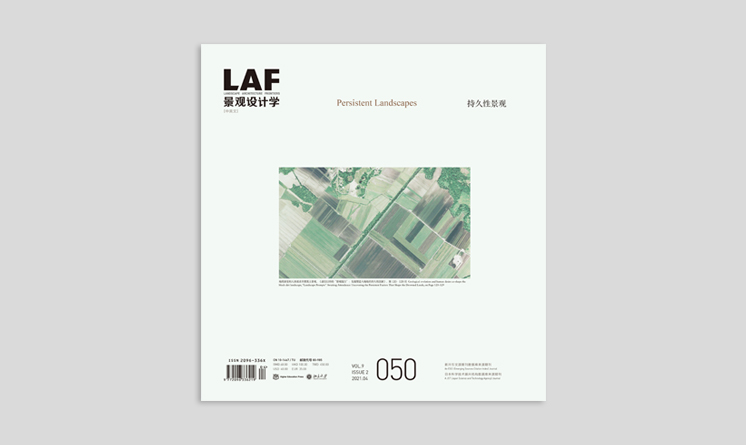
景觀的“變”與“不變”
The “Change” and the “Constancy” of Landscapes
作者:羅濤 LUO Tao
摘要
科學(xué)辨識(shí)與主動(dòng)介入景觀的演變是景觀設(shè)計(jì)學(xué)領(lǐng)域的重要話題?��!白儭笔强陀^的���、絕對(duì)的,“不變”則是主觀的���、相對(duì)的���。因此�����,景觀的演變是絕對(duì)的�����,但人類對(duì)這一表象的衡量則是相對(duì)的����?����;谶@一認(rèn)識(shí)����,我們提出具備時(shí)間維度的連續(xù)性與穩(wěn)定性,和空間維度的穩(wěn)定差異化表征的“持久性景觀”���,指出理解這一概念的關(guān)鍵在于對(duì)自然生態(tài)系統(tǒng)的穩(wěn)定與人文社會(huì)脈絡(luò)的融合的觀察�����。然而�,隨著城鎮(zhèn)化進(jìn)程的加速推進(jìn),城鄉(xiāng)特色喪失�、環(huán)境污染、生態(tài)破碎�、文化斷裂等問題相繼產(chǎn)生,如何重新認(rèn)識(shí)人地關(guān)系���,并科學(xué)制定可持續(xù)發(fā)展策略����,成為需要景觀設(shè)計(jì)學(xué)界重點(diǎn)研討的話題�。希望藉由本期的探索�����,推動(dòng)景觀設(shè)計(jì)師適應(yīng)時(shí)代需求���,賦予景觀新的內(nèi)容與形式�����,創(chuàng)造更加健康����、詩意����,且具有文化底蘊(yùn)與空間特色的高品質(zhì)人居環(huán)境。
關(guān)鍵詞:持久性景觀�;景觀演變;景觀韌性�����;景觀評(píng)價(jià)����;可持續(xù)景觀
Abstract
Scientifically recognizing and wisely intervening the evolution of landscape is an important topic in Landscape Architecture, since evolution (change) is absolute. For human, landscape changes, however, can be measured in a relative sense. Upon such an understanding, the concept “persistent landscape” highlights the landscape’s continuity and stability over time, as well as the stable variety of physical environment. The key to understand this concept lies in landscape architects’ observation of not only the stability of natural ecosystems but also the harmony of cultural-social contexts. However, the rapid urbanization has caused many pressing problems such as the loss of characteristics in urban and rural area, environmental pollution, ecological fragmentation, and cultural fracture, which calls for landscape architects who can re-recognize the man-land relationship and formulate scientific strategies for sustainable development. In this issue, LA Frontiers hopes to offer landscape architects with insights to meet contemporary needs by embracing new landscape forms and implications, so as to create healthier and more poetic-quality living environments with cultural and spatial characteristics.
Keywords:Persistent Landscape; Landscape Evolution; Landscape Resilience; Landscape Assessment; Sustainable Landscape
縣級(jí)城市居住街區(qū)空間形態(tài)地域特征的時(shí)空差異研究——以慶城縣、武安市���、長(zhǎng)興縣�����、連江縣�����、金堂縣為例
Research on the Spatial–Temporal Changes of Regional Morphology of Residential Neighborhoods in County-Level Cities of China: Cases Studies on Qingcheng County, Wu’an City, Changxing County, Lianjiang County, and Jintang County
作者:黃圳����,劉江,羅濤�����,洪昕晨 HUANG Zhen, LIU Jiang, LUO Tao, HONG Xinchen
摘要
城市粗放式開發(fā)促使城鎮(zhèn)特色丟失���,并促使人居環(huán)境愈發(fā)趨向“千城一面”���。為此,本研究以位于中國不同氣候區(qū)的縣級(jí)城市為研究對(duì)象�����,以其居住街區(qū)空間形態(tài)為切入點(diǎn)����,借助ArcGIS 10.2�、SPSS 22與Origin 2021軟件對(duì)60個(gè)代表性居住街區(qū)的空間形態(tài)以12個(gè)形態(tài)學(xué)指標(biāo)進(jìn)行主成分分析與相關(guān)性分析,借此判別、描述并解讀了地域特征的時(shí)空差異�。研究表明:1)60個(gè)樣本街區(qū)的建設(shè)年代與中國住房制度改革的歷史變遷存在一定協(xié)同性;2)不同氣候區(qū)的縣級(jí)城市居住街區(qū)空間形態(tài)存在差異����,可借助街區(qū)形狀、開發(fā)強(qiáng)度���、街區(qū)規(guī)模�、平面秩序和聚集程度5個(gè)表征因子進(jìn)行描述���;3)同一氣候區(qū)的縣級(jí)城市居住街區(qū)空間形態(tài)在不同時(shí)期存在差異����,主要表現(xiàn)在建筑密度����、街區(qū)面積和綠地率這三個(gè)形態(tài)學(xué)指標(biāo)上,而不同氣候區(qū)的縣級(jí)城市居住街區(qū)空間形態(tài)在同一時(shí)期也存在顯著差異����,主要表現(xiàn)在綠地率、建筑角度紊亂度和建筑距離紊亂度這三個(gè)形態(tài)學(xué)指標(biāo)上���;4)縣級(jí)城市居住街區(qū)空間形態(tài)地域特征的時(shí)空差異與住房政策制度����、氣候條件、居住建筑布局方式����、城市自身發(fā)展進(jìn)程等因素有關(guān),為未來的政策�����、規(guī)劃�����、建設(shè)等提供了尊重地域差異的參考依據(jù)���。
關(guān)鍵詞:空間形態(tài)���;中國縣級(jí)城市;居住街區(qū)�;地域差異�;主成分分析���;相關(guān)性分析
Abstract
The extensive growth in most Chinese cities at the expense of local identities of living settlement. Taking the 60 residential neighborhoods in county-level cities of varied climate zones in China as examples, this paper explores their spatial–temporal changes and differences in morphology, based on 12 morphological indicators through Principal Component Analysis and correlation analysis by ArcGIS 10.2, SPSS 22, and Origin 2021. The results show that 1) the construction dating of the 60 sample neighborhoods conforms to the development of China’s housing reform; 2) the spatial morphology of residential neighborhoods in county-level cities of different climate zones could be charaterized by 5 factors, i.e. neighborhood shape, development intensity, neighborhood size, layout order, and aggregation degree; 3) the disparities in the spatial morphology of residential neighborhoods in the same climate zone in different period of time are mostly indicated with 3 morphological indicators, i.e. Building Density, Neighborhood Area, and Green Space Ratio; rather, the morphology of residential neighborhoods built during a same period of time varies largely between climate zones, mainly indicated with Green Space Ratio, Degree of Building Angle Disorder, and Degree of Building Distance Disorder; and 4) China’s housing policies, climatic conditions, residential building patterns, and the urbanization of each city together influence the spatial–temporal changes in the spatial morphology, offering references to policy making, planning, and construction to protect the regional characteristics in the future.
Keywords:Spatial Morphology; County-Level Cities in China; Residential Neighborhoods; Regional Differences; Principal Component Analysis; Correlation Analysis
美國密歇根州麥克斯頓平原矮化植被群叢視覺指標(biāo)研究
Visual Metrics for the Maxton Plains Alvars in Michigan, USA
作者:艾米麗?艾夫斯(普瑞斯康),喬恩?布萊恩?伯利�,凱倫?拉舍爾,羅伯特?舒茨基�����,周璟 Emily IVES (PRIESKORN), Jon Bryan BURLEY, Karen RUSSCHER, Robert SCHUTZKI, ZHOU Jing
摘要
在美國�,規(guī)劃師、設(shè)計(jì)師�、環(huán)保主義者、熱心市民和政府官員對(duì)保護(hù)和管理擁有獨(dú)特生態(tài)環(huán)境的小型自然區(qū)域充滿熱忱�。相關(guān)研究表明,土地利用類型與視覺質(zhì)量評(píng)價(jià)指標(biāo)之間聯(lián)系密切�����;在同一個(gè)連續(xù)區(qū)間中�����,相較于人造元素居多的用地類型�����,受訪者更偏好自然元素更多的用地類型。本研究評(píng)估并記錄了在美國密歇根州德拉蒙德島麥克斯頓平原矮化植被群叢中植物群落的視覺指標(biāo)情況�����。大尺度的有關(guān)視覺質(zhì)量的制圖項(xiàng)目通常以城市區(qū)域�、林地、水體���、耕地�、牧場(chǎng)和草原為評(píng)估對(duì)象���,矮化植被這類小型卻獨(dú)特且稀有的景觀類型較少被關(guān)注�。本研究采用了兩個(gè)版本的預(yù)測(cè)模型來評(píng)估視覺指標(biāo)���?���;趯?duì)60張現(xiàn)場(chǎng)照片的研究���,麥克斯頓平原矮化植被群叢的視覺指標(biāo)評(píng)估結(jié)果顯示�,研究區(qū)域在視覺感官上擁有中等水平的吸引力和視覺一致性:由方程(1)計(jì)算出的結(jié)果在52~58分之間,由方程(2)計(jì)算出的結(jié)果在47~53分之間�。相較于許多其他的景觀和土地利用類型,研究區(qū)域的環(huán)境具有中等水平的視覺偏好����。若得分的浮動(dòng)在平均值的±2.5分區(qū)間之外�����,那么與現(xiàn)狀相比�,可預(yù)測(cè)到顯著的(p≤0.05)視覺質(zhì)量變化。視覺指標(biāo)系統(tǒng)為矮化植被群叢自身及其周邊區(qū)域的空間管理提供了一個(gè)定量評(píng)估框架���。研究表明�����,建筑物���、入侵林地、農(nóng)業(yè)用地�、鋪裝等景觀元素對(duì)視覺質(zhì)量均具有顯著的負(fù)面影響(超過±2.5分范圍)。
關(guān)鍵詞:環(huán)境設(shè)計(jì)���;景觀設(shè)計(jì)學(xué)�;植物生態(tài)學(xué);景觀評(píng)價(jià)指標(biāo)����;視覺評(píng)估
Abstract
Planners, designers, environmentalists, concerned citizens, and government officials are interested in the management and preservation of small rare and unique ecological environments. Scholars have discovered that land-use and visual quality metrics often co-vary together and that various land-uses reside on a continuum scale from high respondent preference (biospheric land-uses) to low respondent preference (noospheric land-uses). This study assessed and documented the visual metrics for the Maxton Plains alvar/alvar grassland plant communities found on Drummond Island, Michigan, USA. These unique, small, and rare landscape types are not usually studied by large-scale visual quality mapping efforts which assess urban areas, woodlands, water, farmland, pastureland, and prairies. The visual metrics were assessed using two versions of predictive visual quality assessment models. Results from 60 field photographs reveal that the visual metrics assessment for the Maxton Plains alvars/alvar grasslands have a moderate visual preference, consistent visual quality scores: ranging from the low to middle 50s with the first equation and high 40s to low 50s with the second equation. Compared to many landscape and land-uses, these environments have scores that indicate a moderate visual preference and appreciation. Scores beyond ± 2.5 of the mean would indicate a significant (p ≤ 0.05) perceivable drift from the existing conditions. The visual metrics provide a numerical framework for managing the spatial contents within and adjacent to the alvars. Landscape features such as buildings, invasive woodlands, agriculture, and pavement would all decrease the visual quality beyond the ± 2.5 score range.
Keywords:Environmental Design; Landscape Architecture; Plant Ecology; Landscape Metrics; Visual Assessment
蘇州鄉(xiāng)村水域空間生態(tài)系統(tǒng)文化服務(wù)評(píng)價(jià)及其優(yōu)化策略研究
Research on Evaluation and Optimization Strategies of Cultural Ecosystem Services of Rural Water Spaces in Suzhou
作者:劉宇舒,王振宇�,單卓然 LIU Yushu, WANG Zhenyu, SHAN Zhuoran
摘要
蘇州“以水成聚,因水而興”的地域特征是影響廣域范圍城鄉(xiāng)空間發(fā)展演進(jìn)的關(guān)鍵要素�。水域空間是城鄉(xiāng)公共空間的重要組成部分,其所能提供的美學(xué)���、游憩�、教育�、文化等生態(tài)系統(tǒng)文化服務(wù)(CES)是公眾需求的核心指向。伴隨著城鎮(zhèn)化的快速推進(jìn)����,如何通過CES的有效供給實(shí)現(xiàn)水域空間存量更新與文化復(fù)興,是當(dāng)下亟待解決的現(xiàn)實(shí)問題����。本研究通過識(shí)別蘇州水域空間CES類型,以當(dāng)?shù)氐湫退蚩臻g為研究案例����,引入重要性–績(jī)效分析法�����,進(jìn)而建立CES類型與景觀要素及特征之間的聯(lián)系����。研究采集了公眾對(duì)景觀要素及特征的CES重要性和績(jī)效水平的評(píng)價(jià)數(shù)據(jù)�,實(shí)現(xiàn)了對(duì)水域空間CES供需關(guān)系的測(cè)度與評(píng)價(jià)�����,進(jìn)而依據(jù)“繼續(xù)維持–過度表現(xiàn)–毋須優(yōu)先–重點(diǎn)改善”的優(yōu)化需求策略分區(qū)�����,從水網(wǎng)生態(tài)治理�����、挖掘水鄉(xiāng)特色資源�、強(qiáng)化在地項(xiàng)目策劃三個(gè)方面提出促進(jìn)蘇州水域空間CES有效供給的規(guī)劃策略與建設(shè)指引。
關(guān)鍵詞:水域空間���;生態(tài)系統(tǒng)文化服務(wù)�;重要性–績(jī)效分析法;景觀要素及特征����;優(yōu)化策略;蘇州
Abstract
Suzhou City enjoys its regional water networks as a driver to promote the evolution of urban-rural landscapes, where water space is an important part of urban-rural public spaces that defines spatial characteristics, supports public health, and offers recreational opportunities. Cultural ecosystem services (CES) ranging from aesthetics, recreation, education to culture are the core public demands and a key aspect in shaping the identity and vitality of water spaces. However, along with the rapid urbanization, the historical city-water spatial pattern, social connections and relations, and regional cultural spirit have gradually faded away. Such problems can be addressed through inventory renewals and cultural revivals of water spaces based on CES enhancement. This research introduces the Importance–Performance Analysis to study CES of water spaces by examining representative water spaces of Suzhou, in order to examine the correlations between CES types and landscape elements/factors. By collecting the residents’ assessment data on the importance and performance of a series of landscape elements/factors, this research measures and evaluates the demand–supply relations of the studied water spaces, conducts a strategic zoning to identify the landscape elements/factors to maintain, of over-supply, needs no priority or to improve, respectively. Finally, the paper proposes planning strategies and construction guidance for enhancing water space CES in Suzhou in the aspects of ecological management of water network, highlighting of water town image, and planning and scheming of local projects.
Keywords:Water Spaces; Cultural Ecosystem Services; Importance–Performance Analysis; Landscape Elements and Factors; Optimization Strategies; Suzhou
21世紀(jì)以來國際視野下的中國園林研究—基于《園林與設(shè)計(jì)景觀史》與敦巴頓橡樹園的歷時(shí)性考察
Chinese Garden Research in the 21st Century International Academia—A Diachronic Analysis of Journal Studies in the History of Gardens & Designed Landscapes and Dumbarton Oaks Library and Collection
作者:張亦弛����,王珺哲 ZHANG Yichi, WANG Junzhe
摘要
中國園林研究正成為國際景觀設(shè)計(jì)行業(yè)的研究熱點(diǎn)與關(guān)注對(duì)象,而如何在卷帙浩繁的國際學(xué)界中把握中國園林研究的學(xué)術(shù)潮流則成為進(jìn)一步促進(jìn)中國景觀研究發(fā)展的關(guān)鍵所在�����。本文旨在對(duì)《園林與設(shè)計(jì)景觀史》(Studies in the History of Gardens & Designed Landscapes)和哈佛大學(xué)敦巴頓橡樹園(Dumbarton Oaks Research Library and Collection)這兩個(gè)引領(lǐng)國際學(xué)術(shù)潮流的期刊和學(xué)術(shù)機(jī)構(gòu)基金項(xiàng)目進(jìn)行歷時(shí)性考察���,探討21世紀(jì)以來國際景觀設(shè)計(jì)視野下中國園林研究的動(dòng)態(tài)趨向���。借助文獻(xiàn)計(jì)量法,本文首先運(yùn)用統(tǒng)計(jì)方法分析國際話語體系下中國園林研究的發(fā)展規(guī)律和增長(zhǎng)趨勢(shì)����,再以此為基礎(chǔ),拾取出這些規(guī)律中的歷史時(shí)間因子���,將其代入相關(guān)學(xué)術(shù)背景對(duì)其源流進(jìn)行解構(gòu)�����。經(jīng)過探討����,本研究指出在華人學(xué)者的主導(dǎo)下,國際學(xué)界內(nèi)中國園林研究展現(xiàn)出穩(wěn)中有升的趨勢(shì)����,并吸引了多學(xué)科背景學(xué)者的參與�����;其不僅形成了中國和英國兩大學(xué)術(shù)重鎮(zhèn)���,還在研究范式上呈現(xiàn)出從古典到近代����、從單一到多元�、從中國到跨國的轉(zhuǎn)變。
關(guān)鍵詞:景觀研究����;《園林與設(shè)計(jì)景觀史》�����;敦巴頓橡樹園�����;中國園林�;研究趨勢(shì)�;21世紀(jì)
Abstract
In response to increasing attention from international academia on Chinese gardens, this article advances China’s landscape studies by exploring international research trends on Chinese gardens during the 21st century. It mainly adopts a diachronic perspective to examine the journal Studies in the History of Gardens & Designed Landscapes—a leading journal, and Dumbarton Oaks Research Library and Collection (Trustees for Harvard University)—international academia’s leading institution on landscape studies. Using a bibliometric approach, it first carries out a statistical analysis of the rules and trends of development to explore the distribution patterns of Chinese gardens. Based on this analysis, it uses time series analysis to study the relationships of related academic discourses and contexts. The study reveals that Chinese garden studies led by Chinese scholars has attracted increasing attention from international academia and has involved growing numbers of scholars from various disciplines. Consequently, it has not only shaped much of the output from China and Britain, but is also driving a paradigm shift away from studying Chinese classical gardens to modern designed landscapes, drawing upon a monolithic approach to investigate the pluralistic, and from focusing on Chinese national interaction to transnational interaction.
Keywords:Landscape Studies; Studies in the History of Gardens & Designed Landscapes; Dumbarton Oaks Research Library and Collection; Chinese Garden; Research Trends; 21st Century
倫理導(dǎo)向下的看護(hù)實(shí)踐和看護(hù)人——美國北卡羅來納州公共景觀看護(hù)案例研究
Ethics-Based Stewardship Practices and the Stewards—Case Studies on Public Landscape Stewardship From North Carolina, USA
作者:劉亞東 LIU Yadong
摘要
公共景觀的持久性是實(shí)現(xiàn)社區(qū)韌性和可持續(xù)性的重要途徑,但其在中國景觀設(shè)計(jì)行業(yè)的“前期”規(guī)劃設(shè)計(jì)和“后期”運(yùn)營管理均未得重視�。本文引入西方視角下的“看護(hù)”概念,通過研究美國北卡羅來納州的三個(gè)公共景觀看護(hù)案例����,將當(dāng)代公共景觀看護(hù)實(shí)踐勾勒為以景觀師對(duì)場(chǎng)地的長(zhǎng)期責(zé)任和主動(dòng)關(guān)心為主要驅(qū)動(dòng)力的場(chǎng)地景觀可持續(xù)經(jīng)營,并得出看護(hù)概念的內(nèi)核在于其倫理范疇—景觀師(即看護(hù)人)對(duì)景觀和土地的眷戀���、責(zé)任和關(guān)愛���,以及在面對(duì)復(fù)雜多變的社會(huì)生態(tài)系統(tǒng)時(shí)保持謙遜、敏銳和熱忱�。案例研究指出����,為適應(yīng)社會(huì)經(jīng)濟(jì)形勢(shì)的變化而制定和落實(shí)新的著眼于場(chǎng)地長(zhǎng)期利益的總體規(guī)劃設(shè)計(jì)方案是公共景觀看護(hù)成果的典型表現(xiàn)����,并總結(jié)出景觀師實(shí)現(xiàn)公共景觀看護(hù)實(shí)踐的一系列工作原則和方法。最后���,基于與案例有關(guān)的討論���,本文認(rèn)為看護(hù)的倫理和實(shí)踐對(duì)正步入存量發(fā)展階段的中國城市將產(chǎn)生社會(huì)、經(jīng)濟(jì)和環(huán)境等方面的積極影響����,并提出了公共景觀看護(hù)應(yīng)用于中國景觀設(shè)計(jì)行業(yè)的建議����。
關(guān)鍵詞:景觀看護(hù);公共景觀�;景觀師;持久性���;可持續(xù)性����;倫理
Abstract
The persistence of public landscapes is a critical approach to community resilience and sustainability. But in China’s landscape architectural field, it is neglected in both planning and design, and post-occupancy operations and maintenance. With the case studies of three public landscape sites in North Carolina, the United States this article introduces the concept of stewardship, and outlines the contemporary public landscape stewardship practice as management efforts predominantly driven by the landscape architect’s long-term duty and proactive care to create a sustainable landscape for the site. This article emphasizes that the essence of stewarding public landscapes lies in the ethics—the attachments to and the responsibilities and care of the land and the landscape; and modesty, discernment, and enthusiasm when facing the ever-changing socio-ecological systems—and the outcome of public landscape stewardship typically takes the form of developing and implementing new and future-oriented master plans for the sites. This article also summarizes a set of site-based principles and approaches to public landscape stewardship. Finally, based on the discussion about the case studies, this study points out the practical implications of public landscape stewardship for Chinese cities which are progressively entering into an era of inventory development. Recommendations for its application to the Chinese landscape architectural profession are further addressed.
Keywords:Landscape Stewardship; Public Landscape; Landscape Architect; Persistence; Sustainability; Ethics
遺址生境管理:空間規(guī)劃中考古遺址管理的跨學(xué)科方法
Managing Archaeotopes:
An Interdisciplinary Approach to Archaeological Sites Management in Spatial Planning
作者:霍爾格?貝姆,劉江 Holger BEHM, LIU Jiang
摘要
在空間規(guī)劃中����,以考古遺址為代表的多維景觀歷史發(fā)展常被忽略。本文通過提出“遺址生境管理”的新概念�����,將考古學(xué)研究與空間規(guī)劃聯(lián)系起來�����。該概念主張通過跨學(xué)科方法來幫助構(gòu)建考古遺址的“遺址生境”����,從而將場(chǎng)地中的考古學(xué)、美學(xué)和生態(tài)價(jià)值相互融合�����。作者認(rèn)為�,考古遺址在時(shí)間維度,尤其是歷史變遷和重要事件中留下的痕跡(即景觀史)����,以及遺址景觀的動(dòng)態(tài)變化應(yīng)被視為空間規(guī)劃的必要信息����。因此�,本文指出綜合多學(xué)科知識(shí)的必要性,包括能夠反映景觀發(fā)展和動(dòng)態(tài)變化的學(xué)科�,如地質(zhì)學(xué)、古生物學(xué)���、考古學(xué)和歷史地理學(xué)�����;能夠提供地方特征信息的相關(guān)學(xué)科���,如生物學(xué)和專名學(xué);以及與人類需求相關(guān)的學(xué)科�����,如社會(huì)學(xué)和心理學(xué)����。最后,從5個(gè)方面提出了與“遺址生境管理”相關(guān)的當(dāng)前和未來議題�����,并強(qiáng)調(diào)了認(rèn)識(shí)和實(shí)現(xiàn)跨學(xué)科協(xié)作對(duì)于成功規(guī)劃所發(fā)揮的關(guān)鍵作用�。
關(guān)鍵詞:空間規(guī)劃;時(shí)間維度�����;考古遺址�����;遺址生境管理���;跨學(xué)科知識(shí)
Abstract
The multifaceted historical development of a landscape typically represented by archaeological sites are often overlooked in spatial planning. In this article, Managing Archaeotopes was proposed as a new concept connecting archaeological research with spatial planning. The concept advocates that an interdisciplinary approach could help to build the “Archaeotopes” of archaeological sites, which brings together their archaeological, aesthetic, and ecological values in the landscape. The authors argue that the temporal dimension, i.e. landscape history, especially in terms of the remaining relics of historic development and events in the landscape today, and the dynamics of landscape changes should be treated as necessary information for spatial planning. Thus, knowledge should be acquired from relevant disciplines reflecting the timeline and dynamics of a landscape, such as Geology, Paleontology, Archaeology, Historical Geography, as well as other relevant sources and disciplines providing local characteristic information such as Biology and Onomastics. Knowledge from Sociology and Psychology would be needed when considering human requirement. At last, topics in the present and future were proposed in five aspects to facilitate Managing Archaeotopes, and emphasized the key role of the acceptance and realization of interdisciplinary work for a successful planning in the future.
Keywords:Spatial Planning; Temporal Dimension; Archaeological Site; Managing Archaeotopes; Interdisciplinary Knowledge
物聯(lián)網(wǎng)視角下的建成景觀設(shè)計(jì)項(xiàng)目運(yùn)行信息管理:從空缺到途徑
IoT-Based Operational Information Management for Built Landscape Projects:From Vacancy to Approaches
作者:周懷宇�,劉海龍 ZHOU Huaiyu, LIU Hailong
摘要
伴隨著第四次工業(yè)革命下新一代數(shù)字技術(shù)的快速更迭�����,數(shù)字景觀與智慧景觀設(shè)計(jì)已逐步成為設(shè)計(jì)領(lǐng)域研究的前沿和熱點(diǎn)����。物聯(lián)網(wǎng)作為新興的數(shù)字工具���,擁有被用于建成景觀項(xiàng)目的運(yùn)行信息管理的巨大潛力。本文以建成景觀設(shè)計(jì)項(xiàng)目的運(yùn)行階段為研究對(duì)象���,以空缺分析及研究述評(píng)的方式探討物聯(lián)網(wǎng)(IoT)技術(shù)輔助項(xiàng)目運(yùn)行信息管理的途徑�。本文首先提出運(yùn)行信息管理的主要目標(biāo)為開展景觀績(jī)效評(píng)估和精細(xì)化后期管理�,進(jìn)而指出兩大數(shù)字工具的缺失:生態(tài)數(shù)據(jù)監(jiān)測(cè)工具缺乏和動(dòng)態(tài)景觀信息建模工具缺失。本文而后結(jié)合已有案例����,重點(diǎn)探討IoT技術(shù)輔助生態(tài)數(shù)據(jù)在線監(jiān)測(cè)及動(dòng)態(tài)信息建模的應(yīng)用路徑與相關(guān)注意事項(xiàng)。本文同時(shí)強(qiáng)調(diào)�,景觀設(shè)計(jì)師和項(xiàng)目管理者不僅要關(guān)注IoT技術(shù)的研究動(dòng)向,更重要的是要明確學(xué)科本身的實(shí)踐需求���,以避免落入“為了應(yīng)用而應(yīng)用”的陷阱���;而面向?qū)W科研究的未來時(shí),本文意在揭示行業(yè)技術(shù)升級(jí)將引發(fā)需求升級(jí)的發(fā)展過程�����,這一升級(jí)也將帶來景觀設(shè)計(jì)師定位和培養(yǎng)模式的轉(zhuǎn)變�����,以及景觀設(shè)計(jì)和研究工具的革新�����。
關(guān)鍵詞:在線監(jiān)測(cè)�;景觀信息建模;績(jī)效評(píng)估�;空缺分析;智慧景觀設(shè)計(jì)����;運(yùn)行信息管理
Abstract
With the rapid advance of digital technology under the fourth industrial revolution, digital landscape and smart landscape architecture have gradually become the research hot spots in design professions. The Internet of Things (IoT), as an emerging digital tool, has shown great potential to assist operational information modeling for built landscape projects. This article, focusing on the post-operation for built projects, deliberates IoT-based approaches to operational information management (OIM)through vacancy analysis and literature review. It first argues that OIM’s main goals are performance evaluation and refined management, and points out the absence of effective monitoring tools for ecological performance and dynamic modeling tools for data storage, analysis, and visualization. Combing with existing cases, it also demonstrates and summarizes the methods for IoT-based ecological performance monitoring and dynamic information modeling, as well as the principles for related application. In addition, landscape architects and project managers should pay attention to emerging research trends of IoT technology, and more importantly, emphasize authentic application scenarios to avoid blind practice. As for the future of Landscape Architecture, this article attempts to reveal the profession development trajectory that technological upgrade leads to demand upgrade, which will also bring about changes in landscape architects’ contemporary mission and the methods for talent training, and about the innovations of landscape design and research tools.
Keywords:Online Monitoring; Landscape Information Modeling; Performance Evaluation; Vacancy Analysis; Smart Landscape Architecture; Operational Information Management
始于原型設(shè)計(jì)與試驗(yàn)—瑞典哥德堡禧年公園的景觀設(shè)計(jì)
Prototyping a Park—Landscape Design of Jubileumsparken in Gothenburg, Sweden
作者:馬丁?埃里克 Martin ALLIK
摘要
瑞典哥德堡禧年公園的設(shè)計(jì)采用“雙軌并行”模式—其永久性園區(qū)將于2021年底竣工并開放;自2014年起�����,一系列臨時(shí)公園和設(shè)施將隨著若干公眾工作坊的開展陸續(xù)建成�����。場(chǎng)地的逐步演化給了生態(tài)系統(tǒng)適應(yīng)的時(shí)間����,也使公眾有機(jī)會(huì)直接參與建設(shè)和種植活動(dòng)���,同時(shí)間接表達(dá)自己對(duì)公園的關(guān)注點(diǎn)以及期望,幫助優(yōu)化永久性公園的最終設(shè)計(jì)�����。針對(duì)場(chǎng)地原本以荒草為主的脆弱濱水生態(tài)系統(tǒng)以及社會(huì)文化遺產(chǎn)����,在公眾的配合下,一座1:1比例的景觀實(shí)驗(yàn)室—“水岸園”得以建立���,用于測(cè)試各類新材料�、工作方法����,以及種植和維護(hù)技術(shù),以便應(yīng)用于永久性“嬉學(xué)園”的建設(shè)���。該設(shè)計(jì)過程強(qiáng)調(diào)觀設(shè)計(jì)師與場(chǎng)地維護(hù)人員的緊密合作�����,以期在長(zhǎng)遠(yuǎn)的未來實(shí)現(xiàn)可持續(xù)發(fā)展目標(biāo)����、創(chuàng)造美學(xué)價(jià)值�,亦強(qiáng)調(diào)了景觀設(shè)計(jì)師持續(xù)參與公園維護(hù)以及數(shù)字工具應(yīng)用的重要性。該項(xiàng)目還采用巖土工程技術(shù)建造了一片緩坡濕地����,并創(chuàng)建本土與引進(jìn)物種混合的植物群落,促進(jìn)其自然演替以應(yīng)對(duì)氣候變化���,為生物多樣性的長(zhǎng)期提升創(chuàng)造先決條件����。通過這樣的原型設(shè)計(jì)和測(cè)試����,廣大公眾、維護(hù)人員和專家都參與到項(xiàng)目中����,從城市生態(tài)系統(tǒng)、荒野景觀和美學(xué)角度促成了一場(chǎng)有關(guān)景觀持久性的對(duì)話����。
關(guān)鍵詞:港口更新�����;場(chǎng)所營建���;城市生態(tài)系統(tǒng);漸進(jìn)式設(shè)計(jì)過程�;城市綠地維護(hù)
Abstract
The design of Jubileumsparken in Gothenburg, Sweden runs on two parallel tracks—a permanent park will be completed and opened in late 2021, and before that a series of temporary parks and installations had been set up during several public workshops since 2014. The gradual evolution of the site allows ecosystems to adapt and invites the public to leave their imprint on the park through not only directly building and planting, but even more importantly, indirectly voicing their interests and desires which impacts the final design of the permanent park. With a focus on the existing fragile ruderal and coastal ecosystems, as well as the socio-cultural heritage of the site, a 1:1 scale landscape laboratory—the Shoreline Park—was built up together with the public. It allowed for testing new materials, work methods, planting and maintenance techniques that would then be used in the permanent Play & Learn Park. The design process also highlights the need for a closer collaboration between landscape architects and maintenance staff to achieve the sustainability goals and the aesthetic value of the park over a longer period, as well as the importance of landscape architects’ continuous involvement in park maintenance and the use of digital tools. The project also adopted geotechnic infrastructure to create a gently sloping wetland and proposed a mixed planting plan of indigenous species, natural succession and exotics to address climate change, and to create preconditions for high biodiversity even in the long term. Through such prototyping and testing, the wider public, maintenance staff, and experts got engaged in this project, which initiated a dialogue about the persistence in landscape between urban ecosystems, wildscapes, and aesthetics.
Keywords:Harbor Regeneration; Place Building; Urban Ecosystems; Evolutive Design Process; Urban Greenspace Maintenance
暗物質(zhì):密蘇里州圣路易斯墓地景觀演變研究
Dark Matter: Research on an Evolving Funerary Landscape in St. Louis, Missouri
作者:約翰?惠特克 John WHITAKER
摘要
畢業(yè)設(shè)計(jì)《暗物質(zhì)》研究了遺體的生態(tài)價(jià)值及其對(duì)促進(jìn)城市墓地生物多樣性的潛在作用。該項(xiàng)目采用地上腐熟加速技術(shù)(即“自然有機(jī)還原”)���,將人體組織和骨骼轉(zhuǎn)化為富含養(yǎng)分的類土壤�。遺體隨著時(shí)間的推移逐漸腐爛�����、與生態(tài)環(huán)境融合�����,對(duì)逝者的吊唁和緬懷就此永恒�����。能量和物質(zhì)在轉(zhuǎn)化的過程中轉(zhuǎn)移至鄰近的其他生命,整個(gè)自然系統(tǒng)和生態(tài)生產(chǎn)力都成為了紀(jì)念逝者的載體�����。于是����,墓地景觀從靜態(tài)的紀(jì)念場(chǎng)所分散為一個(gè)不斷演變的紀(jì)念體系�,使生者參與其中。
在這個(gè)疫情橫行����、物種大規(guī)模滅絕、氣候危機(jī)不斷加深的時(shí)代�����,致力于環(huán)境倫理的殯葬儀式將個(gè)體的消逝與全球生態(tài)破壞和環(huán)境衰退格局聯(lián)系起來���。人類在不同時(shí)間尺度上對(duì)逝者的哀思也不盡相同�����,這意味著需要一種新型紀(jì)念景觀�����,將人類生命置于更長(zhǎng)久的自然周期中—出生����、死亡、腐爛并蛻變�����。當(dāng)紀(jì)念程序�����、生態(tài)保護(hù)和集體行動(dòng)的場(chǎng)所合而為一時(shí)����,紀(jì)念儀式、管理和行為模式將發(fā)生難以預(yù)料的變化�。《暗物質(zhì)》提出了一個(gè)具有高生物多樣性的公共景觀網(wǎng)絡(luò)�,為肉體的消亡賦予助推生態(tài)系統(tǒng)中生命再生的意義。
關(guān)鍵詞:墓地景觀�����;紀(jì)念體系;分解作用(腐熟)�����;生態(tài)損失����;生物多樣性
Abstract
Dark Matter, a research by design thesis, investigates the ecological value of human remains, and their latent agency for advancing biological diversity in urban cemeteries. The project proposes an expedited aboveground decomposition process (Natural Organic Reduction) to convert human tissue and bone into nutrient-rich soil-like materials. Following decomposition, human remains merge with non-human ecologies over time to offer mourners an extended period of ceremony and remembrance. Transference of energy and matter to adjacent non-human life is emphasized in the transition, and a memorial’s embodiment in physical space is expanded to include natural systems and ecological productivity. The funerary landscape is thus decentralized from a static site of memorial to an evolving memorial system that invites engagement with the living.
In an age of pandemic, mass extinction, and deepening climate crises, a commitment to an environmentally ethical funeral practice connects the loss of the individual to global patterns of ecological ruin and environmental decline. These layered scales of grief are experienced at divergent timescales, suggesting the need for a new typology of memorial landscape that positions the human life within larger natural cycles of birth, death, decay, and metamorphosis. Rituals of commemoration, management, and activism would be alchemized to unexpected outcomes when the program of memorial, ecological preserve, and a theater for collective actions are merged. Dark Matter proposes a network of biodiverse public landscapes where bodily death events meaningfully contribute to ecological systems of propulsive regenerative life.
Keywords:Funerary Landscapes; Memorial System; Decomposition; Ecological Loss; Biodiversity
虛位以待的“景觀提白”:發(fā)掘塑造大淹地的持久性因素
“Landscape Prompts” Awaiting Attendance:Uncovering the Persistent Factors That Shape the Drowned Lands
作者:陳嘉誠 CHEN Jiacheng
摘要
美國紐約州的黑土農(nóng)業(yè)區(qū)素以出產(chǎn)口味獨(dú)特的洋蔥聞名遐邇,而這得益于土壤中80%以上的有機(jī)質(zhì)���。但近年���,當(dāng)?shù)亟┗慕?jīng)濟(jì)模式制約了地區(qū)發(fā)展���,同時(shí)本地農(nóng)業(yè)生產(chǎn)也在日趨頻繁的洪災(zāi)影響下愈發(fā)脆弱���。當(dāng)“盛產(chǎn)農(nóng)作物”逐漸成為這一地區(qū)的標(biāo)簽時(shí),人們便忽視了形成黑土農(nóng)業(yè)區(qū)景觀背后的持久性因素�����。而它的別名“大淹地”(the Drowned Lands)或許能更好地表征這片土地與水之間的糾葛關(guān)系����。
本文立足于美國的鄉(xiāng)村現(xiàn)狀與歷史沉積���,將水文地質(zhì)的動(dòng)態(tài)與人的需求視為景觀連續(xù)性與穩(wěn)定性的兩大因素,并重新勾畫出當(dāng)?shù)鼐坝^自末次冰盛期以來的圖景�����。設(shè)計(jì)方案為黑土農(nóng)業(yè)區(qū)開辟了一條兼具生態(tài)功能與游逸價(jià)值的復(fù)合路徑����。沿途的一系列“景觀提白”講述了鮮為人知的地質(zhì)學(xué)知識(shí)與史前文化。通過設(shè)計(jì)干預(yù)�����,鄉(xiāng)村景觀的其他可能性獲得了檢驗(yàn)����,農(nóng)業(yè)用地的意義變得觸手可及,更為和諧的人地關(guān)系得以修復(fù)����。
關(guān)鍵詞:持久性因素;(去)冰川化;水文地質(zhì)學(xué)����;景觀演變;景觀提白���;氣候變化�;地質(zhì)倫理
Abstract
The Black Dirt Region in the State of New York has been well-known for the unique taste of its onions, which is attributed to the organic matter that weighs over 80% in the soil. In recent years, however, the rigid economic pattern restrains the development of this area. In the meantime, local agricultural production is more and more vulnerable to flooding. When this region is labeled as “highly productive of crops,” the persistent factors that have been shaping the black-dirt landscape are omitted. The other name of the place, “the Drowned Lands,” may better capture its entangled relationship with water.
In this article, hydrogeological dynamics and human desire are regarded as the factors that sustain landscape continuity and stability. Based on the research on historical sedimentation in the Drowned Lands, this article attempts to delineate a local scenario of covert landscape evolution since the Last Glacial Maximum. The proposal initiates a composite pathway of ecological functions and touristic values in the agricultural region. Within a series of “l(fā)andscape prompts,” a lesser-known tale of local geology and prehistoric culture is told. Through design interventions, alternative possibilities of rural landscape are tested, embedded meaning of the agricultural land becomes tangible, and a more adaptive human–land relationship is restored.
Keywords:Persistent Factor; (De)glaciation; Hydrogeology; Landscape Evolution; Landscape Prompt; Climate Change; Geological Ethics
 京公海網(wǎng)安備 110108000058號(hào)
