利用游客受雇拍攝法和云圖標(biāo)注應(yīng)用程序接口探究均質(zhì)化景觀的識(shí)別與分類
——以日本東京橋區(qū)河流景觀為例
Recognition and Classification of Homogeneous Landscape With Visitor–Employed Photography and Cloud Image Annotation API—An Example of the Riverscape in Nihonbashi, Tokyo, Japan
作者:施佳穎,本條毅���,矢澤優(yōu)里子�����,古谷勝則 SHI Jiaying, Tsuyoshi HONJO, Yuriko YAZAWA, Katsunori FURUYA
摘要
對(duì)景觀照片進(jìn)行有效的分類是數(shù)據(jù)處理和環(huán)境分析中至關(guān)重要的一步�。隨著地理信息的收集逐漸采用眾包模式,越來越多的研究開始利用帶有地理標(biāo)記的照片��,將人們對(duì)場(chǎng)所的感知與互動(dòng)可視化��,并探究場(chǎng)所的美學(xué)����、文化和游憩價(jià)值����。近年來,圖像識(shí)別機(jī)器學(xué)習(xí)算法的應(yīng)用極大提高了關(guān)鍵詞匹配的效率�����,并實(shí)現(xiàn)了大批量照片的自動(dòng)分類��。然而�,這類方法在景觀分類實(shí)踐中—尤其是針對(duì)具有相似特點(diǎn)的均質(zhì)化景觀—應(yīng)用仍顯不足。本研究利用谷歌云視覺API和多層次聚類法�,研發(fā)了一種半自動(dòng)化的分類器來識(shí)別均質(zhì)化景觀照片,并將其應(yīng)用于日本東京橋區(qū)城市河流均質(zhì)化景觀照片的分類中�����。分類器將所有河流景觀劃分為9個(gè)特征組,這些特征組的視覺印象與人們的直觀感知一致�。研究中所應(yīng)用的混淆矩陣顯示,分類器分類結(jié)果總體上的準(zhǔn)確性達(dá)82.61%���,表明機(jī)器分類與人工分類的結(jié)果十分相近�。因此��,該分類器對(duì)均質(zhì)化河流景觀照片的分類切實(shí)有效����。這種方法可大力推動(dòng)評(píng)估過程中的公眾參與及城市旅游管理。
關(guān)鍵詞
均質(zhì)化景觀�����;景觀特征��;圖像標(biāo)注��;照片分類�;城市河流景觀;機(jī)器學(xué)習(xí);聚類
Abstract
Effective classification of landscape photographs is a vital step in data processing and environment analysis. With the popularity of crowdsourcing geo-information, an increasing number of studies have used geotagged photographs to visualize how people perceive and interact with destinations and explore the aesthetic, cultural, and recreational value of the areas. In recent years, machine-learning algorithms for image recognition have dramatically improved the efficiency of the assignment of keywords and provide possibilities for the automatic classification of numerous photographs. However, the applicability of such methods for the practical landscape classification is still not clear, especially for the photographs presenting a homogeneous landscape that has similar characteristics. This study developed a semi-automatic classifier for homogeneous landscape photographs by using Google Cloud Vision API and multi-level hierarchical clustering. The classifier was applied to the classification of urban riverscape photographs, which is a typical example of homogeneous landscapes in Nihonbashi, Tokyo, Japan. The riverscapes can be classified into 9 characteristic groups by the classifier and the visual impression of these groups matches well with our intuitive feeling. A confusion matrix showed that the overall accuracy was 82.61%, indicating a strong agreement between the classifier and manual classification. Therefore, the classifier is practical for classifying homogeneous riverscape photographs. Such methodology also provides the possibility of public participation in the assessing process, which, in turn, contributes to urban tourism management.
Keywords
Homogeneous Landscape; Landscape Characteristics; Image Annotation; Photograph Classification; Urban Riverscape; Machine Learning; Clusters
不同視覺感知自然度水景照片對(duì)個(gè)體認(rèn)知的影響
Effects of Pictures With Waterscapes of Varied Visual Perception of Naturalness on Individual Cognition
作者:王曉博�,金穎,宋旸 WANG Xiaobo, JIN Ying, SONG Yang
摘要
自然環(huán)境有助于提升個(gè)體認(rèn)知����,而自然度是環(huán)境的一項(xiàng)重要特性。本研究從視覺感知自然度的視角��,探究不同視覺感知自然度的水景對(duì)個(gè)體認(rèn)知的影響�����,并嘗試通過實(shí)驗(yàn)驗(yàn)證如下假設(shè):1)不同自然度水景的主觀恢復(fù)力存在差異����;2)不同自然度水景對(duì)于工作記憶的影響有所不同�����。通過將被試隨機(jī)分配到高自然度水景�、中自然度水景、低自然度水景三個(gè)實(shí)驗(yàn)組及對(duì)照組�����,本研究采用知覺恢復(fù)力量表和恢復(fù)結(jié)果量表反映環(huán)境主觀恢復(fù)力�;運(yùn)用活動(dòng)記憶正確率��、轉(zhuǎn)換代價(jià)��、Stroop任務(wù)指標(biāo)反映被試個(gè)體工作記憶水平�����。依據(jù)研究過程中所得的不同自然度水平水景的特點(diǎn)和實(shí)驗(yàn)結(jié)果顯示出的不同自然度水景所產(chǎn)生的認(rèn)知效益特點(diǎn)����,本文對(duì)指導(dǎo)景觀設(shè)計(jì)實(shí)踐的資源利用�、資金投入等方面,以及人們以不同目的游覽水景提供以下建議:1)在資金����、生態(tài)等條件允許的情況下,應(yīng)考慮建設(shè)水景����,發(fā)揮其認(rèn)知效益;2)以高主觀恢復(fù)力�����、增強(qiáng)中央執(zhí)行系統(tǒng)抑制功能為目的時(shí),可優(yōu)先選擇高自然度水景����;3)以較高主觀恢復(fù)力、增強(qiáng)中央執(zhí)行系統(tǒng)刷新功能為目的時(shí)���,可優(yōu)先選擇中自然度水景�����;4)以注重提高注意力恢復(fù)水平�����,提高中央執(zhí)行系統(tǒng)轉(zhuǎn)換功能為目的時(shí),可優(yōu)先選擇低自然度水平水景����。
關(guān)鍵詞
視覺感知;自然度�����;水景��;認(rèn)知;主觀恢復(fù)力����;注意力;工作記憶
Abstract
Natural environments can provide individual cognitive benefits, and naturalness is often regarded as a valued property of environment. This research focuses on the visual perception of naturalness and investigates the impact of waterscapes of varied naturalness levels on people’s cognition, by proposing and verifying two hypotheses: 1) subjective restoration varies across waterscapes of varied naturalness levels; and 2) waterscapes of varied naturalness levels affect people’s working memory accordingly. Through a between-subjects experiment, participants in this research were randomized into three experiment groups (waterscapes of high, medium, and low naturalness level) and the control group, and the Perceived Restorative Scale and the Restoration Outcome Scale are introduced to measure the subjective restoration of the environment. The running memory accuracy, shifting cost, and Stroop task indicators are used to measure an individual’s working memory. According to the characteristics of waterscapes of varied naturalness levels summarized upon the research and the findings on the corresponding cognitive benefits, suggestions are concluded for optimizing resource allocation and investments in landscape design practice, as well as guiding visitors’ usage of waterscapes: 1) waterscapes are recommended in spatial creation for their productive cognitive benefits, if financial and ecological conditions permit; 2) in terms of cognitive benefits, waterscapes of high naturalness level are conducive to high subjective restoration and enhanced inhibition function of central executive system; 3) waterscapes of medium naturalness level can lead to a relatively high subjective restoration and improved updating function of central executive system; and 4) waterscapes of low naturalness level can bring about a better attention restoration and better performance on shifting function of central executive system.
Keywords
Visual Perception; Naturalness; Waterscape; Cognition; Subjective Restoration; Attention; Working Memory
基于機(jī)器視覺識(shí)別的戶外環(huán)境情緒感受測(cè)度研究
Affective Experience Measurement in Outdoor Environment via Machine Visual Cognition
作者:付而康���,周佳玟���,姚智,李西 FU Erkang, ZHOU Jiawen, YAO Zhi, LI Xi
摘要
良好的戶外環(huán)境有利于改善人群身心健康����,環(huán)境中個(gè)體情緒感受的實(shí)時(shí)測(cè)度能客觀反映人群對(duì)戶外環(huán)境品質(zhì)的滿意程度,但目前應(yīng)用于戶外環(huán)境中的情緒感受測(cè)度方法還較少�����,且無法在場(chǎng)地面積大����、樣本量較多的情境下實(shí)現(xiàn)大范圍的高效測(cè)度。人工智能領(lǐng)域的機(jī)器視覺識(shí)別可通過視頻數(shù)據(jù)實(shí)現(xiàn)對(duì)動(dòng)態(tài)面部表情特征的準(zhǔn)確識(shí)別�,使得開展高精度、長(zhǎng)周期的戶外環(huán)境情緒感受測(cè)度成為可能��。本文以城市社區(qū)廣場(chǎng)環(huán)境為實(shí)證實(shí)驗(yàn)場(chǎng)地,基于卷積神經(jīng)網(wǎng)絡(luò)算法模型���,同步收集人群在戶外環(huán)境體驗(yàn)時(shí)的面部視頻數(shù)據(jù)和皮電數(shù)據(jù)�����,訓(xùn)練生成和檢驗(yàn)測(cè)試可判別戶外環(huán)境中個(gè)體面部情緒的深度學(xué)習(xí)算法模型——編解碼器-SVM優(yōu)化模型��,并在街頭綠地環(huán)境中展開拓展實(shí)驗(yàn)檢驗(yàn)?zāi)P涂煽啃?��。研究結(jié)果表明:1)實(shí)證實(shí)驗(yàn)和拓展實(shí)驗(yàn)中的人群情緒感受測(cè)度準(zhǔn)確度分別達(dá)到82.01%、65.08%�����;2)拓展實(shí)驗(yàn)證實(shí)該算法模型具備推廣應(yīng)用潛力��;3)模型對(duì)于人群行為豐富����、視野開闊的空間更具適用性����。因此�,基于機(jī)器視覺識(shí)別的戶外環(huán)境情緒感受測(cè)度將有助于在場(chǎng)地面積較大�、樣本量較多的情境下揭示人群在環(huán)境體驗(yàn)中的心理狀態(tài),提升景觀品質(zhì)優(yōu)化策略的有效性���,同時(shí)也將為存在溝通或閱讀障礙的特殊人群的情緒感受識(shí)別提供技術(shù)支撐����,有望推動(dòng)智慧城市建設(shè)的精細(xì)化轉(zhuǎn)型���。
關(guān)鍵詞
機(jī)器視覺識(shí)別���;戶外環(huán)境體驗(yàn);情緒感受測(cè)度�;卷積神經(jīng)網(wǎng)絡(luò)算法模型;健康促進(jìn)�;設(shè)計(jì)研究
Abstract
Outdoor environments with quality landscapes can benefit people’s physical and mental health. Real-time assessment on individuals’ environmental affective experience can improve the scientism in measuring the quality of outdoor environments. Existing measurement methods are often insufficient for the cases of a larger site area or sample size. The machine visual cognition of Artificial Intelligence can realize the recognition of facial expressions and the changes in video images, which supports high-precision and long-cycle measurements on individuals’ affective experience in outdoor environments. Taking an urban community square as the study site, this research simultaneously collects participants’ facial data from video images and their electrodermal activity data, wherein Convolutional Neural Network algorithm model is trained with a deep learning algorithm, i.e. codec–SVM optimized model, whose reliability is tested through an additional experiment. The research reveals that: 1) The accuracy rate of the main and additional experiments in measuring individuals’ affective experience is 82.01% and 65.08%, respectively; 2) The additional experiment verifies the application potential of the codec–SVM optimized model; And 3) the model works more effective for outdoor scenarios with varying usage behaviors and open views. Therefore, machine visual cognition can be used for emotion measurement in a larger site area or sample size and contributes to the effectiveness of landscape optimization efforts, especially as an instrumental tool to study the affective experience of the ones who have communication or reading disability. The findings also demonstrate the model’s great potential in building Smart Cities with refined public services.
Keywords
Machine Visual Cognition; Outdoor Environments Experience; Affective Experience Measurement; Convolutional Neural Network Algorithm Model; Health Promotion; Design Research
深圳市城市居住單元綠化水平與空間差異研究
Research on the Greening Rate and Spatial Differences of Urban Residential Neighborhoods in Shenzhen
作者:古維迎,湯子雄�,陳義勇,戴牧野 GU Weiying, TANG Zixiong, CHEN Yiyong, DAI Muye
摘要
居住區(qū)綠地是城市居民使用最多的城市綠地類型之一���。鑒于既有綠化指標(biāo)無法準(zhǔn)確衡量城市居住區(qū)綠化水平的空間差異����,本文提出居住單元綠化覆蓋率、綠視率���、500m范圍內(nèi)的公園綠地率三項(xiàng)居住單元綠化指標(biāo)�,旨在探討城市綠地服務(wù)的公平性問題�����。研究以2017年的深圳市建成區(qū)居住單元為例����,利用土地覆被圖、街景圖片等建立了包含14 196個(gè)居住單元的綠化數(shù)據(jù)庫�,并測(cè)算了每個(gè)居住單元的三項(xiàng)綠化指標(biāo)值,衡量了居住單元綠化水平及其空間差異的影響因素�����。研究表明:1)三項(xiàng)指標(biāo)均可獨(dú)立反映居住單元內(nèi)部或周邊綠化水平�����;2)居住單元的綠化覆蓋率�����、500m范圍內(nèi)的公園綠地率均較低����,綠視率較高;3)不同居住單元內(nèi)部�����、500m范圍內(nèi)的公園綠地�����,以及不同房屋產(chǎn)權(quán)類型的居住單元的綠化水平存在較大空間差異��,綠地服務(wù)的公平性不足����;4)居住單元綠化水平受開發(fā)強(qiáng)度、房屋產(chǎn)權(quán)類型����、海拔和區(qū)位等地理空間因素影響。研究建議城市綠地布局應(yīng)考慮與居住單元的空間關(guān)系����,關(guān)注弱勢(shì)群體的綠地服務(wù)質(zhì)量���,并重視居住區(qū)綠化指標(biāo)的多維化,尤其可將500m范圍內(nèi)的公園綠地率作為現(xiàn)有居住區(qū)綠化指標(biāo)體系的補(bǔ)充指標(biāo)�����。
關(guān)鍵詞
居住單元����;居住單元綠化覆蓋率;綠視率����;500m范圍內(nèi)的公園綠地率;綠化水平�����;空間差異��;深圳
Abstract
Residential green spaces are one of the most frequently used urban green space types. Aiming at filling a gap in the existing greening indicators with considerations on the spatial differences of residential green spaces, as well as to inform the improvement of urban green space service, three greening indicators, i.e. residential unit’s green coverage rate, green view index, and park ratio within a 500 m service radius, are proposed in this paper. This study selects 14,196 residential units in built area of Shenzhen City in 2017 to measure the greening rate and the geographic spatial factors of the units upon multi-sourced geographic databases such as land cover maps and street view images. The research reveals that: 1) the three indicators can all independently measure the greening rate within or around residential units; 2) the studied residential units are low in residential unit’s green coverage rate and park ratio within a 500 m service radius, but high in green view index; 3) there are significant disparities of the greening rate and the surrounding parks in 500 m service radius among the studied units, and among different housing property rights, showing a disequilibrium in green space service; and 4) the greening rate of residential units is mainly impacted by factors such as development intensity, types of housing property right, altitude, and location. In conclusion, it is suggested that urban green space layout should prioritize improving the spatial distribution and layout of residential green spaces, especially for the socially vulnerable population. Finally, the study points out that the park ratio within a 500 m service radius can be adopted as a supplement to existing greening indicators for residential areas.
Keywords
Residential Neighborhoods; Residential Unit’s Green Coverage Rate; Green View Index; Park Ratio Within a 500 m Service Radius; Greening Rate; Spatial Difference; Shenzhen
以生態(tài)健康的文化可持續(xù)性為目標(biāo)進(jìn)行審美體驗(yàn)設(shè)計(jì)
Designing Aesthetic Experiences for the Cultural Sustainability of Ecological Health
作者:李佳陽���,瓊?艾弗森?納索爾 LI Jiayang, Joan Iverson NASSAUER
摘要
保障人類福祉和促進(jìn)生態(tài)健康是當(dāng)代景觀設(shè)計(jì)實(shí)踐和氣候變化適應(yīng)的兩個(gè)核心目標(biāo)����。認(rèn)知科學(xué)認(rèn)為,情緒和情感會(huì)極大影響決策過程�。本文則討論了審美體驗(yàn)如何對(duì)能夠提升或削弱生態(tài)健康的決策產(chǎn)生影響。雖然眾多實(shí)踐已經(jīng)證實(shí)令人愉悅的景觀體驗(yàn)有益健康�,但是這些體驗(yàn)不一定會(huì)促進(jìn)生態(tài)健康。如何推動(dòng)審美體驗(yàn)與生態(tài)健康二者相輔相成仍處于探索階段��?����;凇拔幕沙掷m(xù)性”概念���,本文闡釋了如何在設(shè)計(jì)策略中利用審美體驗(yàn)���,鼓勵(lì)公眾接納高性能的生態(tài)系統(tǒng),避免其因吸引力較弱或不被人熟悉而遭到破壞或抵制���。本文從小尺度���、可以被人迅速識(shí)別的景觀特征出發(fā),以“關(guān)懷線索”(cues to care)為例�����,剖析了如何通過改變?nèi)藗兊母兄颓楦蟹磻?yīng)來促進(jìn)生態(tài)健康,并結(jié)合三個(gè)中國和美國的項(xiàng)目進(jìn)行了討論����。本文期望引導(dǎo)讀者思考:當(dāng)城市面臨氣候變化帶來的全新挑戰(zhàn)時(shí),審美體驗(yàn)在保護(hù)�����、恢復(fù)和營造生態(tài)良好景觀的努力中能夠發(fā)揮何種作用���?如何通過設(shè)計(jì)人們可以迅速識(shí)別的景觀特征來影響審美體驗(yàn)�����?
關(guān)鍵詞
美學(xué)����;景觀感知�����;城市生態(tài)系統(tǒng)���;基于自然的解決方案�����;綠色基礎(chǔ)設(shè)施�����;生態(tài)設(shè)計(jì)
Abstract
Ensuring human wellbeing and promoting ecological health are two central objectives in contemporary landscape architecture practice and adaption to climate change. Cognitive sciences recognize that affect and emotion play a critical role in human decision-making. This article describes how aesthetic experiences could affect decisions that support or undermine ecological health. While the wellbeing benefits of pleasant landscape experiences have been demonstrated empirically, aesthetic experiences may or may not promote ecological health. The question of how to better align the two remains under debate and investigation. Building on the concept of cultural sustainability, this article elucidates how aesthetic experiences can be used in design tactics to encourage societal acceptance for highly functioning ecosystems that otherwise may be destroyed or resisted for their unappealing or unfamiliar appearance. With examples from China and the United States, this article illuminates how fine-scale, immediately noticeable landscape characteristics, such as “cues to care,” can change perceptual and affective responses to promote ecological health. This article invites readers to reflect on what role aesthetic experiences may play in conserving, restoring, and creating ecologically sound landscapes as we face new challenges in the urban era of climate change, and how design can help construct aesthetic experiences with immediately noticeable landscape characteristics.
Keywords
Aesthetics; Landscape Perception; Urban Ecosystems; Nature-Based Solutions; Green Infrastructure; Ecological Design
復(fù)雜景觀的認(rèn)知與設(shè)計(jì):Mapping的作用�、邏輯與機(jī)制研究
Cognition and Design of Complex Landscapes: The Function, Logic, and Mechanism of Mapping
作者:劉京一���,張夢(mèng)晗����,李欣怡���,陳崇賢 LIU Jingyi, ZHANG Menghan, LI Xinyi, CHEN Chongxian
摘要
Mapping為當(dāng)代復(fù)雜景觀研究與實(shí)踐提供了新機(jī)遇��,然而其自由多樣的形式與復(fù)雜晦澀的內(nèi)容也在一定程度上造成了困惑與質(zhì)疑���。深入探究Mapping的作用、邏輯及其啟發(fā)設(shè)計(jì)的機(jī)制將有助于厘清其價(jià)值��,促進(jìn)其理解與應(yīng)用。通過文獻(xiàn)綜述與案例歸納�、實(shí)踐與教學(xué)研究,本文試圖具體回答三個(gè)問題:Mapping如何在表達(dá)與探索之間取舍�����、以何種邏輯結(jié)構(gòu)組織信息�����、以何種機(jī)制啟發(fā)設(shè)計(jì)�?本文主要結(jié)論包括:1)Mapping雖具有面向觀者表達(dá)的功能,但主要作用是服務(wù)制圖者自身的探索活動(dòng)�����,即設(shè)計(jì)者在構(gòu)建既有信息復(fù)雜關(guān)系的過程中����,形成新的認(rèn)識(shí)、創(chuàng)造新的可能�。2)雖然Mapping的形式、媒介與方法等千差萬別����,但它們組織信息的邏輯可大致歸納為五類�����,從簡(jiǎn)單到復(fù)雜依次為序列����、矩陣����、并行、網(wǎng)絡(luò)與解構(gòu)�,它們?cè)诓煌潭壬戏从沉藦?fù)雜景觀自身的邏輯�����。3)Mapping通過一定邏輯框架下的信息與想法的匯集和連接�,自下而上生成對(duì)場(chǎng)地的認(rèn)知與設(shè)計(jì),為根植于場(chǎng)地自身結(jié)構(gòu)與演化過程的設(shè)計(jì)提供了可視化的操作載體�����。Mapping在實(shí)踐與教學(xué)中的推廣有助于增進(jìn)設(shè)計(jì)師對(duì)復(fù)雜景觀結(jié)構(gòu)與過程的認(rèn)知�����,跳出標(biāo)準(zhǔn)流程和強(qiáng)加文化符號(hào)的窠臼。
關(guān)鍵詞
復(fù)雜景觀���;Mapping����;認(rèn)知邏輯�;設(shè)計(jì)方法;非線性���;景觀設(shè)計(jì)
Abstract
Being rich in form and obscure in content, mapping brings not only new opportunities, but also confusion and doubts to the research and practice of contemporary complex landscapes. Therefore, deep exploration of mapping’s function, logic, and mechanism in inspiring design is needed to help recognize the value of Mapping and promote its understanding and application. Through literature review, case studies, and the authors’ practice and teaching, this article attempts to answer three questions: Which function does Mapping emphasize, representation or exploration? What is the logic of mapping in arranging information? And what is the mechanism of mapping in inspiring design? The main conclusions of this article include: 1) Rather than viewer-oriented representation, mapping more often serves the cartographers themselves in their exploration activities, in which they develop new understandings and create new possibilities while constructing the complex relationship of existing information; 2) Despite the various forms, media, and methods, mapping’s logical structures in organizing information would converge into five types: sequence, matrix, parallel, network, and deconstruction reflecting to various degrees the logic of complex landscapes themselves; And 3) through collecting and connecting information and ideas with certain logical frameworks, mapping helps with bottom-up generation of cognition and design of the site, which provides a visual operation carrier that reflects the site’s structures and evolutionary processes. Applying mapping in teaching and practice can promote designers’ cognition on structures and processes of complex landscapes and get rid of the dogma of following standardized workflows or imposed cultural symbols.
Keywords
Complex Landscape; Mapping; Cognitive Logic; Design Method; Non-linearity; Landscape Design
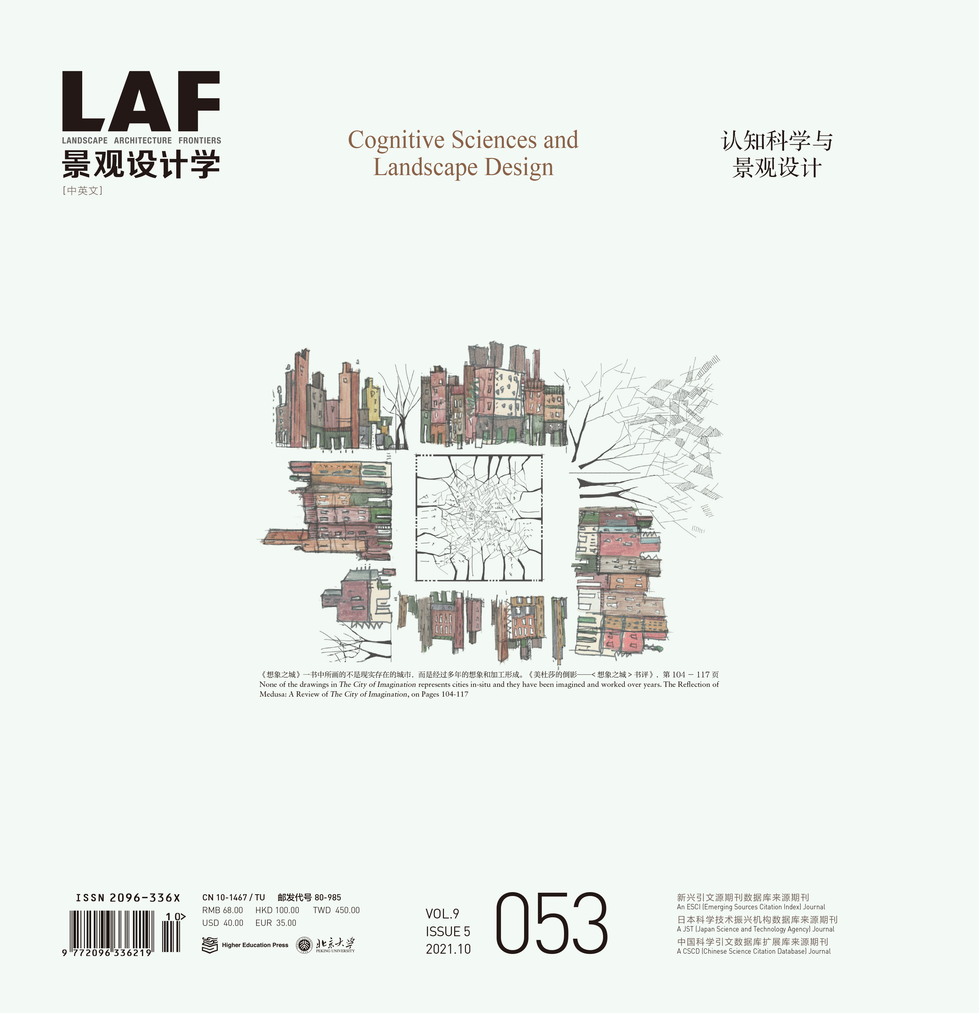
美杜莎的倒影——《想象之城》書評(píng)
The Reflection of Medusa: A Review of The City of Imagination
作者:陳崢能 Albert Zhengneng CHEN
摘要
瓦萊里奧?莫拉比托最近出版的《想象之城》一書質(zhì)疑了景觀解讀的圖像性概念�,并探索了通過講故事來閱讀和呈現(xiàn)景觀的可能性�,這種景觀強(qiáng)調(diào)景觀設(shè)計(jì)學(xué)的文學(xué)性和交流性傾向。本文包括4個(gè)部分����,分別從歷史、認(rèn)識(shí)論��、方法�����,以及相關(guān)文學(xué)淵源(尤其是書中受到伊塔洛?卡爾維諾啟發(fā)的部分)等方面對(duì)《想象之城》進(jìn)行評(píng)述���。作者認(rèn)為����,《想象之城》描繪了在圖像與語言傳統(tǒng)之間進(jìn)行景觀表現(xiàn)的歷史范例;體現(xiàn)了旅行見聞的真實(shí)性��,以及莫拉比托處理旅行記憶的方法�����;講述了莫拉比托如何將故事敘述中認(rèn)知的不完美性應(yīng)用到他的經(jīng)驗(yàn)主義方法中��,以平衡對(duì)景觀的實(shí)證主義解讀��;凸顯了莫拉比托視覺語言中形式自治與詩歌傳統(tǒng)之間的張力�����。本文探討并進(jìn)一步開啟了可感知存在與虛構(gòu)景觀之間的本質(zhì)對(duì)話�,對(duì)人類棲居深層意義的解讀與消費(fèi)���,以及實(shí)證主義與人文主義立場(chǎng)在這一學(xué)科中的認(rèn)知矛盾與調(diào)和����。
關(guān)鍵詞
伊塔洛?旅行見聞;景觀表達(dá)��;閱讀����;會(huì)說話的繪畫;故事講述�����;伊塔洛?卡爾維諾
Abstract
The lately published The City of Imagination by Valerio Morabito challenges the pictorial idea of landscape interpretation and explores the possibilities of storytelling to read and represent the landscape that focuses on the literary and communicative aptitudes of Landscape Architecture. The article reviews the book from the perspective of history, epistemology, method, and reception regarding its literary root, which is notably inspired by Italo Calvino. The review consists of four sections: First, word and image: the historical exemplars of landscape representation between pictorial and verbal tradition. Second, memory and foresight: the authenticity of travelogue and Morabito’s method of working with his travel memories. Third, truth and myth: how Morabito applies the cognitive imperfection in storytelling to his empirical approach that counterbalances the positivist reading of the landscape. And fourth, form and language: the tension between the formal autonomy and the bardic tradition in the visual language of Morabito. The article approaches and further opens the essential dialogues between the palpable existence and fictive landscape, the interpretation and consumption of the thick meanings in human inhabitation, and the cognitive antinomy and reconciliation of positivist and humanistic stances in the discipline.
Keywords
Travelogue; Landscape Representation; Reading; Verbal Drawings; Storytelling; Italo Calvino
基于場(chǎng)所體驗(yàn)的空間營造——深圳市國際山公園街區(qū)公共開放空間設(shè)計(jì)
Placemaking Based on Site Experience—Landscape Design of Parkhill Commons in Shenzhen
作者:江湘蓉�����,秦曉晴����,卡特里娜?奧爾蒂茲 JIANG Xiangrong, QIN Xiaoqing, Katrina ORTIZ
摘要
社區(qū)公園和街道等公共開放空間是居民日常進(jìn)行社交和休閑活動(dòng)的重要場(chǎng)所,其空間環(huán)境設(shè)計(jì)直接影響居民的場(chǎng)所體驗(yàn)���。盡管已有較多學(xué)者從注意力恢復(fù)�����、壓力舒緩等視角探究公共開放空間場(chǎng)所體驗(yàn)對(duì)使用者行為和身心的影響�����,但在設(shè)計(jì)實(shí)踐中��,這些理論成果較少被應(yīng)用于相關(guān)設(shè)計(jì)實(shí)踐中����。本文以深圳市國際山公園街區(qū)公共開放空間設(shè)計(jì)項(xiàng)目為例展開探討。項(xiàng)目團(tuán)隊(duì)梳理了相關(guān)研究成果��,總結(jié)出具有健康促進(jìn)作用的療愈環(huán)境及社會(huì)資本友好型社區(qū)的相關(guān)空間特征��;進(jìn)而以此為設(shè)計(jì)目標(biāo)����,從空間分區(qū)、種植設(shè)計(jì)�����、服務(wù)設(shè)施���、慢行街區(qū)方面制定了相應(yīng)的設(shè)計(jì)策略,期望通過提升場(chǎng)所體驗(yàn)吸引和服務(wù)社區(qū)居民����,創(chuàng)造富有活力�����、令人身心愉悅的公共開放空間��,使社會(huì)效益最大化���,進(jìn)而形成具有凝聚力的慢行街區(qū)。項(xiàng)目建成后�����,項(xiàng)目團(tuán)隊(duì)通過實(shí)地回訪了解了場(chǎng)地的實(shí)際使用情況和公眾評(píng)價(jià)����,評(píng)估了設(shè)計(jì)策略的成效。問卷調(diào)查和實(shí)地觀察結(jié)果顯示�����,項(xiàng)目的整體設(shè)計(jì)效果符合預(yù)期目標(biāo)��。本項(xiàng)目結(jié)論為社區(qū)級(jí)公共開放空間的設(shè)計(jì)實(shí)踐提供了設(shè)計(jì)參考和依據(jù),以期促進(jìn)相關(guān)理論研究與設(shè)計(jì)實(shí)踐的有效橋接��。
關(guān)鍵詞
社區(qū)公園�����;場(chǎng)所體驗(yàn)���;公共開放空間��;空間感知�����;注意力恢復(fù)���;戶外活動(dòng);慢行街區(qū)
Abstract
Placemaking of public open spaces, such as community parks and streetscapes that are foundational to residents’ daily social and recreational life, can significantly influence their site experience. Scholars have explored the influence of such kind of experience on users’ behavioral, physical, and mental conditions from multiple perspectives including attention restoration and stress reduction. However, the findings are seldom applied in practice to convey certain design concepts. This article introduces the landscape design project of Parkhill Commons in Shenzhen. The project team reviewed relevant research findings, and characterized the health-promoting restorative environment and social-capital-friendly communities. Accordingly, strategies for activity zones, planting design, service facilities, and slow-traffic neighborhoods were proposed to enhance site experience and serve nearby residents by creating vital and pleasant community-level public open spaces, and to maximize the social benefits and reinforce community cohesion. After completion, the project team has investigated the site usage and the public’s evaluation, in order to stimulate reflections on design strategies. Results from the questionnaire survey and field observation show the effect of placemaking strategies on users’ site experience. This article provides references for placemaking practice of community-level public open spaces and is expected to help bridge the gap between theoretical research and design practice.
Keywords
Community Parks; Site Experience; Public Open Spaces; Spatial Perception; Attention Restoration; Outdoor Activities; Slow-Traffic Neighborhoods
培育數(shù)字化集成城市系統(tǒng):以加拿大卡雷拉瓦爾公園為例
Fostering Urban Digital Integrated Systems: The Case of Carrè Laval, Canada
作者:馬丁娜?馬扎雷洛�����,法比奧?杜阿爾特���,西蒙娜?莫拉,里卡多?阿爾瓦雷斯,卡洛?拉蒂 Martina MAZZARELLO, Fabio DUARTE, Simone MORA, Ricardo ALVAREZ, Carlo RATTI
摘要
許多城市的政府部門應(yīng)用數(shù)字技術(shù)來提高城市軟硬件設(shè)施系統(tǒng)���,以培育創(chuàng)業(yè)型社會(huì)���,開創(chuàng)新型服務(wù),提高市民生活質(zhì)量�����,優(yōu)化城市體驗(yàn)�,提振地方經(jīng)濟(jì)。建設(shè)有傳統(tǒng)基礎(chǔ)設(shè)施的城市系統(tǒng)往往天然具有壟斷性�,而基于數(shù)據(jù)的數(shù)字平臺(tái)可以促進(jìn)多元利益相關(guān)方的參與。本文提出了混合型數(shù)字化集成城市系統(tǒng)的概念以及設(shè)計(jì)方法論��,旨在將數(shù)字技術(shù)和實(shí)體設(shè)施融入到城市環(huán)境中����。而后介紹了由麻省理工學(xué)院可感知城市實(shí)驗(yàn)室學(xué)生設(shè)計(jì)、筆者指導(dǎo)的設(shè)計(jì)項(xiàng)目��,以加拿大拉瓦爾市卡雷拉瓦爾公園建設(shè)與改造項(xiàng)目為例�,整合了數(shù)字技術(shù)并提出設(shè)計(jì)方案—6名學(xué)生在課程中每人提出一項(xiàng)設(shè)計(jì)方案,分別為“屏幕激活”“無限記憶”“論壇”“智能桌”“我的AR世界”和“飲食足跡”�����,這些設(shè)計(jì)能夠促進(jìn)公園改造項(xiàng)目建設(shè)進(jìn)程中的公眾參與。以人為本��、因地制宜地進(jìn)行方案設(shè)計(jì)可以促進(jìn)數(shù)字技術(shù)與城市系統(tǒng)更好地融合�,并增加城市對(duì)本地新興利益相關(guān)方的吸引力,為他們營造新的城市體驗(yàn)����。
關(guān)鍵詞
城市環(huán)境;城市體驗(yàn)����;公眾參與;以人為本設(shè)計(jì)���;數(shù)字化平臺(tái)���;教育;卡雷拉瓦爾公園
Abstract
City governments are embracing digital technologies to improve hard and soft urban systems, so as to create and improve urban experiences, foster an entrepreneurial city, as well as devise novel services that can improve the livability of citizens and boost the local economy. Unlike traditional infrastructure and urban systems, which tend to be natural monopolies, data-driven digital platforms can engage multiple stakeholders simultaneously. This article, introducing the notion of hybrid urban digital integrated systems, proposes a methodology aims at the integration of digital and physical elements in urban environments. We based our discussion on the work developed by students at the Massachusetts Institute of Technology Senseable City Lab, which focused on the integration of the digital-technology-based solutions in Carré Laval of the city of Laval, Canada. As the result of the workshop, six projects have been developed by students, namely, “Activating Surface,” “Infinite memories,” “Fora,” “iTable,” “MinecARft,” and “Foodprint.”These designs aim at promoting civic engagement as intrinsic elements of the re-appropriation and redesign of this severely underutilized site. The human-centered designs rooted in specific context will help digital technologies embedded in the city and increase the attractiveness of the city to local and new stakeholders.
Keywords
Urban Environment; Urban Experiences; Civic Engagement; Human-Centered Design; Digital Platforms; Education; Carré Laval
 京公海網(wǎng)安備 110108000058號(hào)
