背景與挑戰(zhàn):立體山水城市的濱水重構(gòu)
Background and Challenges:waterfront reconstruction of a mountain city
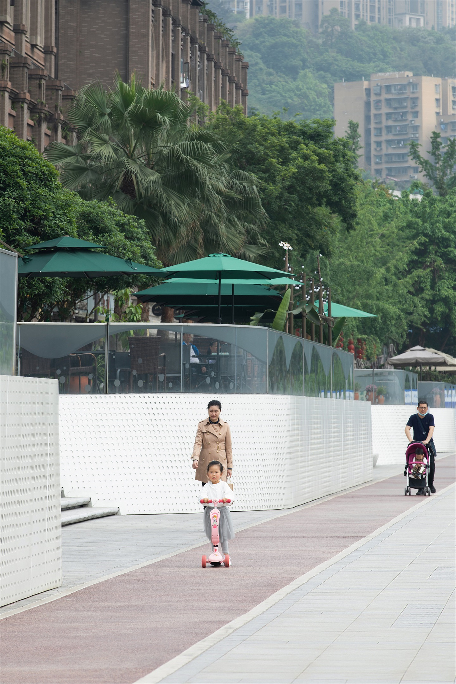
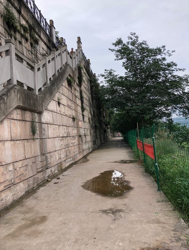
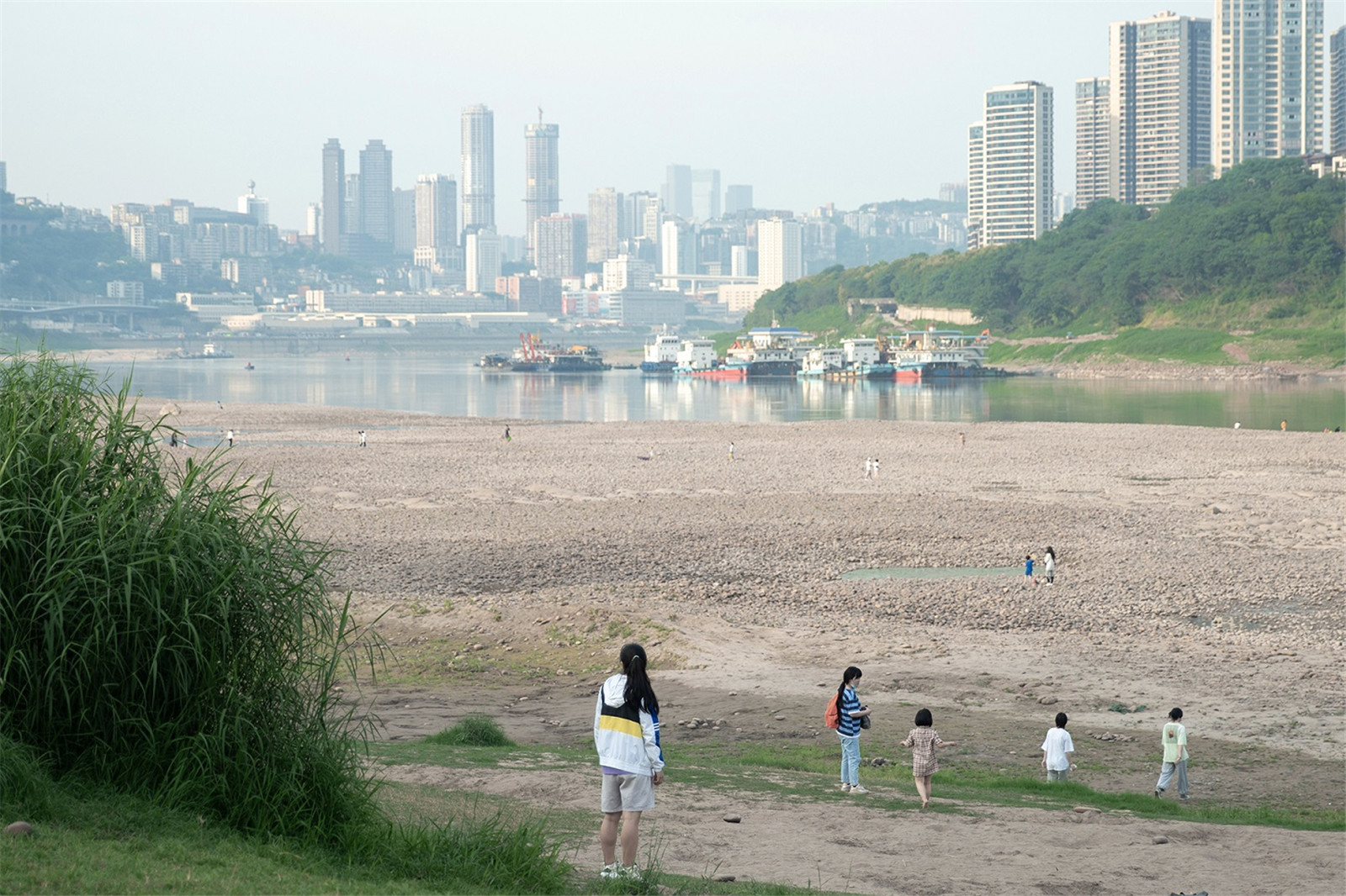
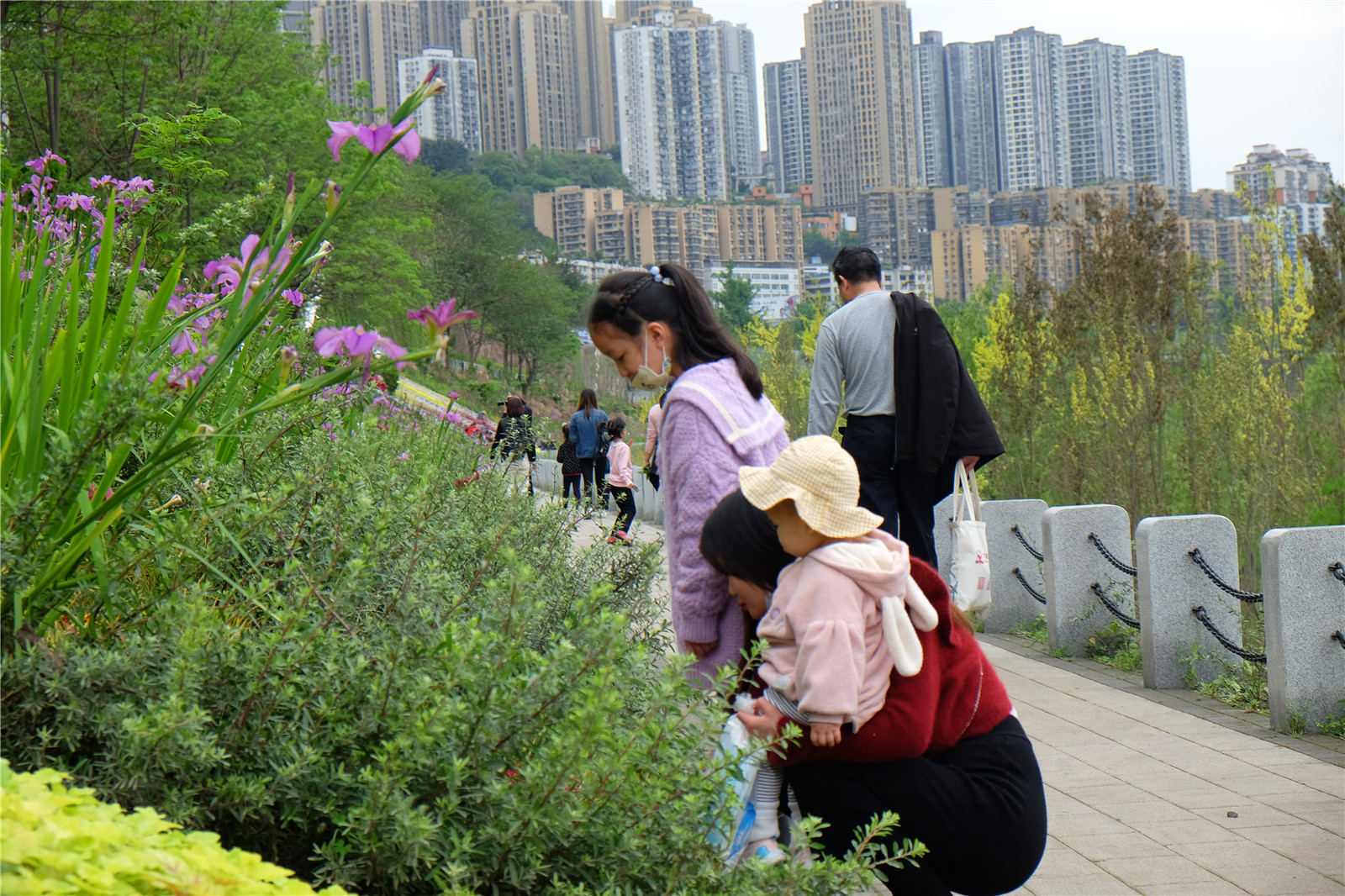
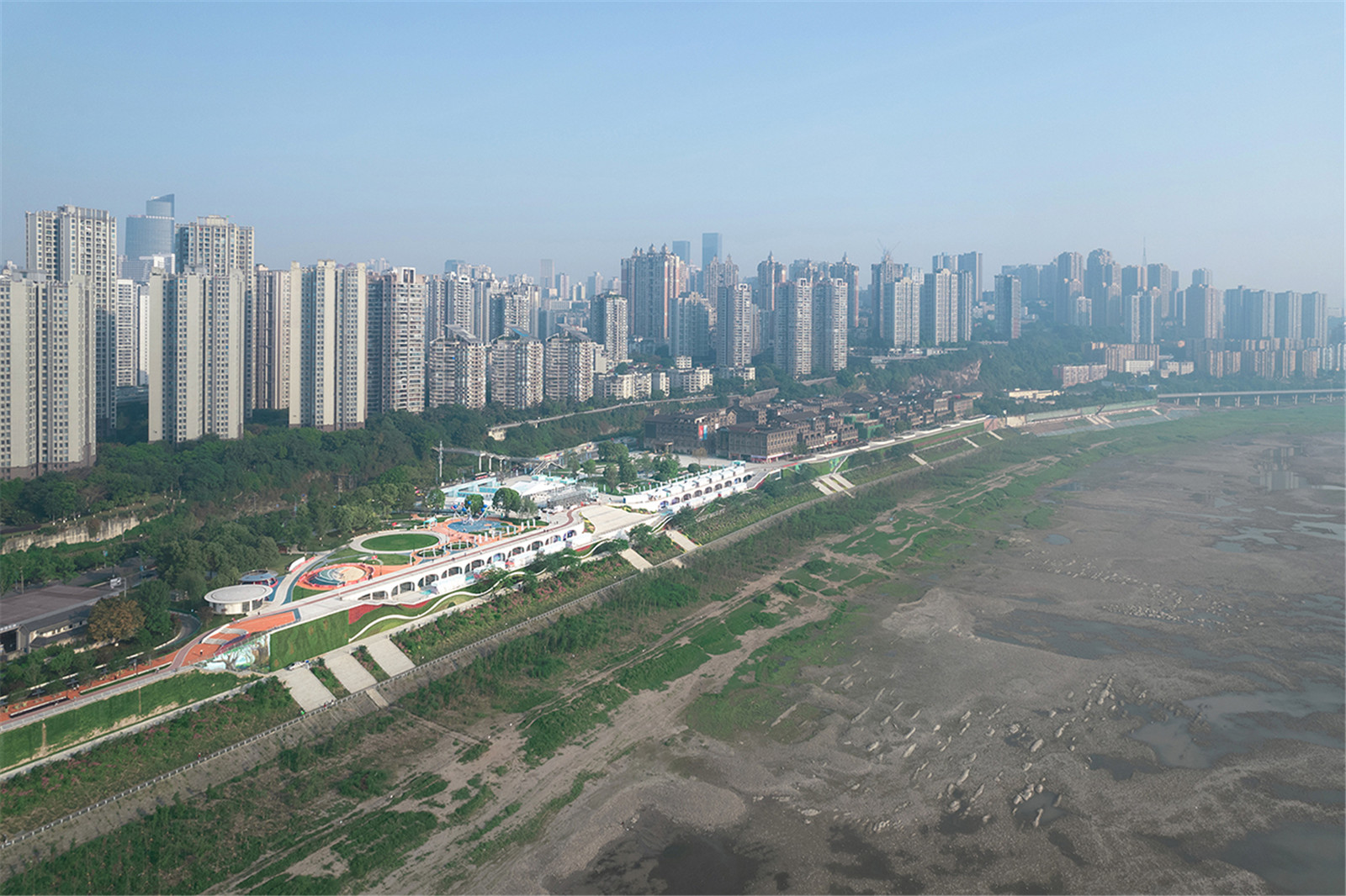
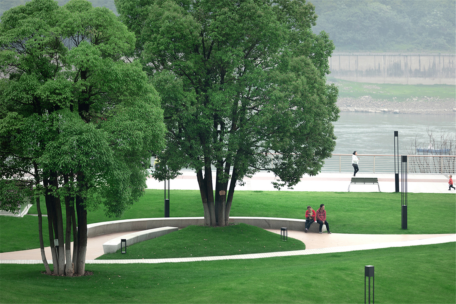
重慶是立體的山地城市,也因無數(shù)的網(wǎng)紅級(jí)現(xiàn)象被稱為5D 魔幻都市���。重慶因長(zhǎng)江而立�����,在水路與步行作為城市主要交通方式的年代�����,城市的生產(chǎn)與生活沿江展開��。濱江是市民重要的公共活動(dòng)空間����,隨著城市進(jìn)入工業(yè)化、城市化階段后��,濱江空間逐漸被道路����、碼頭及工業(yè)等所占據(jù)。然而�����,城市生活區(qū)與濱江空間有巨大的高差�����,因每年季節(jié)性的30-50 米的水位高差所形成的巨大消落帶,使得長(zhǎng)江難以親近��。通過對(duì)游客與市民的隨機(jī)訪問�����,大家普遍表達(dá)了對(duì)濱江的熱愛與回憶�����,但當(dāng)前的濱江難以到達(dá)�����,也無法長(zhǎng)時(shí)間停留�����。
Chongqing is a famous mountain city. It is also called the 5D Magic City because of the countless trend videos and reports which show the huge elevation difference of Chongqing. Chongqing is built by the Yangtze River. At the time when waterway transport and walking were the main means of urban transportation, urban life were relied on the river. Riverside area is the important public activity space for the citizens. The riverside space was gradually occupied by roads, docks and factories as the rapid urbanization of Chongqing. However, there is a huge elevation difference between the urban living area and the riverside space. Even worse, there is a water-level fluctuation zone formed by the seasonal 30-50 meters of water-level difference each year. As a result, Yangtze River became hard to approach. People have expressed their love and memories of the riverside space during interviews and surveys. But people can hardly get close to the riverside space and cannot stay for a long time.
▼重慶是立體的山地城市�,濱江難以到達(dá)
As Chongqing is a mountain city, the riverside area is hard to get close

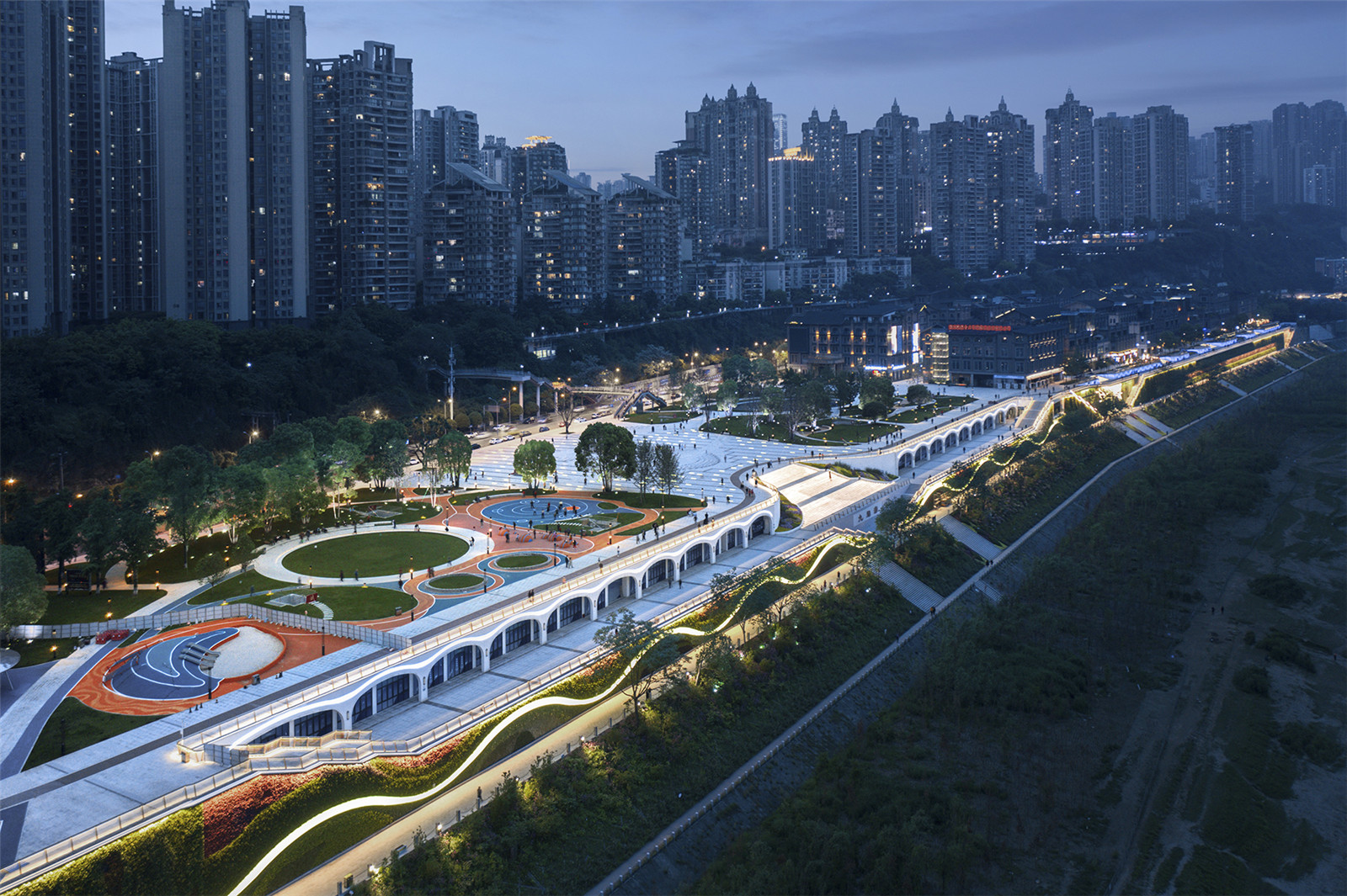
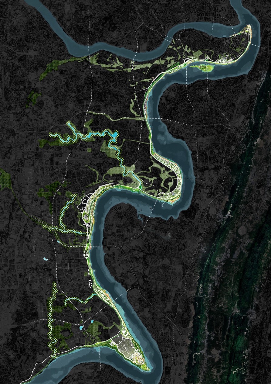
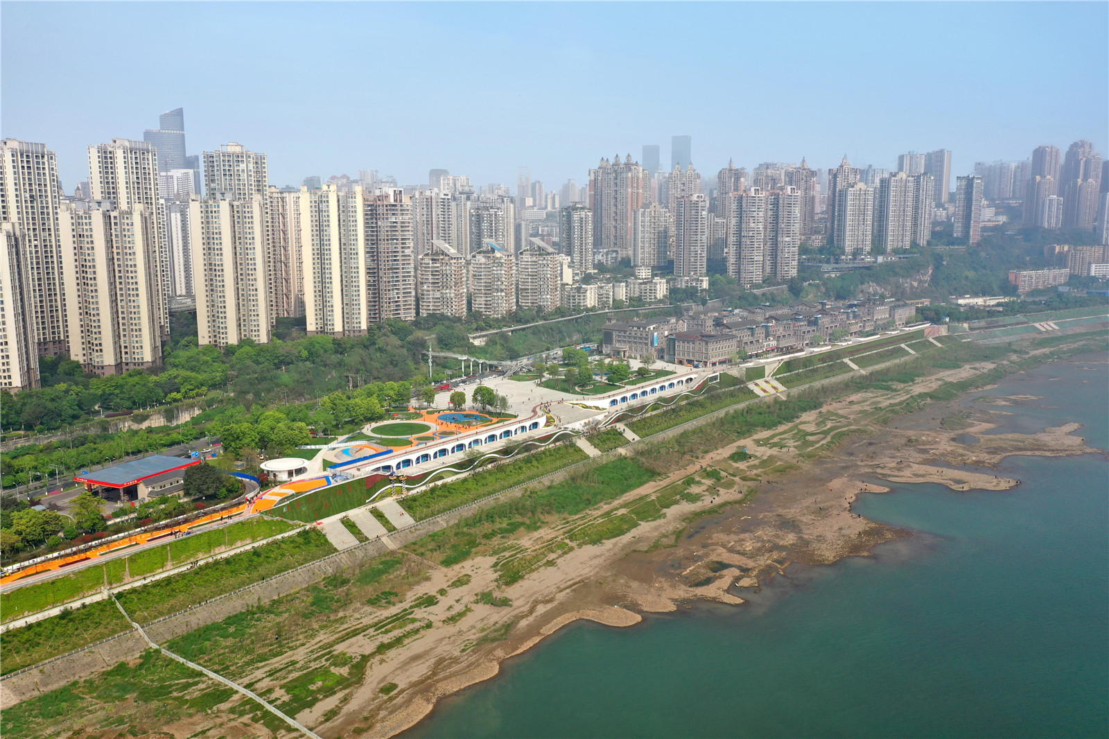
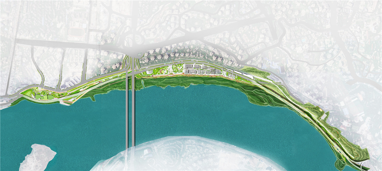
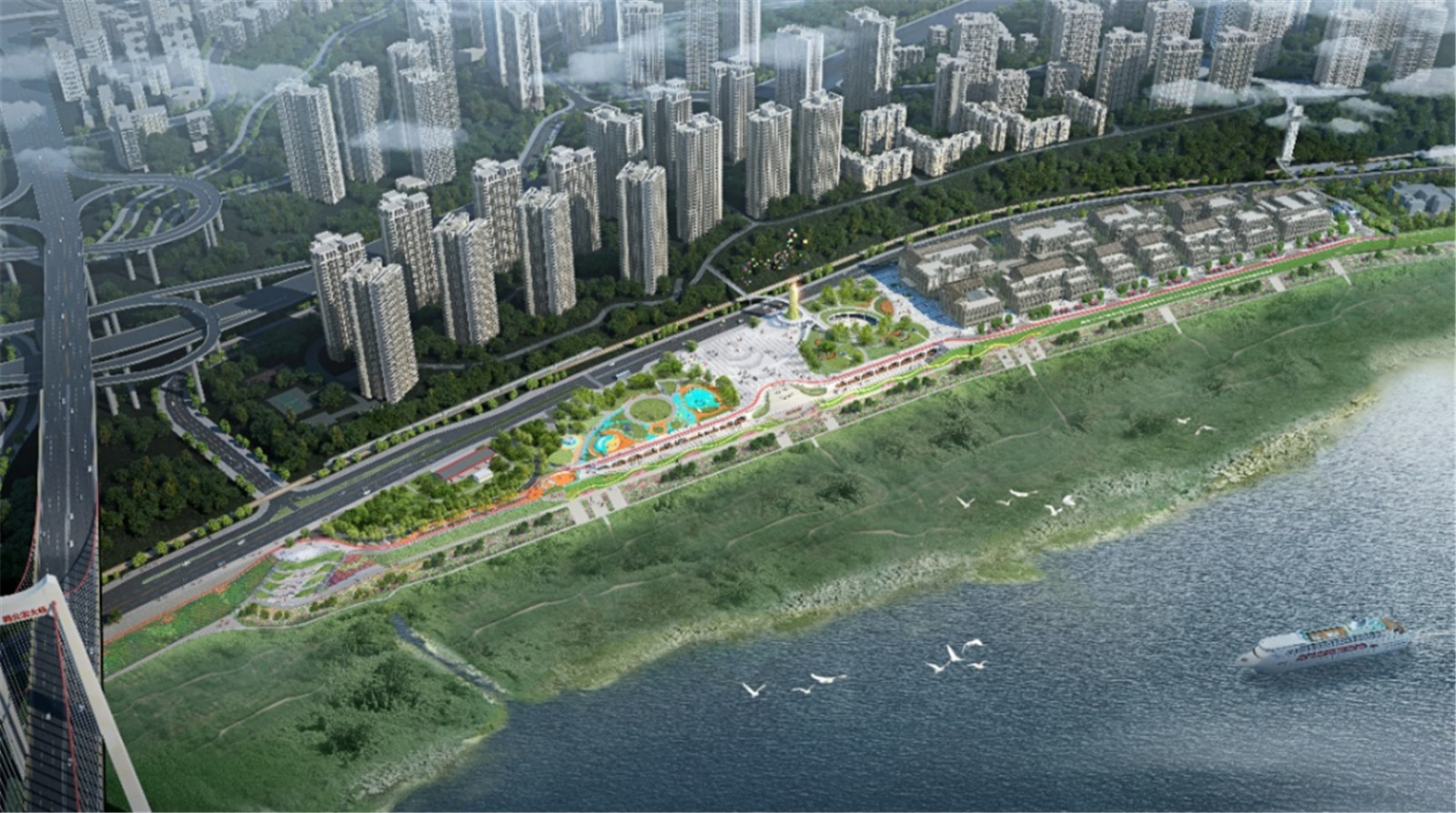
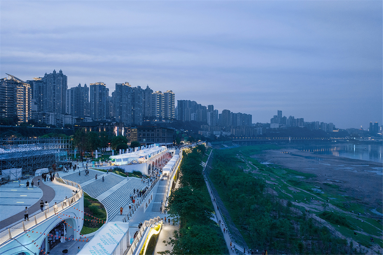
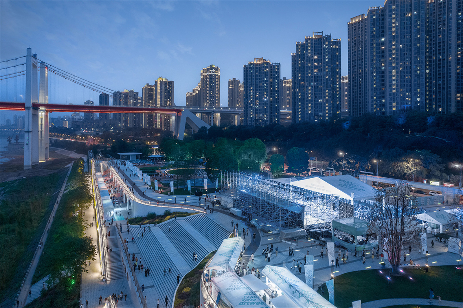
針對(duì)主城區(qū)109 公里的重慶“兩江四岸”治理提升工程的全球競(jìng)賽�����,MYP 邁柏與TYLIN 林同炎組成聯(lián)合團(tuán)隊(duì),以“重回長(zhǎng)江”為理念�����,成功中標(biāo)長(zhǎng)江北岸段�。九龍外灘項(xiàng)目,作為“兩江四岸”十大公共空間節(jié)點(diǎn)之一�����,是目前首個(gè)建成節(jié)點(diǎn)��,獲得了領(lǐng)導(dǎo)與市民的一致好評(píng)�。
MYP and Tylin have formed a joint team to participate the competition of the 109-kilometer "Two Rivers and Four Banks" upgrading project which is in the main urban area of Chongqing. The team have successfully won the competition with the design concept of "returning to the Yangtze River" and got the chance to make detail plans for the northern section of the Yangtze River. The Kowloon Bund, as the first completed node of the ten public nodes of "two rivers and four banks", has won unanimous praise from the officials and citizens.
▼“兩江四岸“長(zhǎng)江北段總體平面
master plan of the north section of the Yangtze River for the "two rivers and four banks"

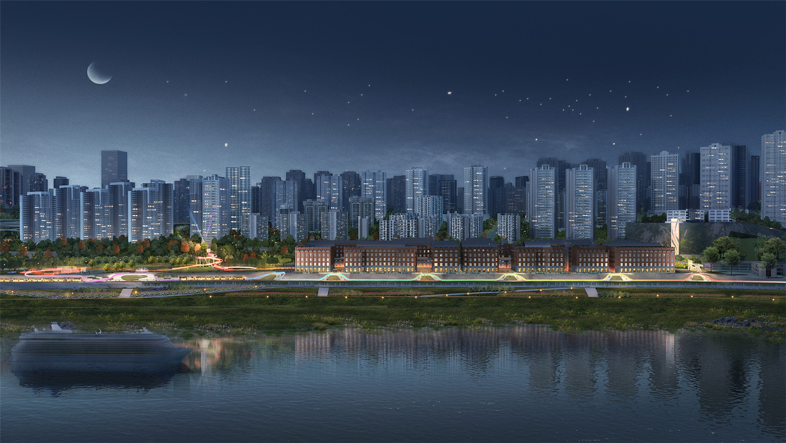
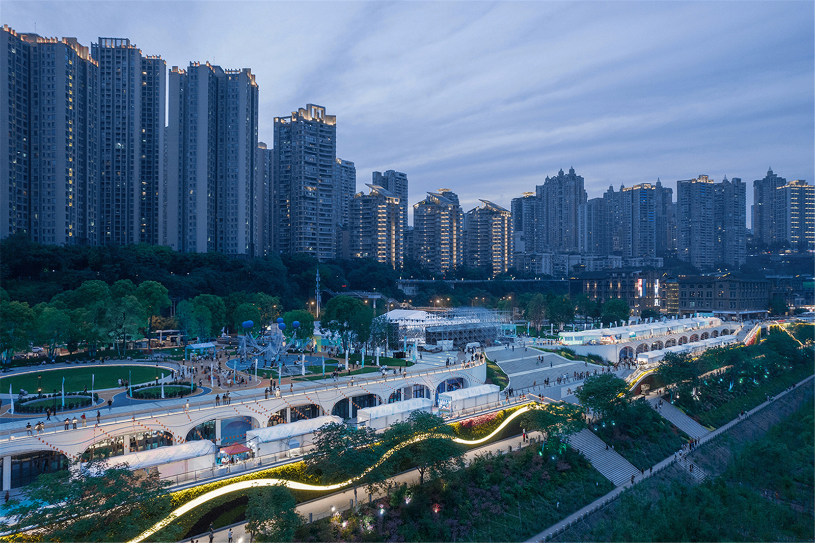
▼九龍外灘建成鳥瞰實(shí)景
aerial view of the Jiulong Bund

打造一個(gè)基于季節(jié)性水位變化的公共空間體系
Create A Public Space System Based On Seasonal Water Level Changes
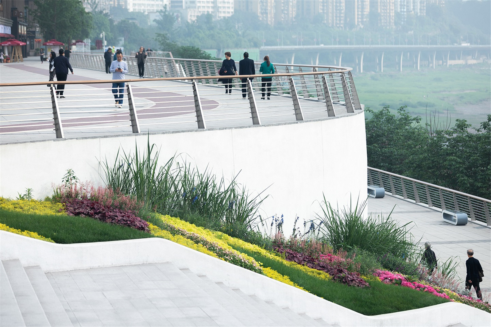
九龍外灘,是九龍坡區(qū)重要的濱江活動(dòng)空間���,岸線長(zhǎng)度2.1 公里��,占地46 公頃����。因巨大的高差與成渝鐵路的分隔�,使得居住區(qū)與濱江空間嚴(yán)重割裂。居住區(qū)與濱江直線距離雖然只有100多米�,卻因30-100 米的高差��,讓人們難以到達(dá)�����。該段長(zhǎng)江洪水位的統(tǒng)計(jì)情況如下:165m(低水位)�,4 月至9 月�����,淹沒期290 天�;175m(高水位)�,10 月至次年3 月,淹沒期111 天�;185m(洪水位),6 月-9 月�����,淹沒期14 天���;191m(20 年一遇洪水位)�����,平常年份不會(huì)被淹沒�。根據(jù)該數(shù)據(jù),項(xiàng)目設(shè)計(jì)了一個(gè)基于不同高差的公共活動(dòng)與生態(tài)體系�����,來重新建立人與自然的連接���。
The Kowloon Bund is an important riverfront activity space in the Kowloon Slope District. It has 2.1 kilometers coastline and 46 hectares. However, the residential area and the riverfront space have been separated by the elevation difference and Chengdu-Chongqing railway. Although there are only 100 meters away from the residential area to the riverfront area, the 30-100 meters of elevation difference makes it difficult for people to get close to the riverfront area.
▼基于季節(jié)性水位變化的公共空間體系
Public Space Based On Seasonal Water Level Changes

▼立體山水城市的濱水重構(gòu)打造
The Reconstruction of the Riverfront Space for a mountain city

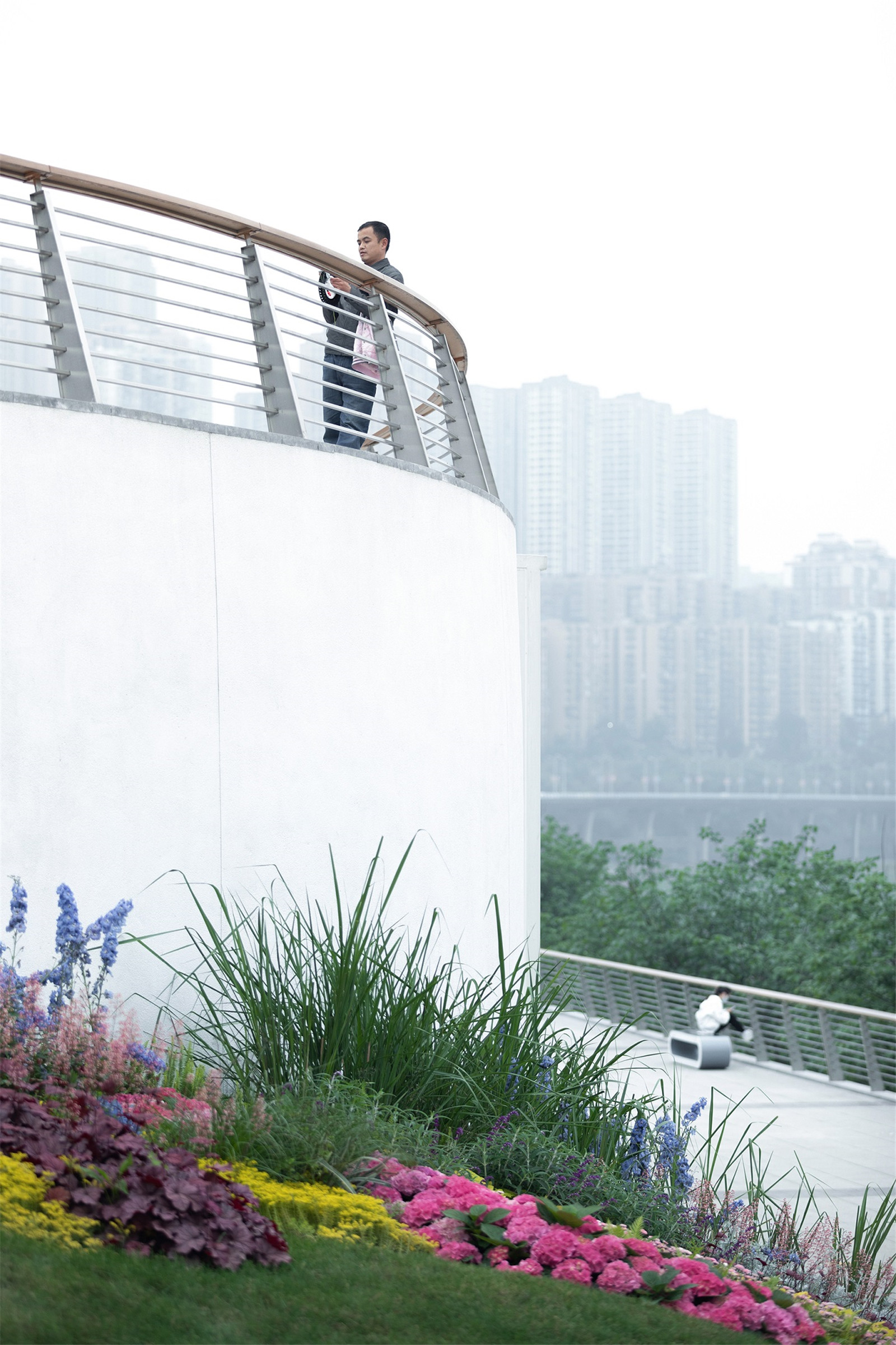
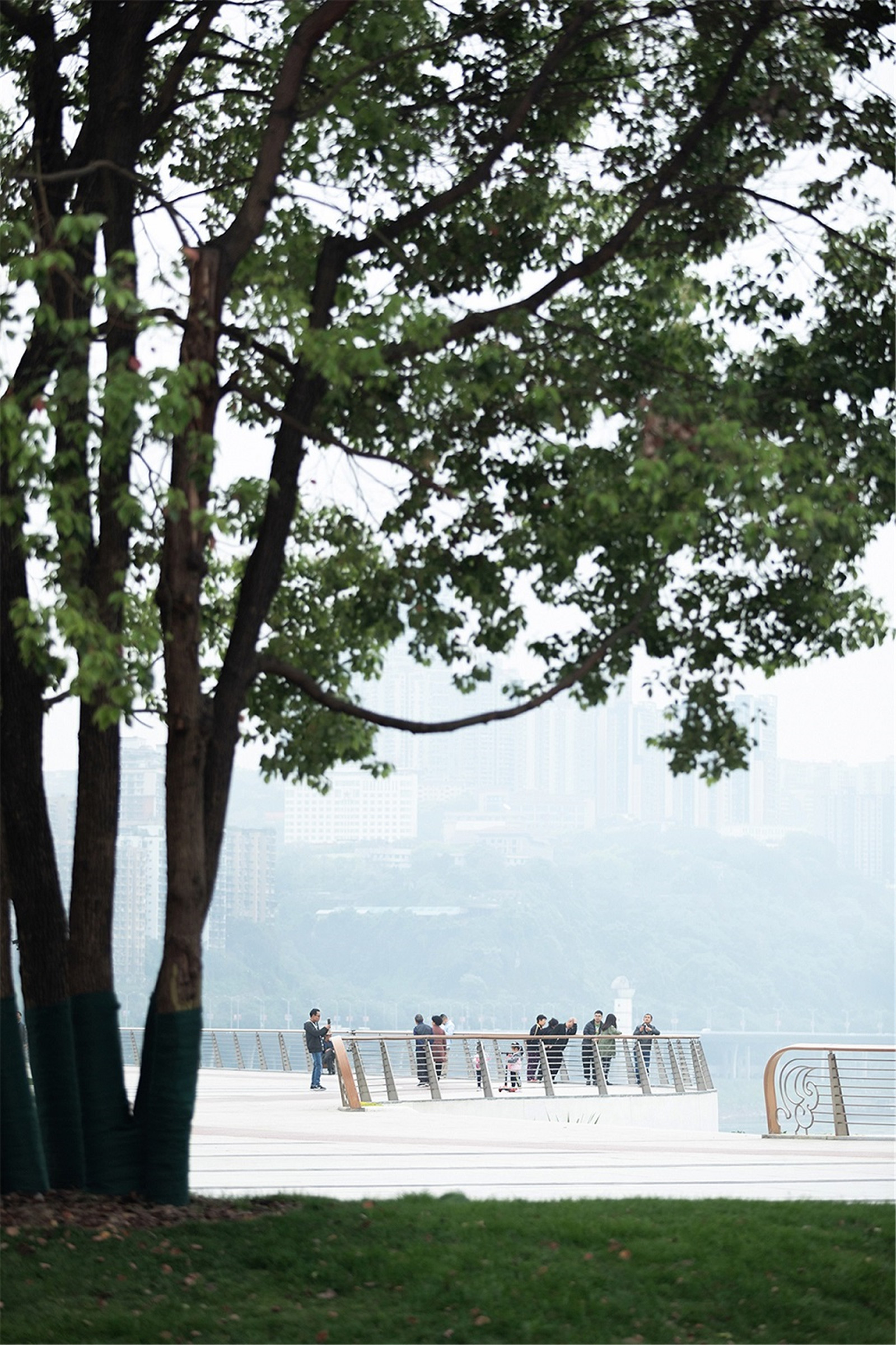
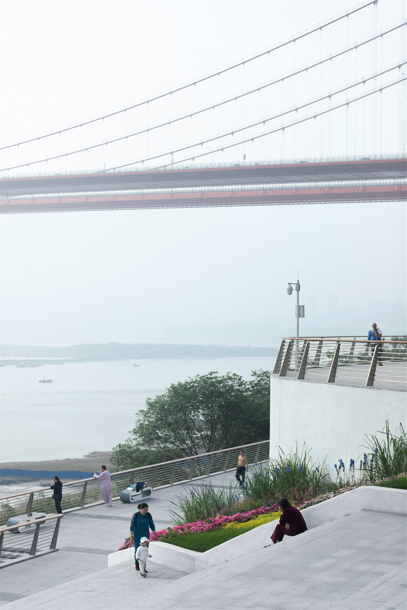
▼不同高度的觀江平臺(tái)
River Viewing Platforms At Different Elevations


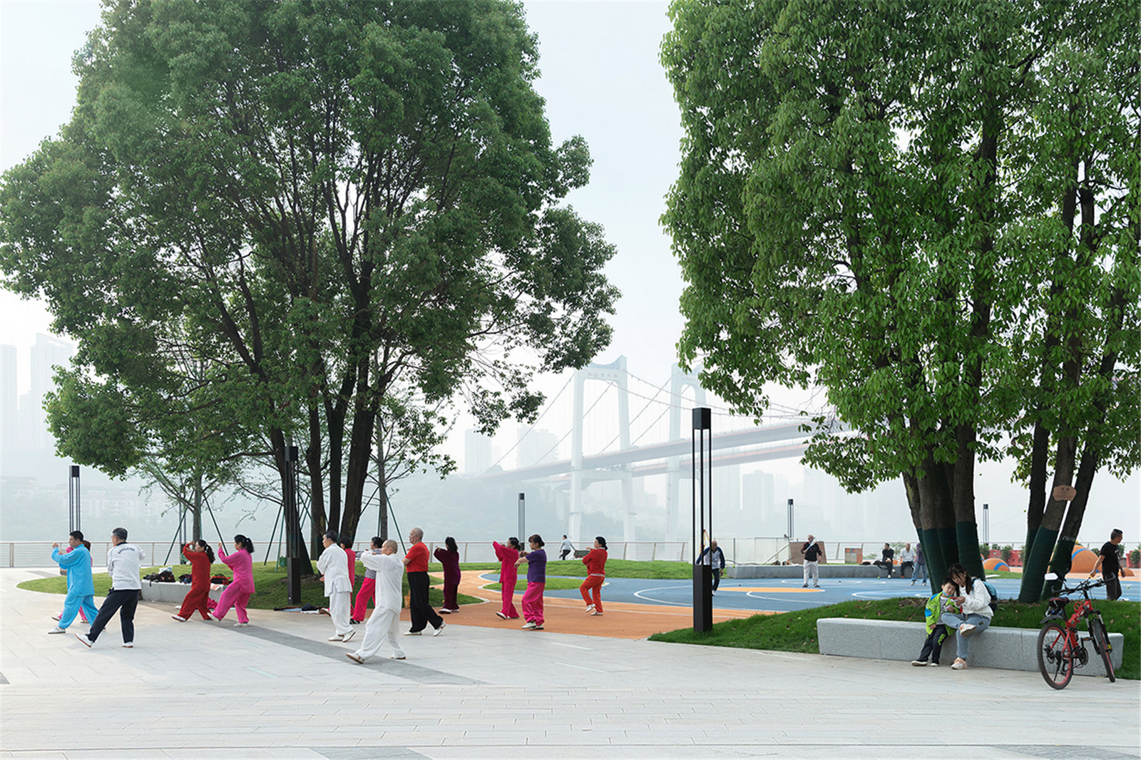
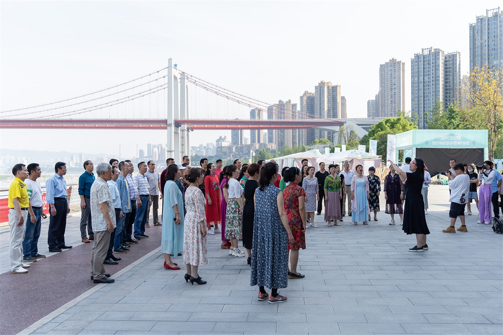
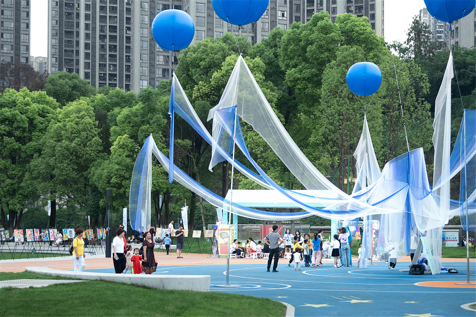
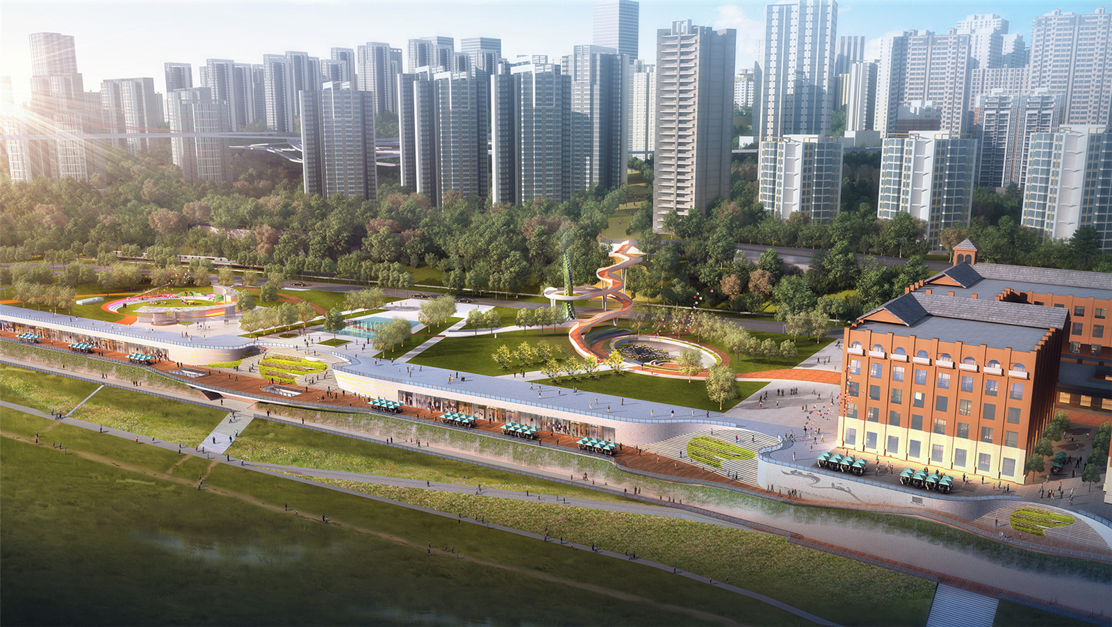
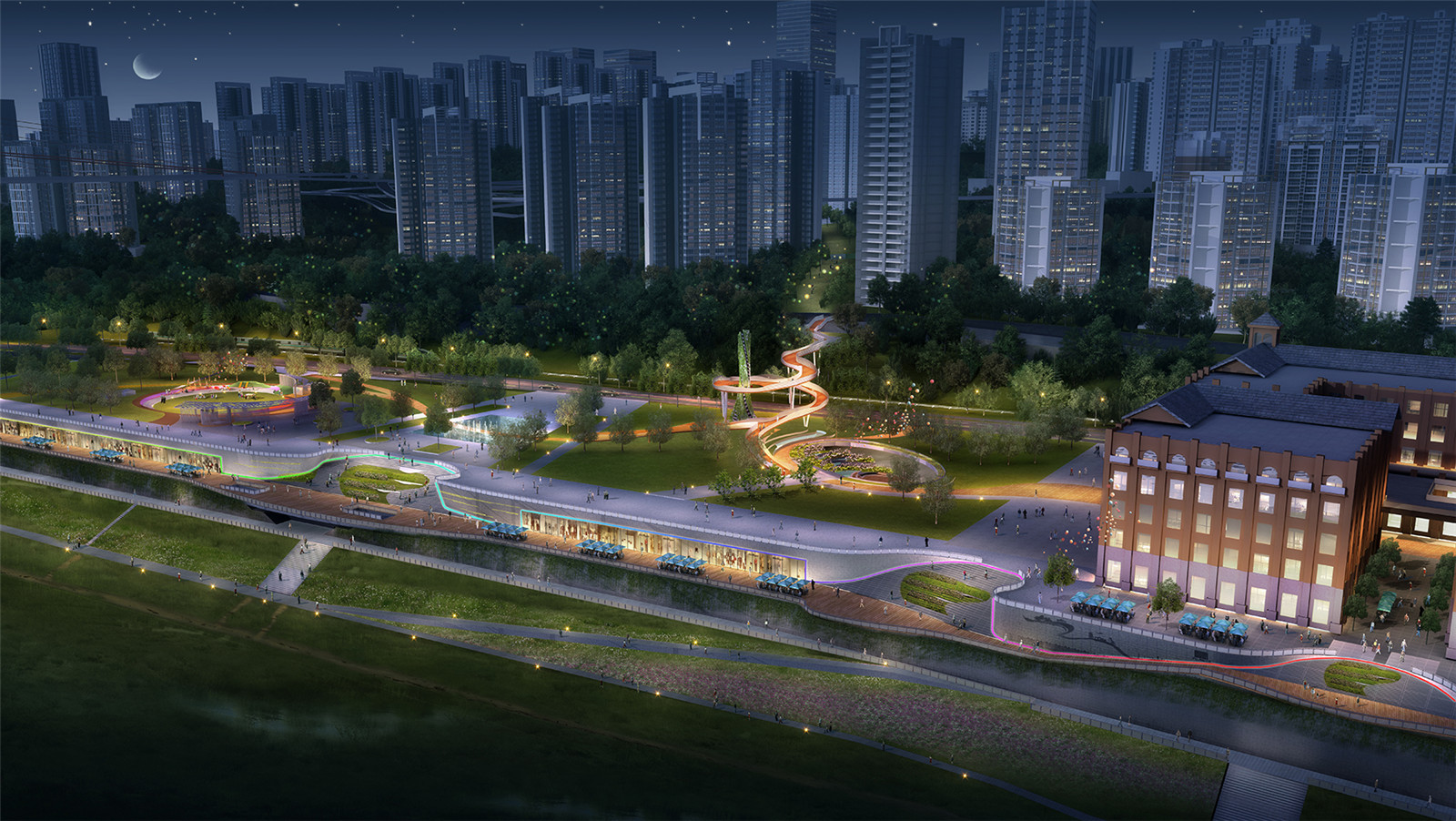
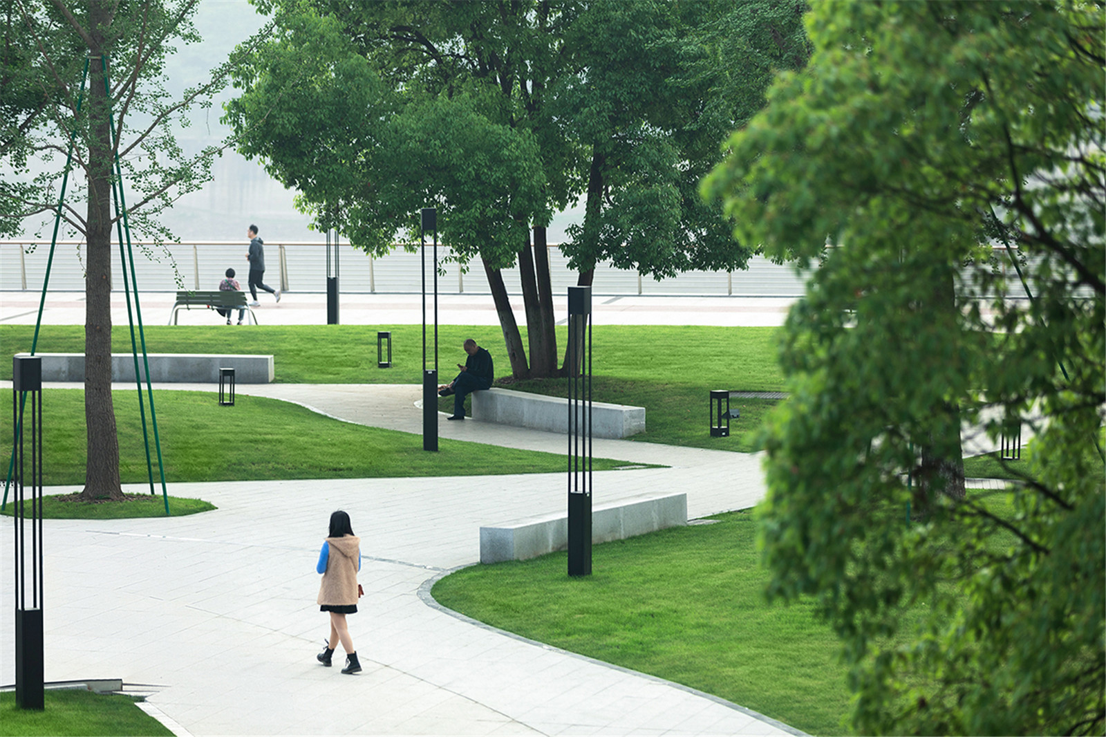
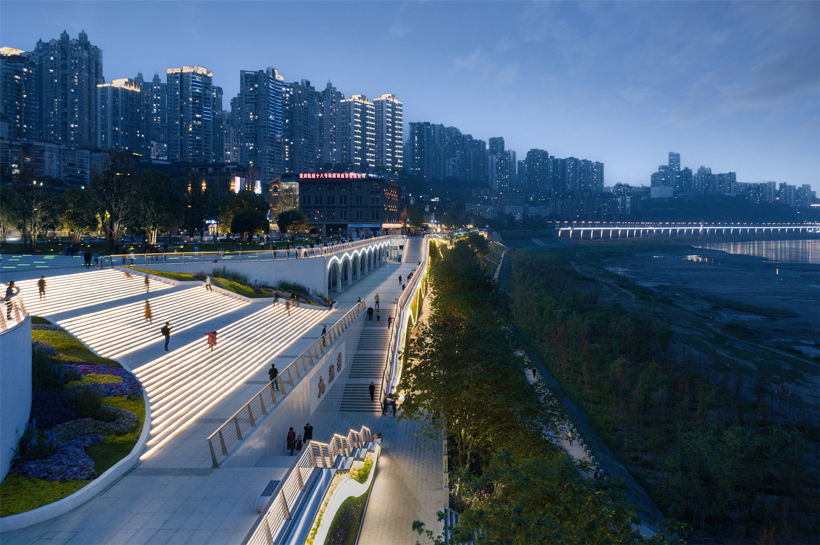
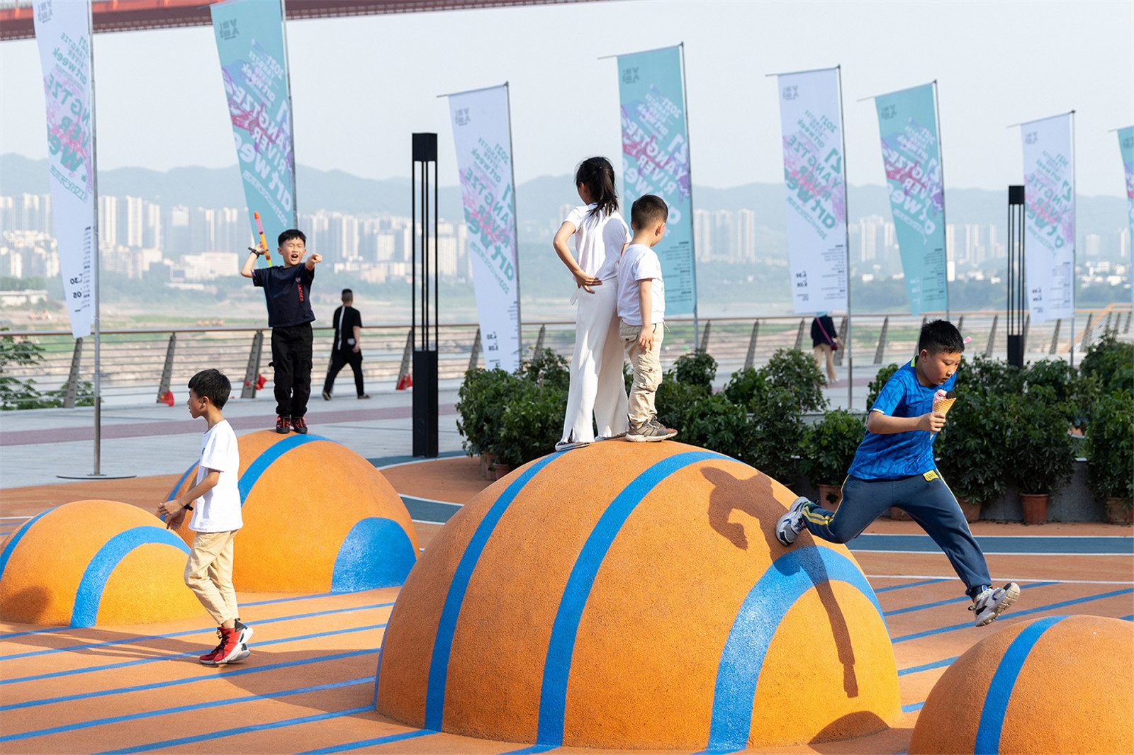
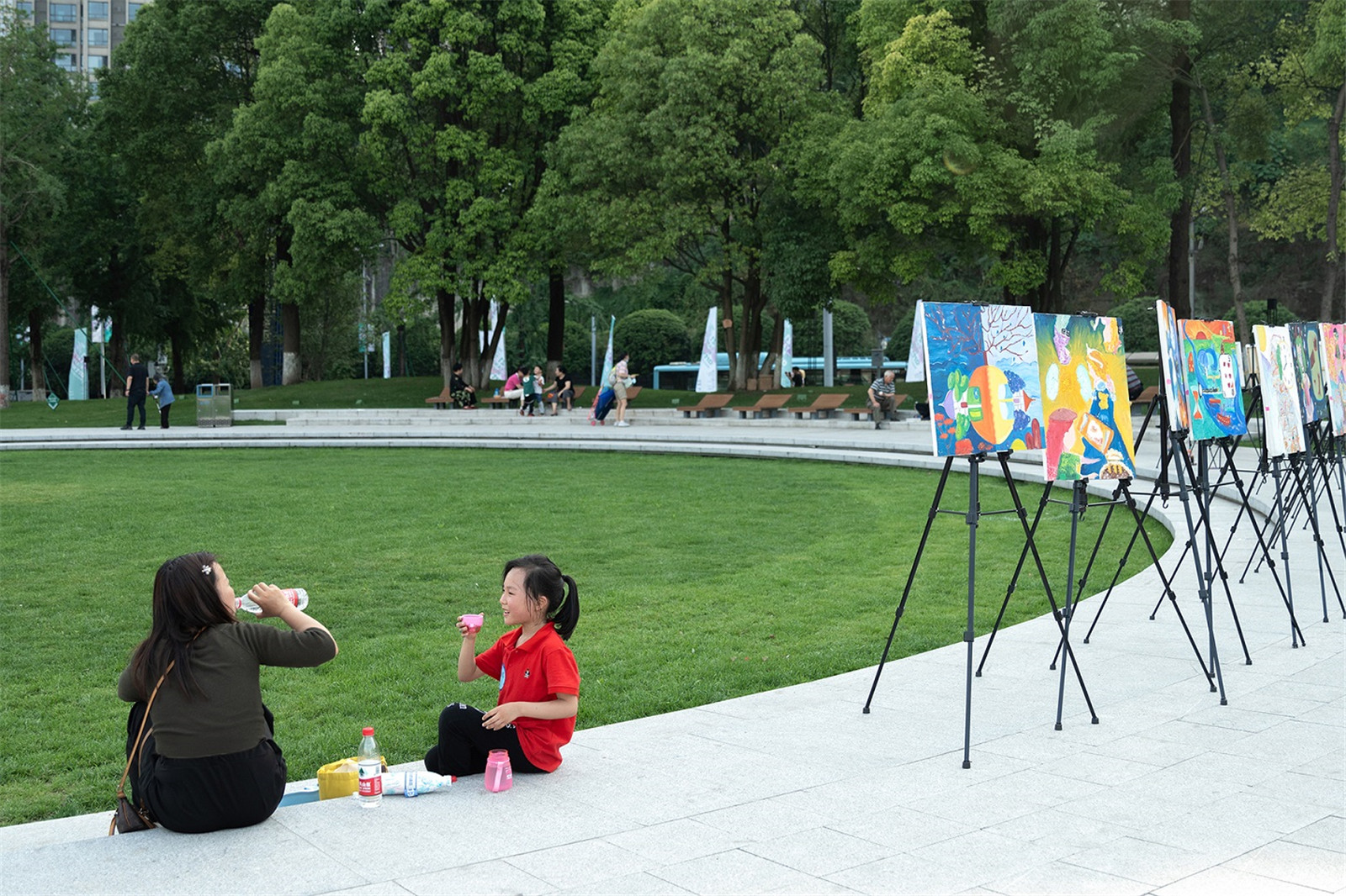
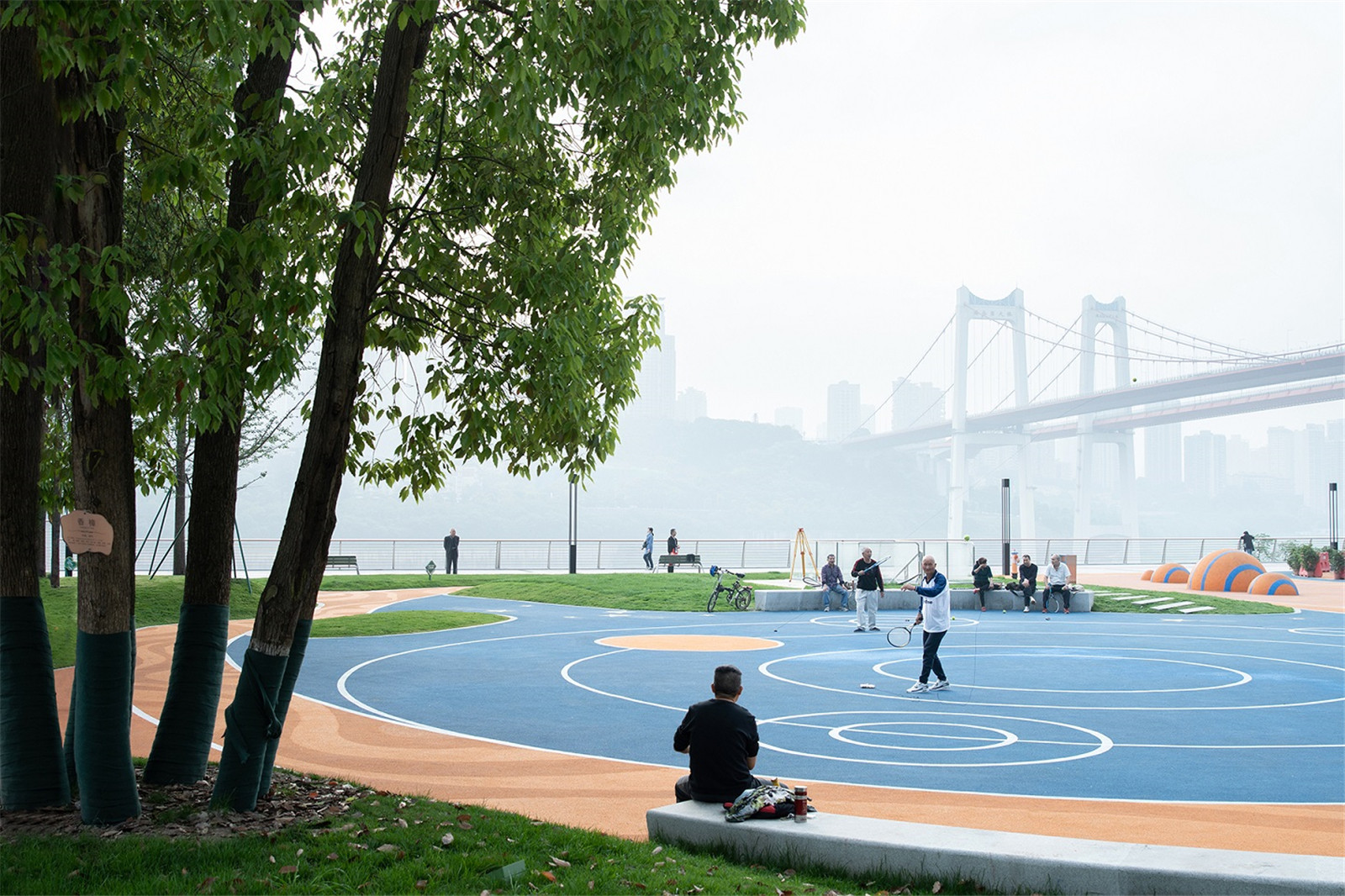
向?yàn)I江打開的彈性慶典廣場(chǎng)
A Flexible Celebration Square face toward the Riverside
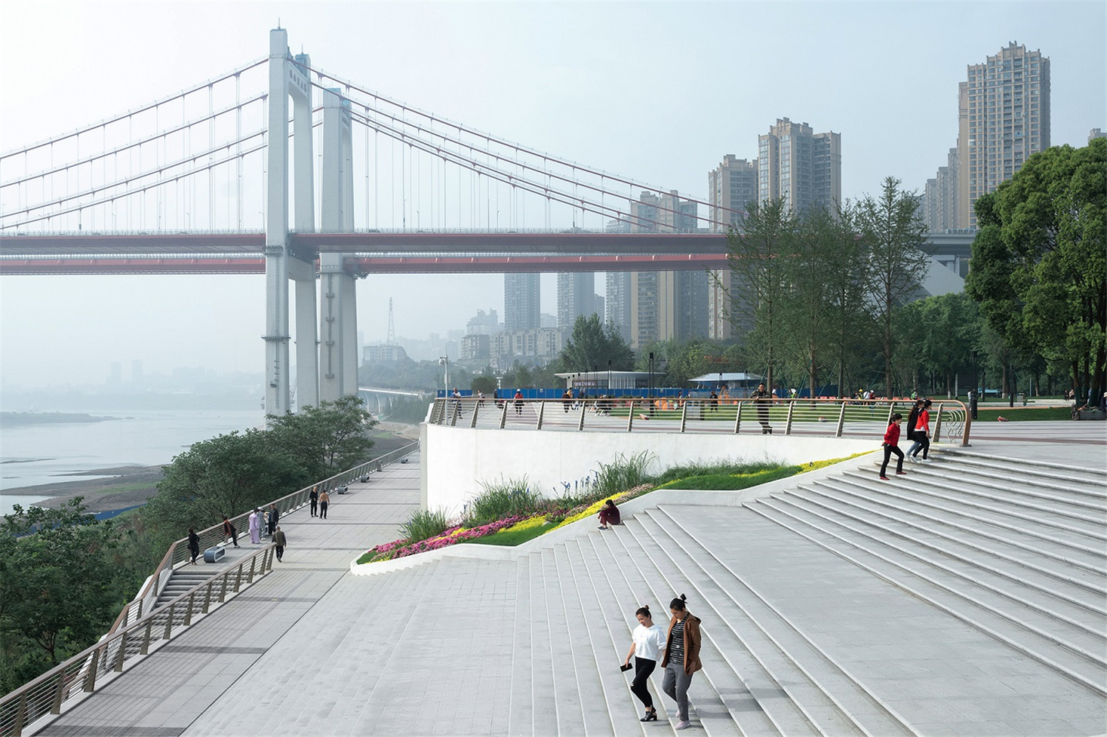
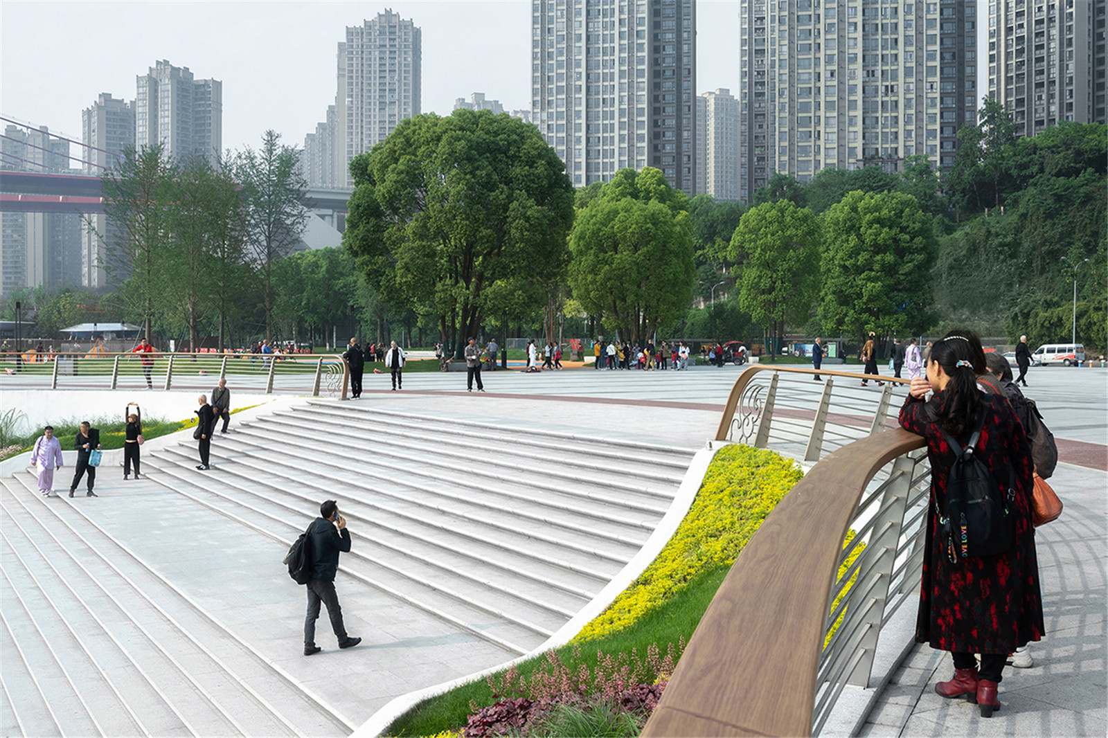
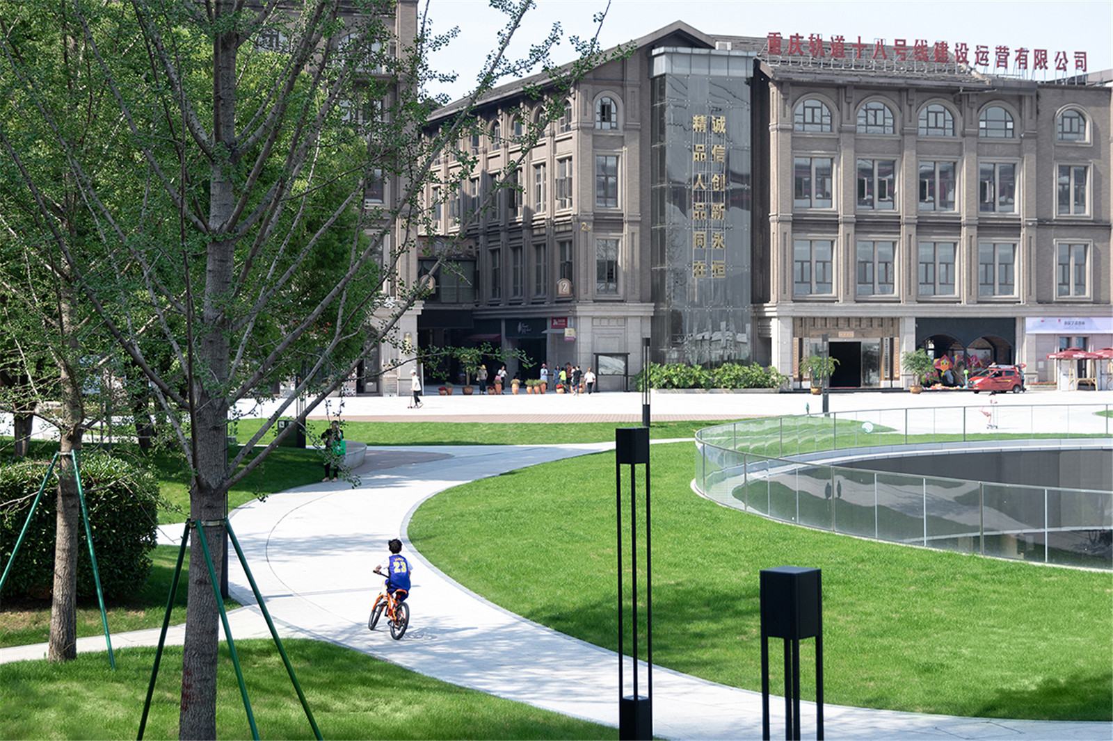
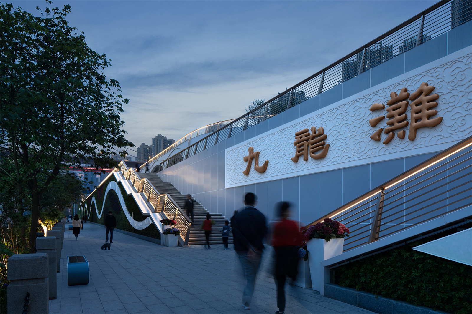
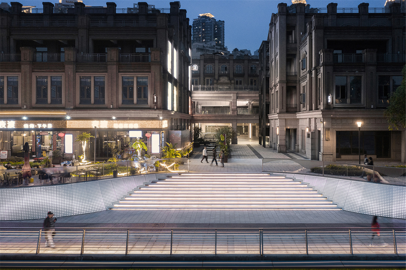
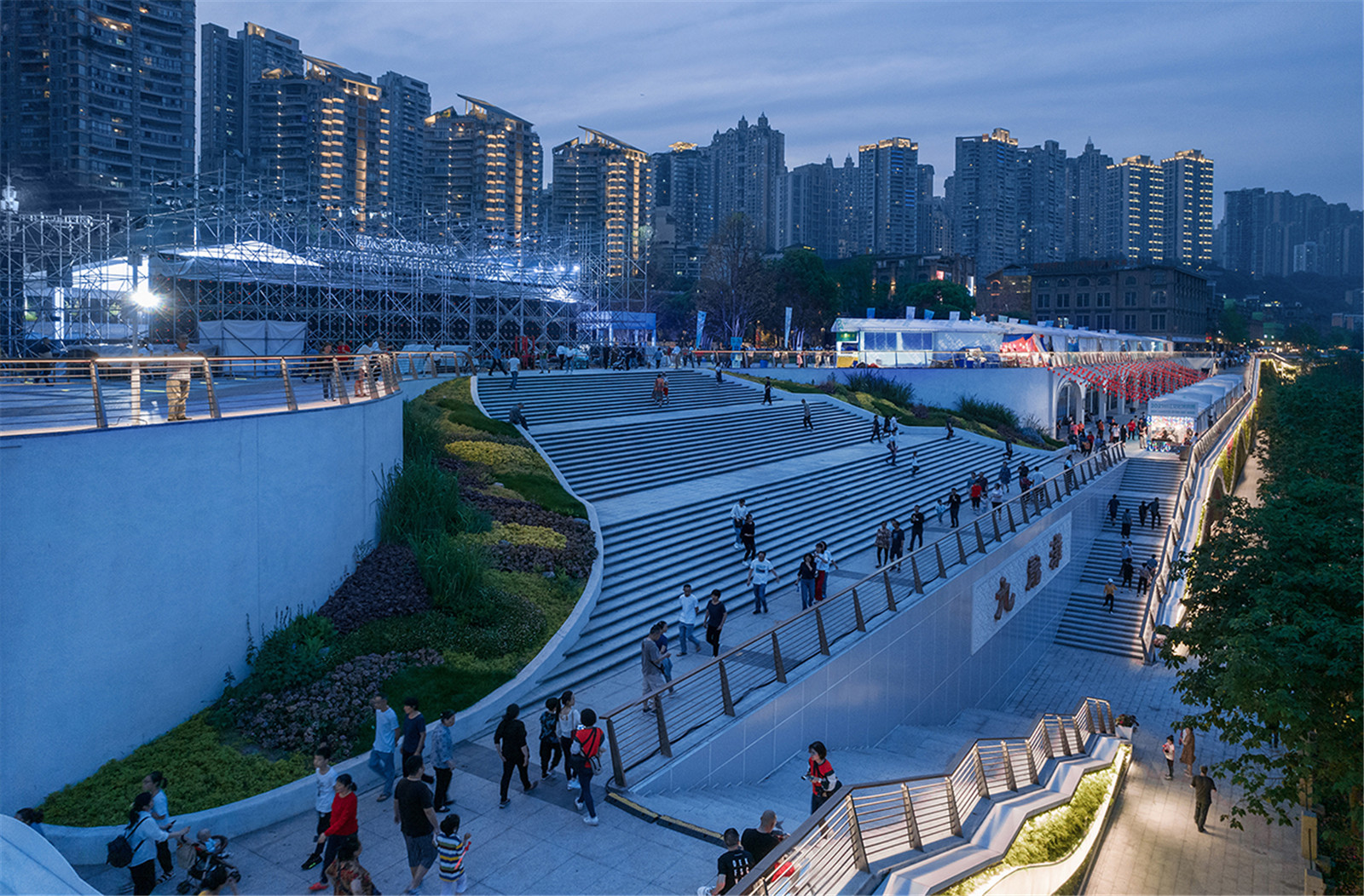
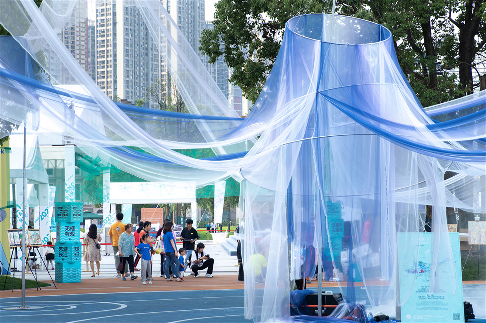
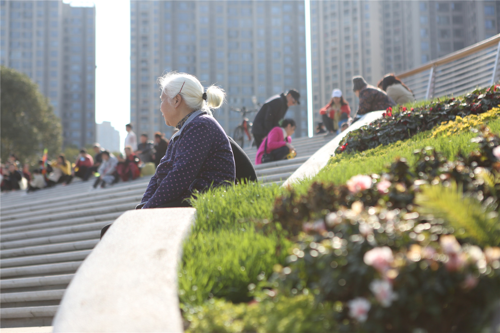
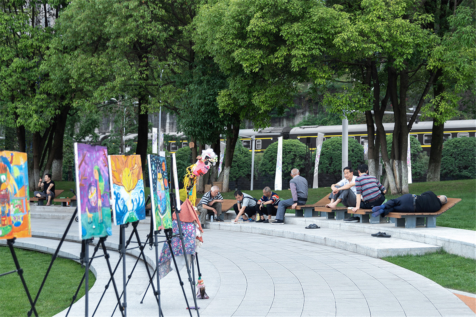
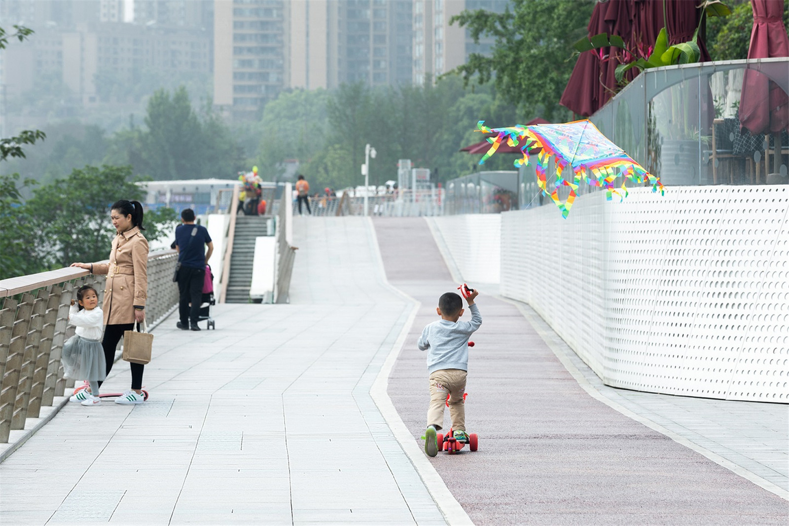
>195 米是城市公共廣場(chǎng)區(qū)����,位于百年洪水位之上�����,主要任務(wù)是建立人流的便利連接與集散�。首先,建立一個(gè)“橋梯驛”系統(tǒng)�,跨過成渝鐵路,實(shí)現(xiàn)居住區(qū)與濱江的快速連接�����。其次,是針對(duì)目前大而空的硬質(zhì)廣場(chǎng)進(jìn)行整體提升�,打造一個(gè)向?yàn)I江打開的慶典廣場(chǎng),供市民彈性使用���。主要包括五個(gè)措施:(1)保留現(xiàn)有的大樹����,增加綠化率7%��。(2)減少豎向人工設(shè)施�����,強(qiáng)調(diào)簡(jiǎn)潔的場(chǎng)地�����。(3)保持主廣場(chǎng)7500 ㎡的尺度���,供節(jié)慶性使用。(4)大臺(tái)階直接向長(zhǎng)江打開�����,將人流快速引向?yàn)I江。(5)增加參與性�、體驗(yàn)性活動(dòng),吸引人群���。
>195 meters is the public square of the city. It is located above the 100-year flood zone. The goal of the city square is to provide a room for people to get connected with each other and the riverfront space as well. First, to build the "bridge ladder" system which can establish the fast connection between the residential area and the riverfront space by crossing the Cheng-Chongqing railway. Second, to transform the large but empty square into a flexible celebration square which opens to the riverfront space. The whole process includes five measures :(1) Keep the existing trees and increase the green area ratio by 7%.(2) Reduce the vertical artificial facilities and keep to the site simple. (2) Remain the size of 7500 square meters for the main square to ensure that there is enough space even during festivals.(3) Manage the people flow into the riverfront area by the leading big steps which are toward the Yangtze River (4) create more experiential activities to attract people.
▼慶典廣場(chǎng)改造前
Celebration Square before the renovation

▼向?yàn)I江打開的彈性慶典廣場(chǎng)
Flexible Celebration Square Face toward the Riverside

▼節(jié)慶性使用的慶典廣場(chǎng)
Celebration Square For Festivals

▼活動(dòng)吸引人們駐足
Activities Attract People To stay

? 三棱鏡


▼趣味的互動(dòng)景觀
Interesting and Interactive Landscape installation


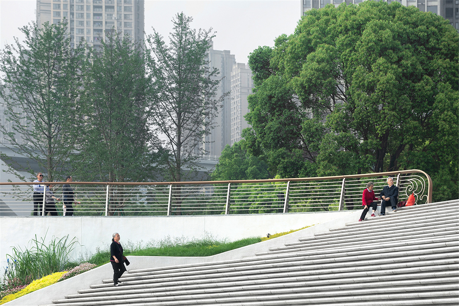
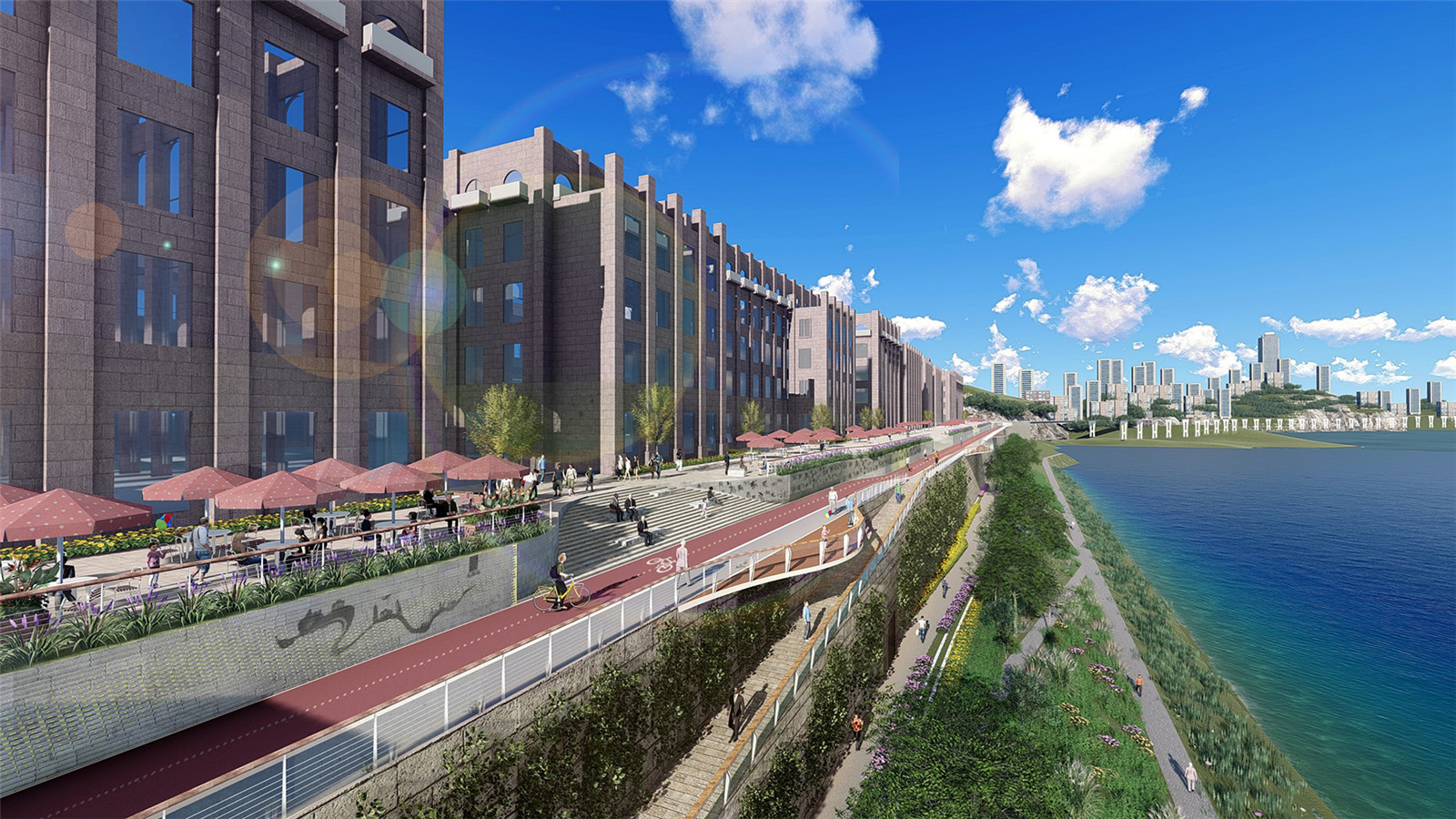
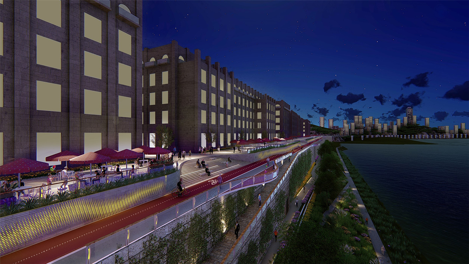
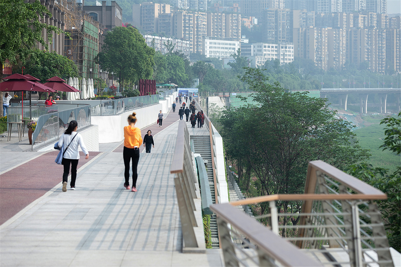
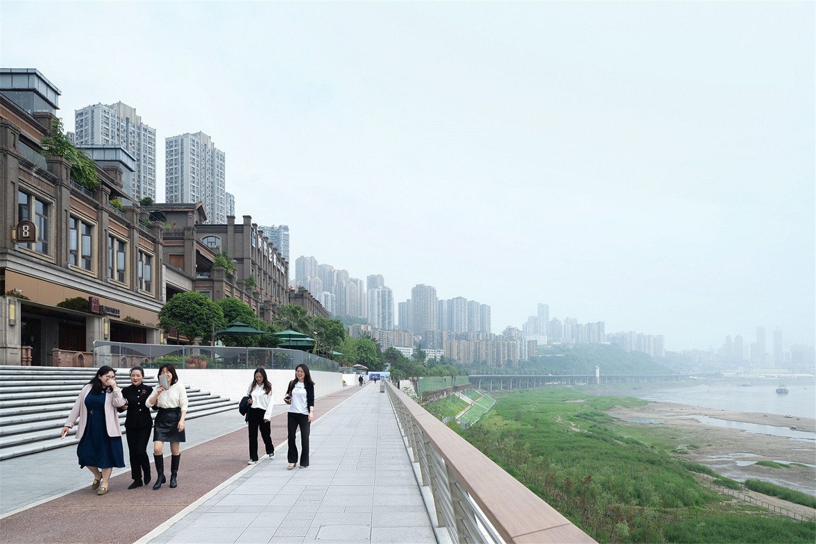
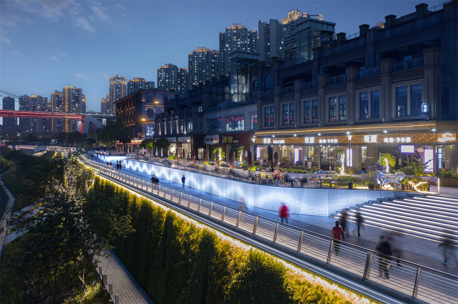
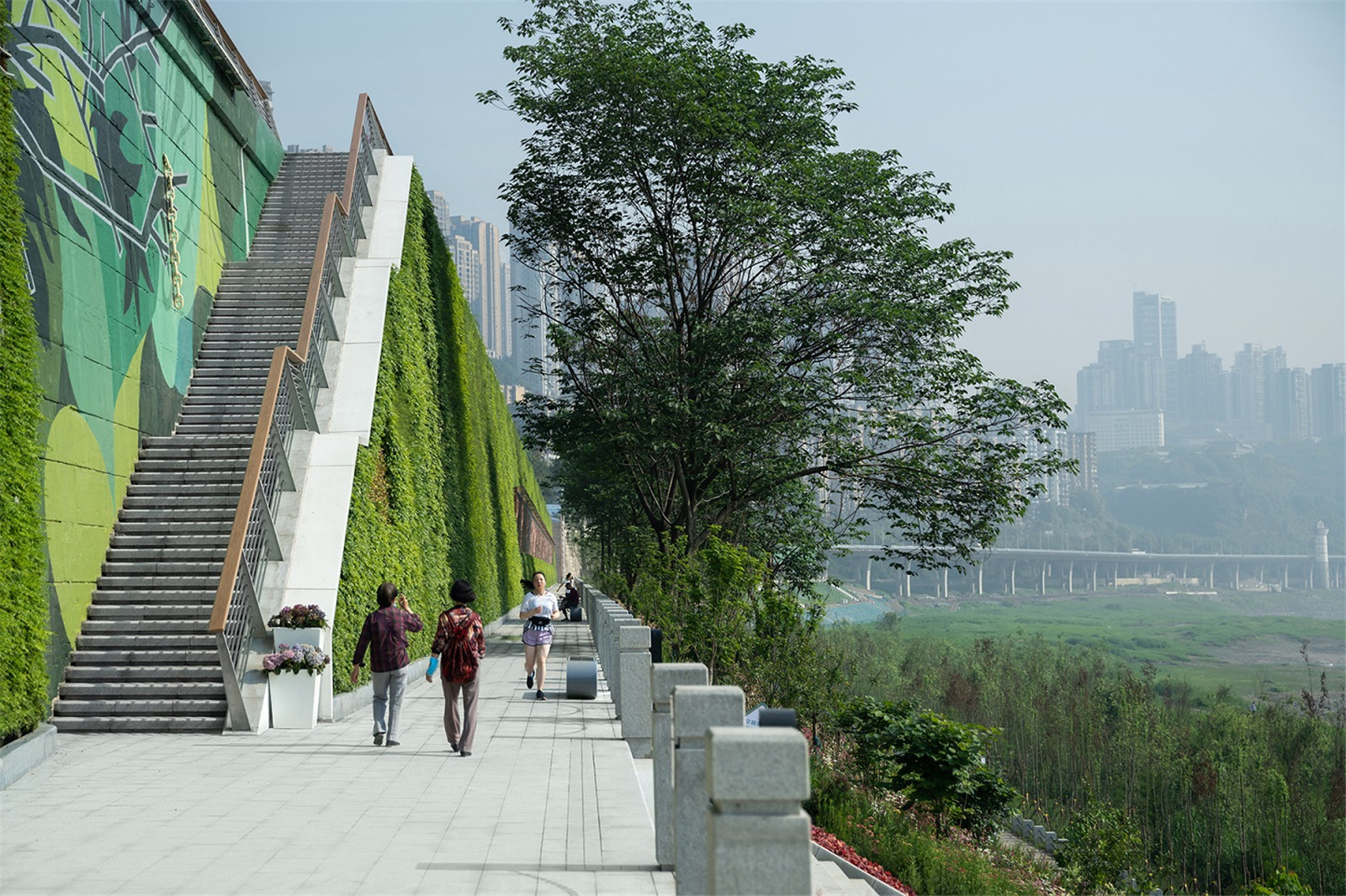
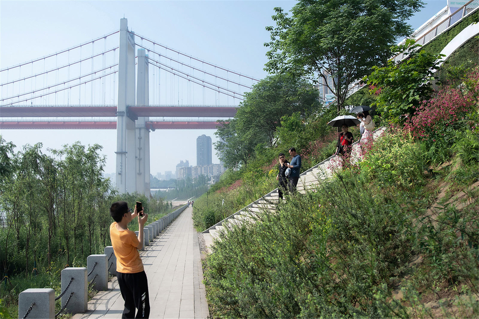
親近長(zhǎng)江的九大臺(tái)階與連貫“親水道”
Nine Steps Closed to the Yangtze River & Consistent "Riverside trails"
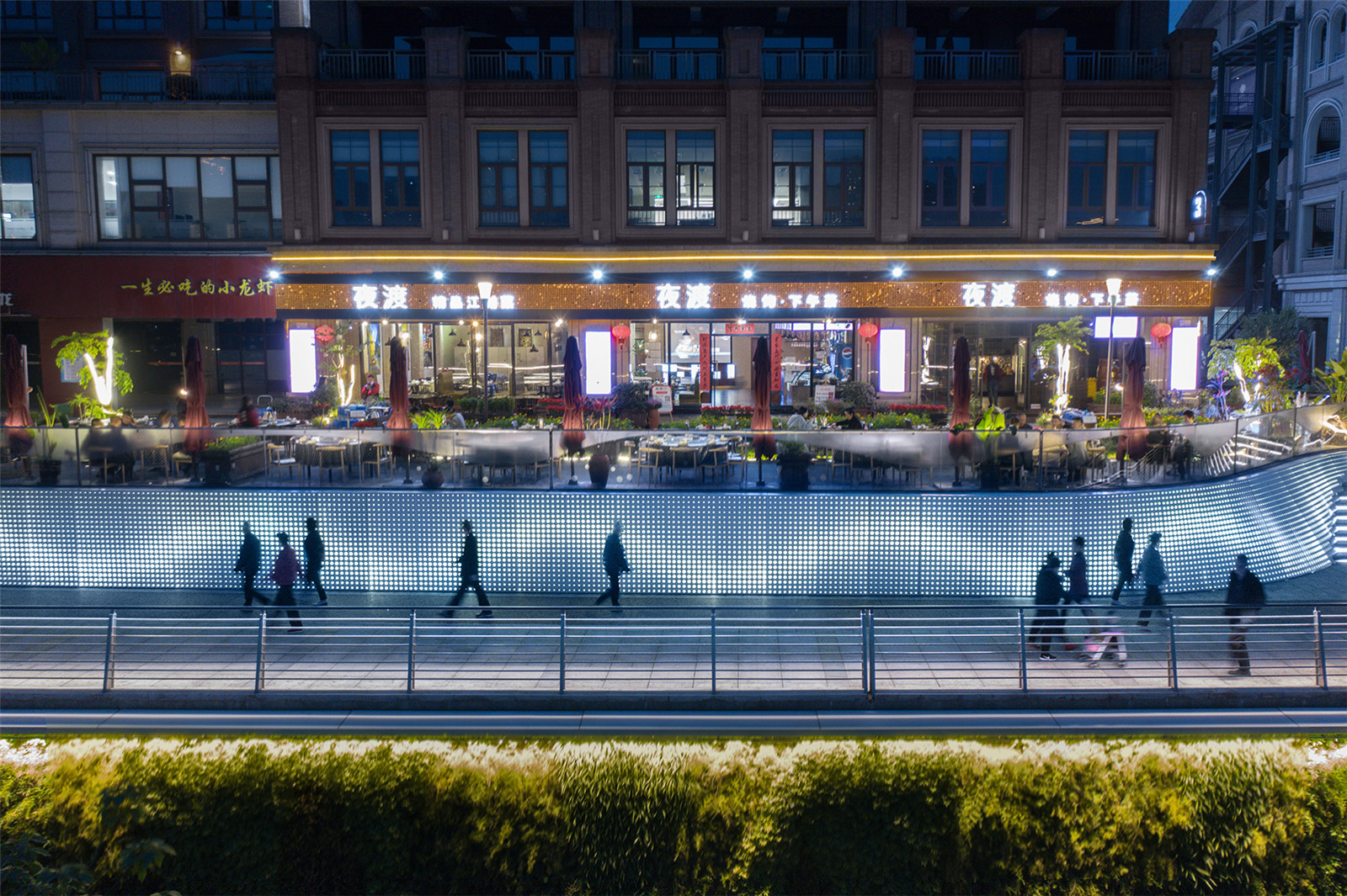
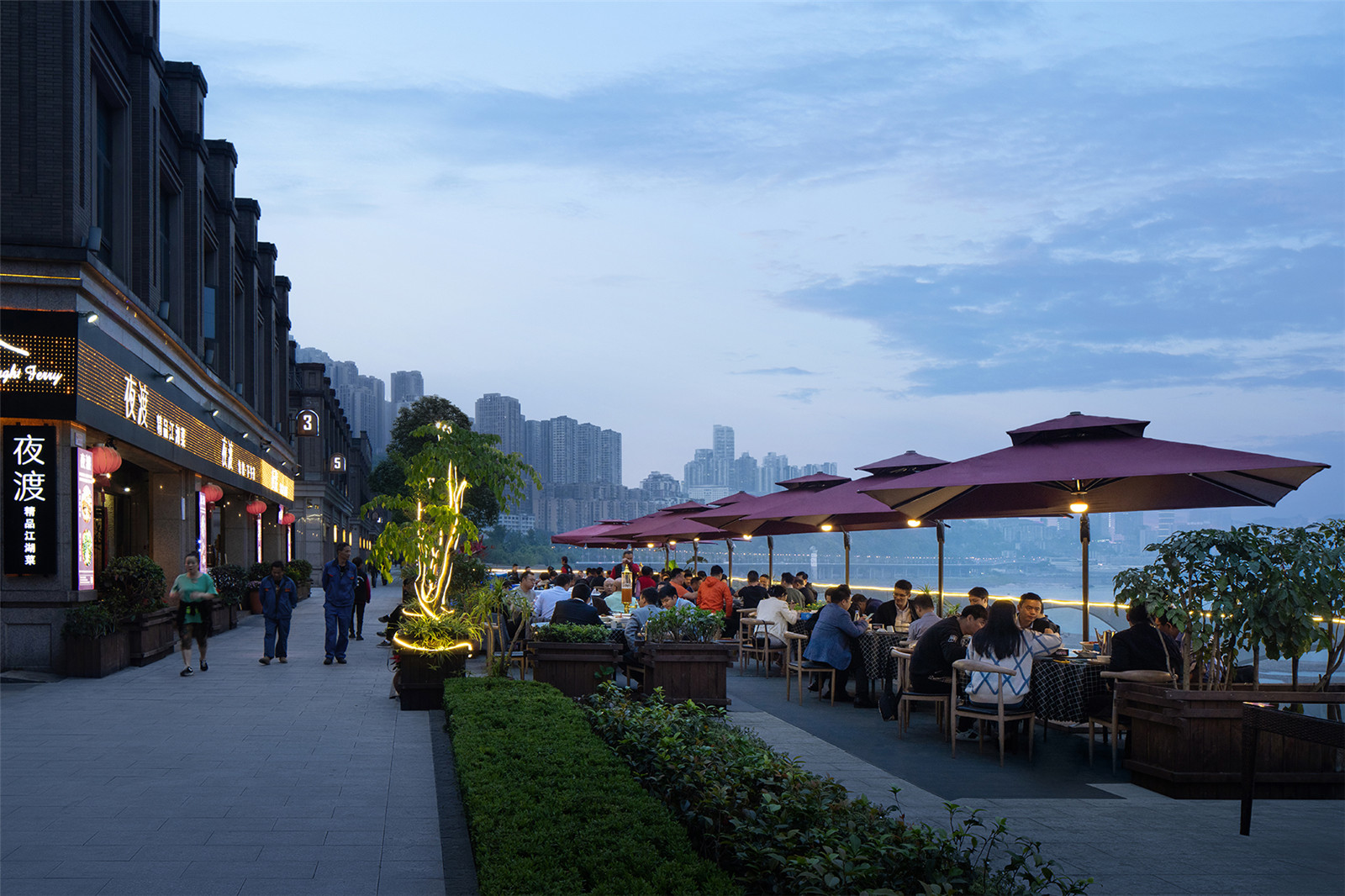
191-195m 是極端洪水淹沒區(qū)����,現(xiàn)狀出于對(duì)行洪安全的考慮��,進(jìn)行了加高加固���,之前被商業(yè)街的外擺所占據(jù)����。設(shè)計(jì)將沿江的5 米區(qū)域進(jìn)行適當(dāng)?shù)南鲁敛⒋蛲?����,形成低于商業(yè)外擺區(qū)域2 米的公共步行區(qū)�,也就是沿江全線貫通的活力道。這一舉措���,一方面明確界定了商業(yè)與公共使用的界限�;另一方面,改變了之前只有側(cè)向臺(tái)階連接濱江的方式�����,恢復(fù)重慶大臺(tái)階的傳統(tǒng)�����,形成九個(gè)特色大臺(tái)階與長(zhǎng)江直接對(duì)話�,使人們最大程度地親近長(zhǎng)江。
191-195m is inside the flood zone. For the safety, this area has been raised and reinforced, and used as the extended space for the commercial streets. The plan proposes to create a sunken plaza by making use of the 5-meter area along the river. This sunken space becomes a public pedestrian which is 2 meters lower than the extended space for the commercial streets. It is also a fitness trail that runs through the whole line along the river. On the one hand, it defines a clear boundary between commercial space and public space; On the other hand, it recreates the traditional steps of Chongqing by changing the way of connection of the side steps. People can get close to the Yangtze River to the greatest extent because of the nine distinctive steps which are directly face toward the river.
▼濱江商業(yè)改造前
Riverside commercial area before renovation

▼明確界定的商業(yè)與公共使用界限
Well-Defined Boundaries Between the Commercial And Public Use


▼商業(yè)外擺區(qū)域
Commercial Outside Space

▼低于商業(yè)外擺區(qū)域2米的公共步行區(qū)
Public pedestrian: 2 meters below the Commercial Outside Space

▼沿江全線貫通的活力道
Consistent "Vibrant trails" along the river

▼恢復(fù)了重慶大臺(tái)階的傳統(tǒng)�����,使人們最大程度地親近長(zhǎng)江
Enable people get close to the Yangtze River to the greatest extent by Recovering the traditional Steps of Chongqing

▼改變側(cè)向臺(tái)階的連接方式����,恢復(fù)重慶大臺(tái)階的傳統(tǒng)
Restore The Traditional Steps of Chongqing by Changing the way of Connection of the side steps

▼親近長(zhǎng)江的九個(gè)特色大臺(tái)階
Nine Steps Close To The Yangtze River

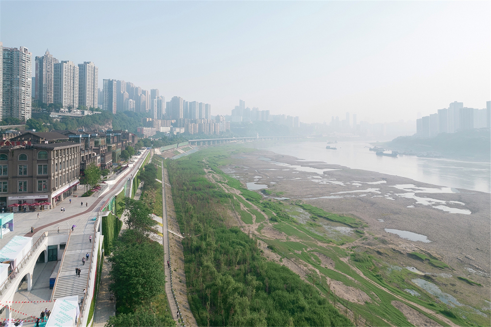
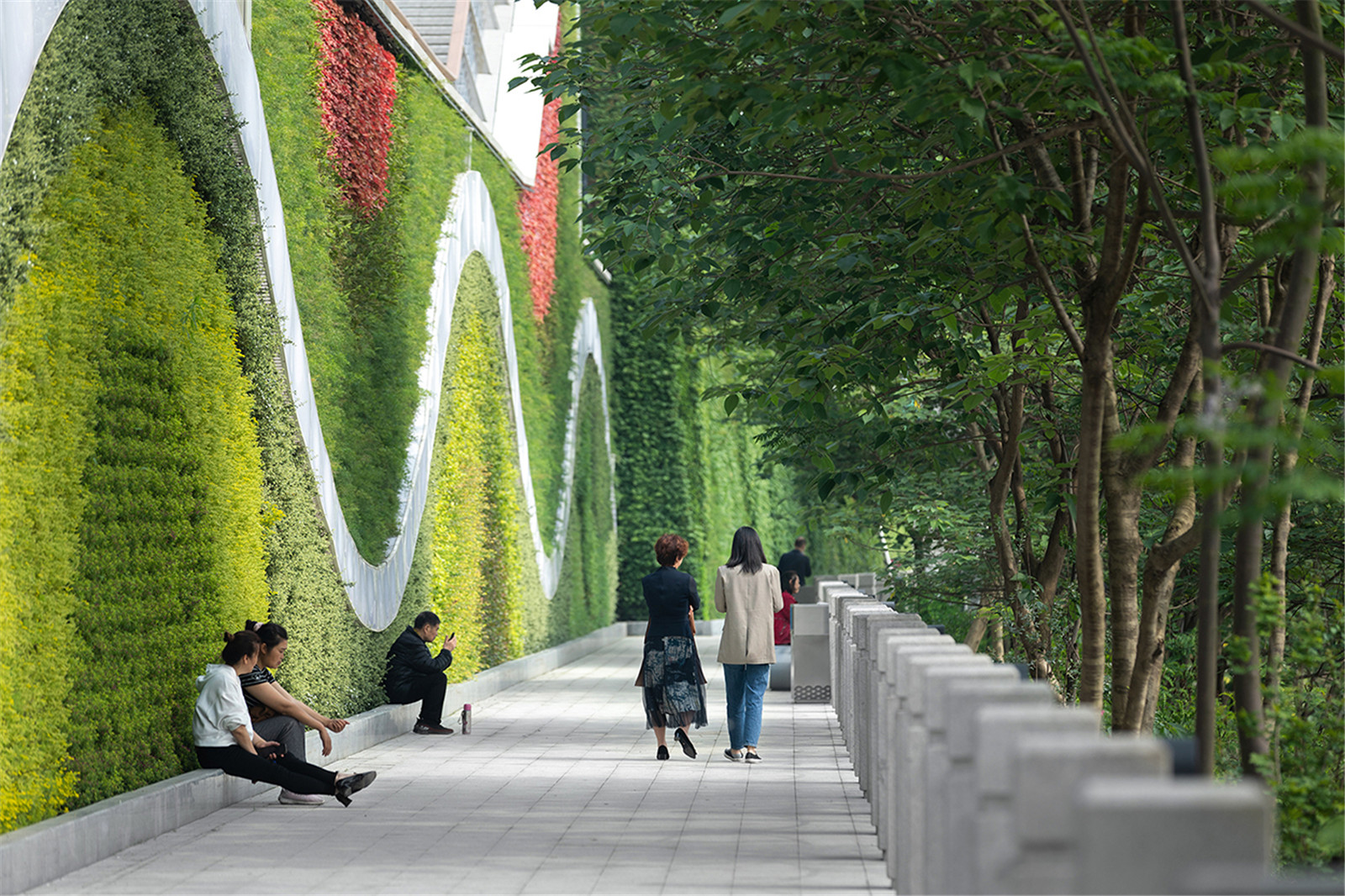
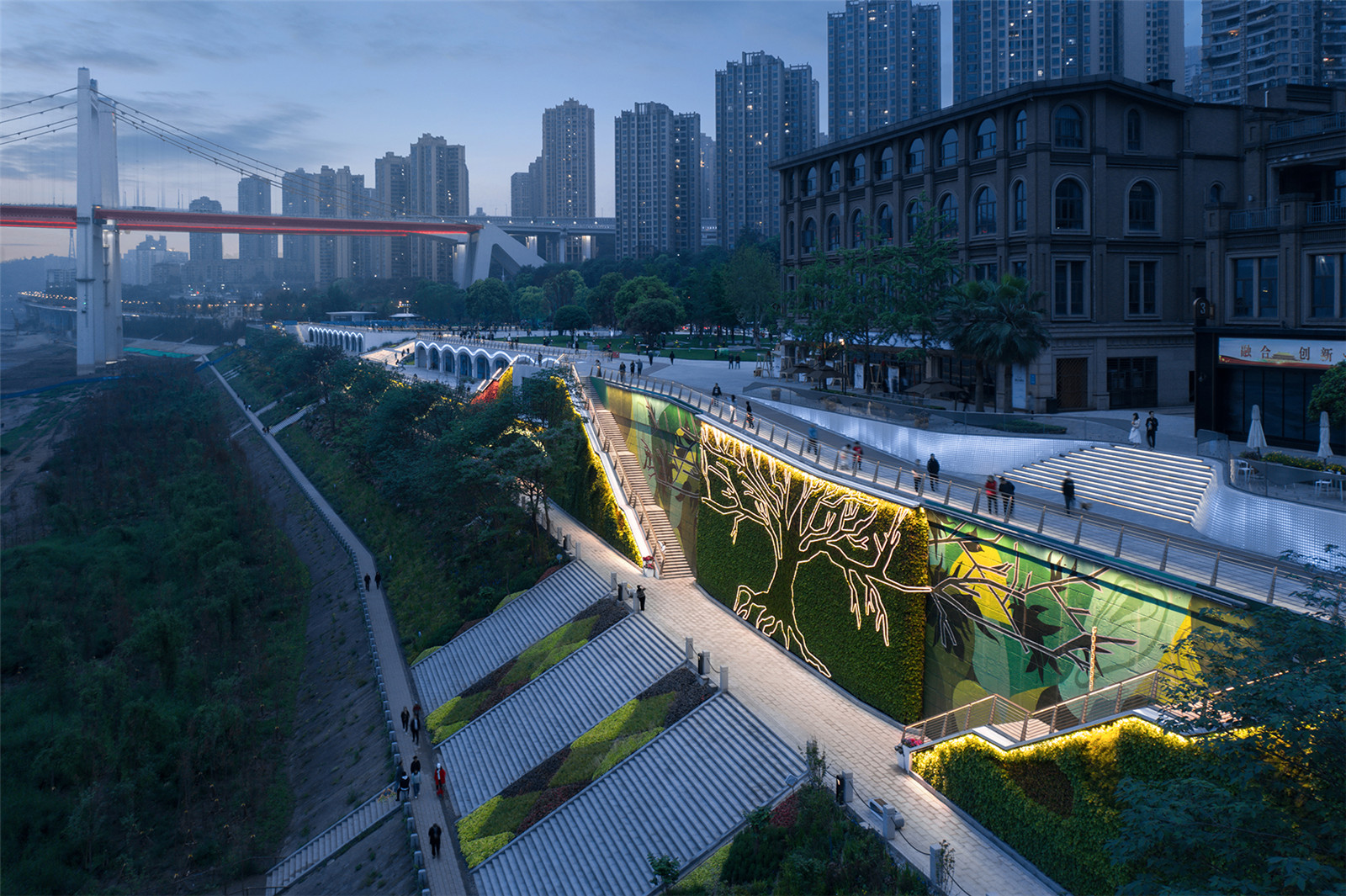
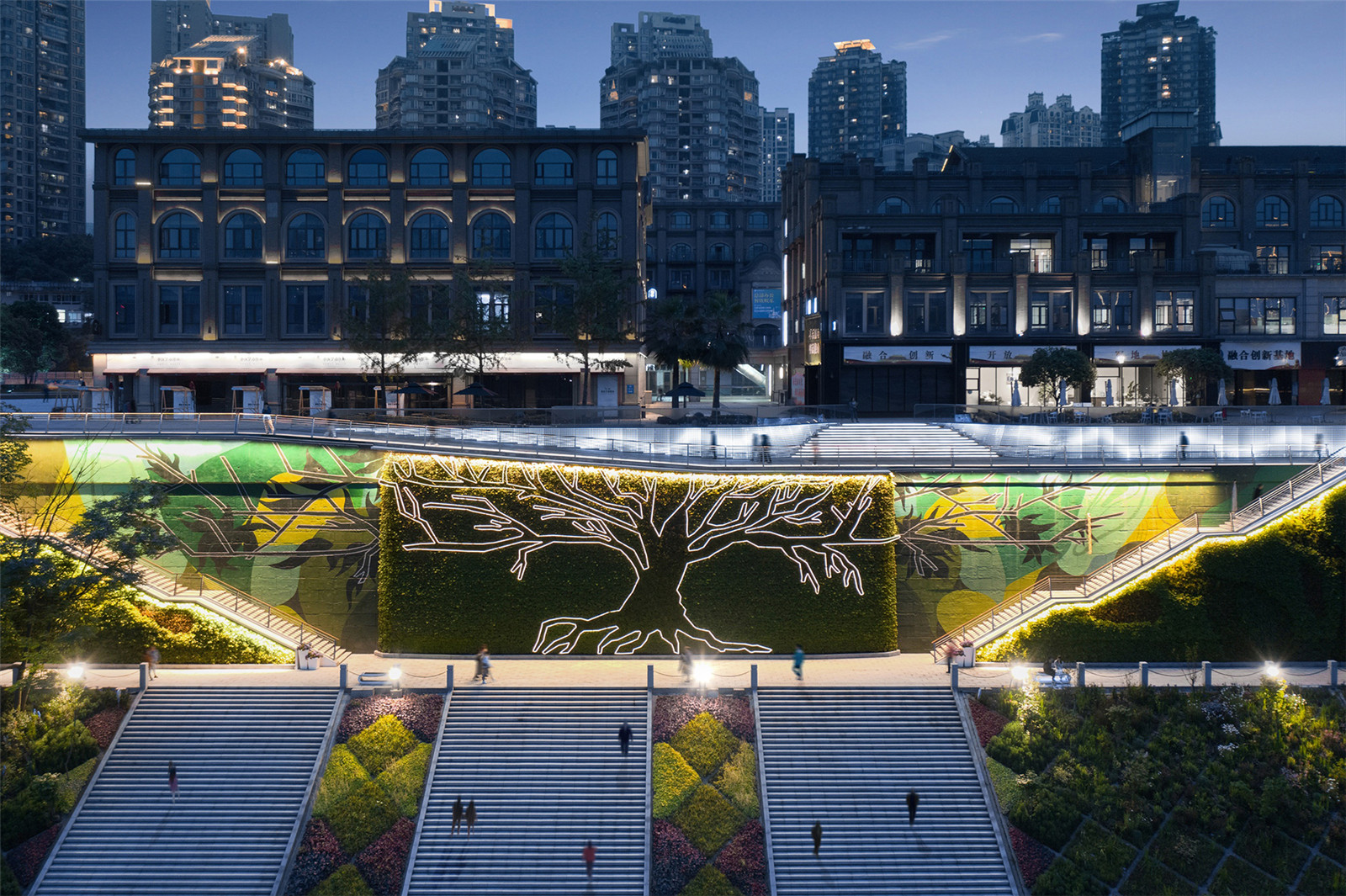
綠色與本地文化柔化防洪墻的分割
Green And Local Culture Soften the division of Flood Wall
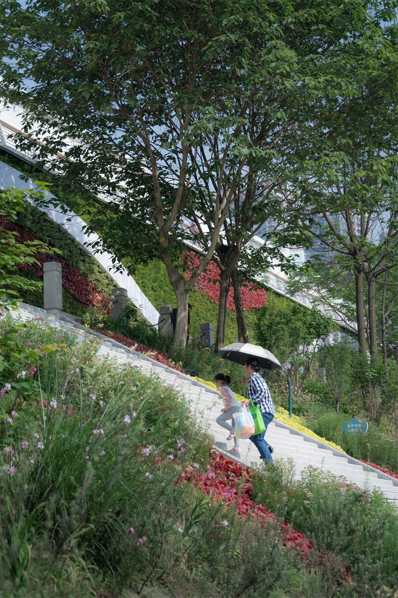
185-195m 是偶爾(10 天)會(huì)被洪水淹沒的區(qū)域����,然而現(xiàn)狀高達(dá)十米的混凝土防洪墻�,對(duì)江灘區(qū)與公共景觀帶,形成了一道生硬的分割����。設(shè)計(jì)采用最先進(jìn)的壘土技術(shù)��,打造了一道低維護(hù)的綠色之墻�,考慮185 米步行道的步行體驗(yàn)需求�����,設(shè)計(jì)了長(zhǎng)達(dá)180 米的長(zhǎng)江萬里圖�。在主入口廣場(chǎng)的大臺(tái)階區(qū),以重慶市樹黃葛樹形象與綠墻共同形成一個(gè)標(biāo)志性的節(jié)點(diǎn)�,賦予了防洪墻的景觀與文化特色。
From 185m to 195m is the zone that will be inundated occasionally (for about 10 days). The current 10-metre concrete flood wall has separated the riverfront area and the public landscape area. To solve the problem, the plan adopts the latest soil laying technology to build a low-maintenance green wall. It creates a 180-meter long Yangtze River map and enrich the walking experience of the 185-meter walking path. In the big-step area of the main entrance square, the plan creates an iconic node by applying the shape of Kudzu trees (the tree of Chongqing) and the green wall, which adds the landscape and cultural characteristics for the flood wall.
▼防洪墻現(xiàn)改造前
Flood wall before renovation

▼采用先進(jìn)的壘土技術(shù)�����,打造成低維護(hù)的綠色之墻
Adopt advanced soil laying technology to build a green wall with low maintenance

▼防洪墻的景觀與文化特色
Landscape And Cultural Features Of the Flood Wall

▼重慶市樹黃葛樹形象與綠墻共同形成標(biāo)志性的節(jié)點(diǎn)
the iconic node with the green wall and the Kudzu trees


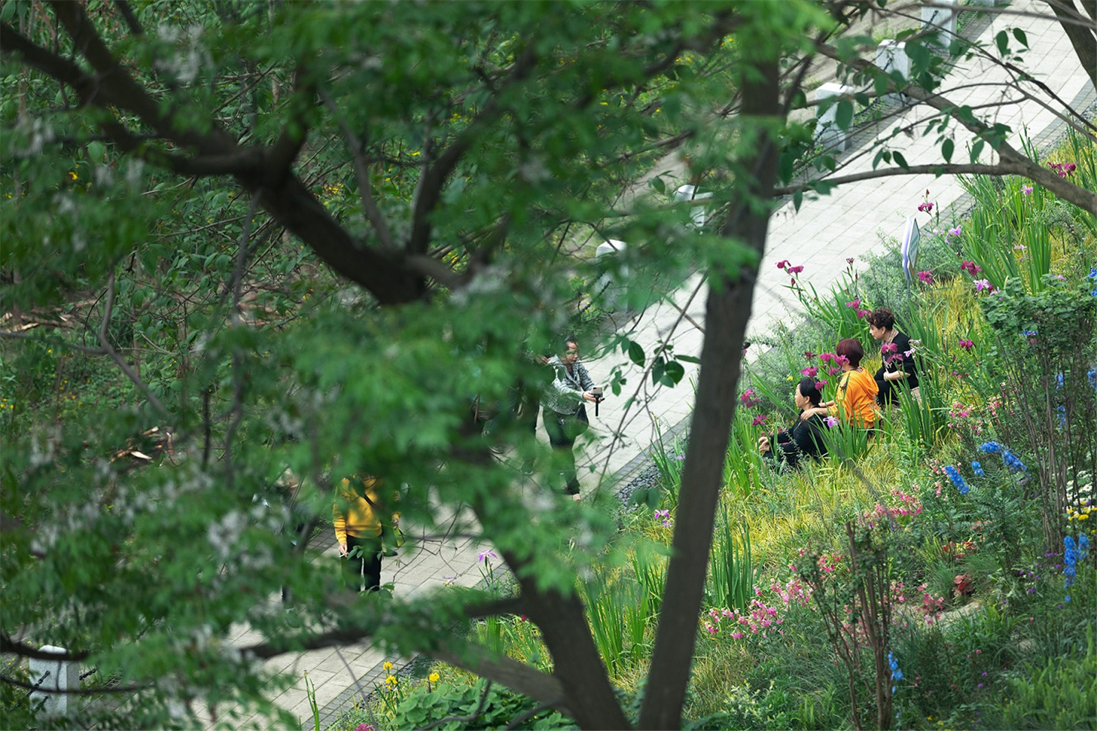
本地耐水植物園提升濱江景觀生態(tài)
Local Botanical Gardens of water tolerant plants Enhance the Riverside Ecosystem and landscape
175-185m 是短期淹沒區(qū)(14 天)�����,當(dāng)前的野生植物長(zhǎng)勢(shì)較好����。項(xiàng)目提出九龍花園的理念,收集了本地耐水淹的植物�����,進(jìn)行九個(gè)特色植物花園的打造,使該區(qū)域在不同的季節(jié)����,成為游客與市民觀賞的重要場(chǎng)所。
From 175m to 185m is the short-term inundation zone (for about 111 days). Wild plants grow well at current. The plan puts forward the concept of Kowloon Garden. It collects local water tolerant plants and creates nine special botanical gardens. It makes the area become an important place for visitors to enjoy in different seasons.
▼短期淹沒區(qū)改造前
the short-term inundation zone Before reconstruction

▼本地耐水植物園提升濱江景觀生態(tài)
Local Botanical Gardens of water tolerant plants Enhance the Riverside Ecosystem and landscape

▼單一的草坪被豐富的植物群落所代替
The single lawn is replaced by the diverse plant communities

▼游客與市民觀賞的重要場(chǎng)所
Important place for tourists and citizens to enjoy


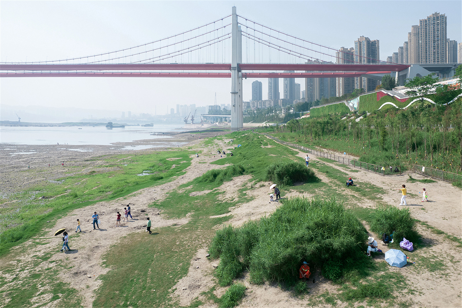
保持自然進(jìn)程與進(jìn)化可能的灘地
keep the original status of the beach to maintain the natural process and remain the possibility of evolution
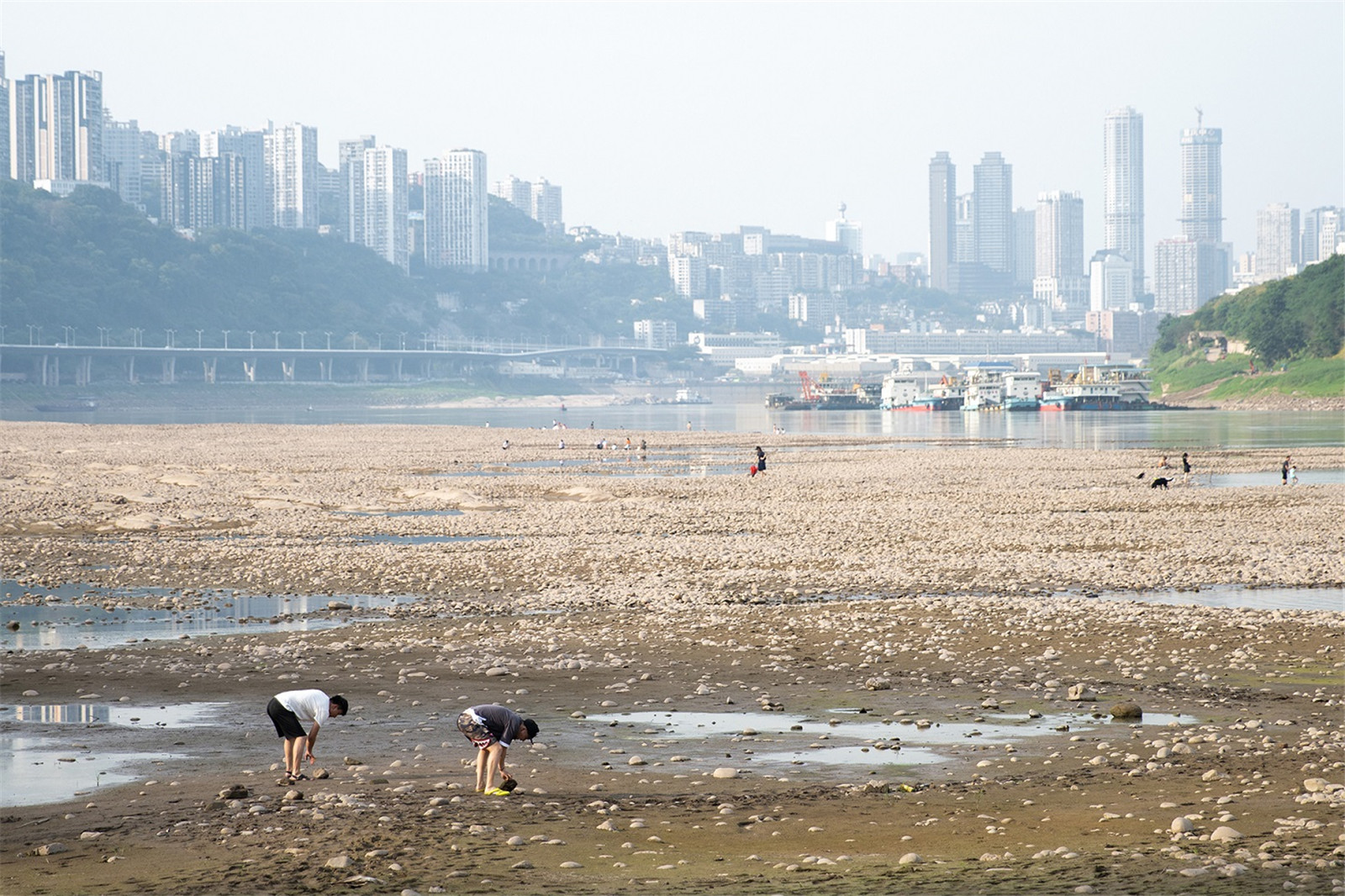
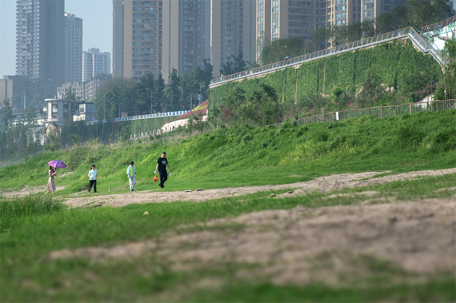
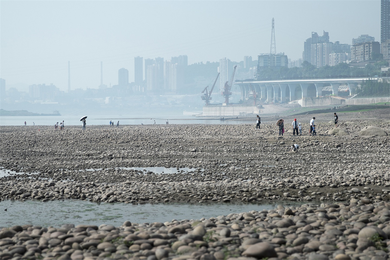
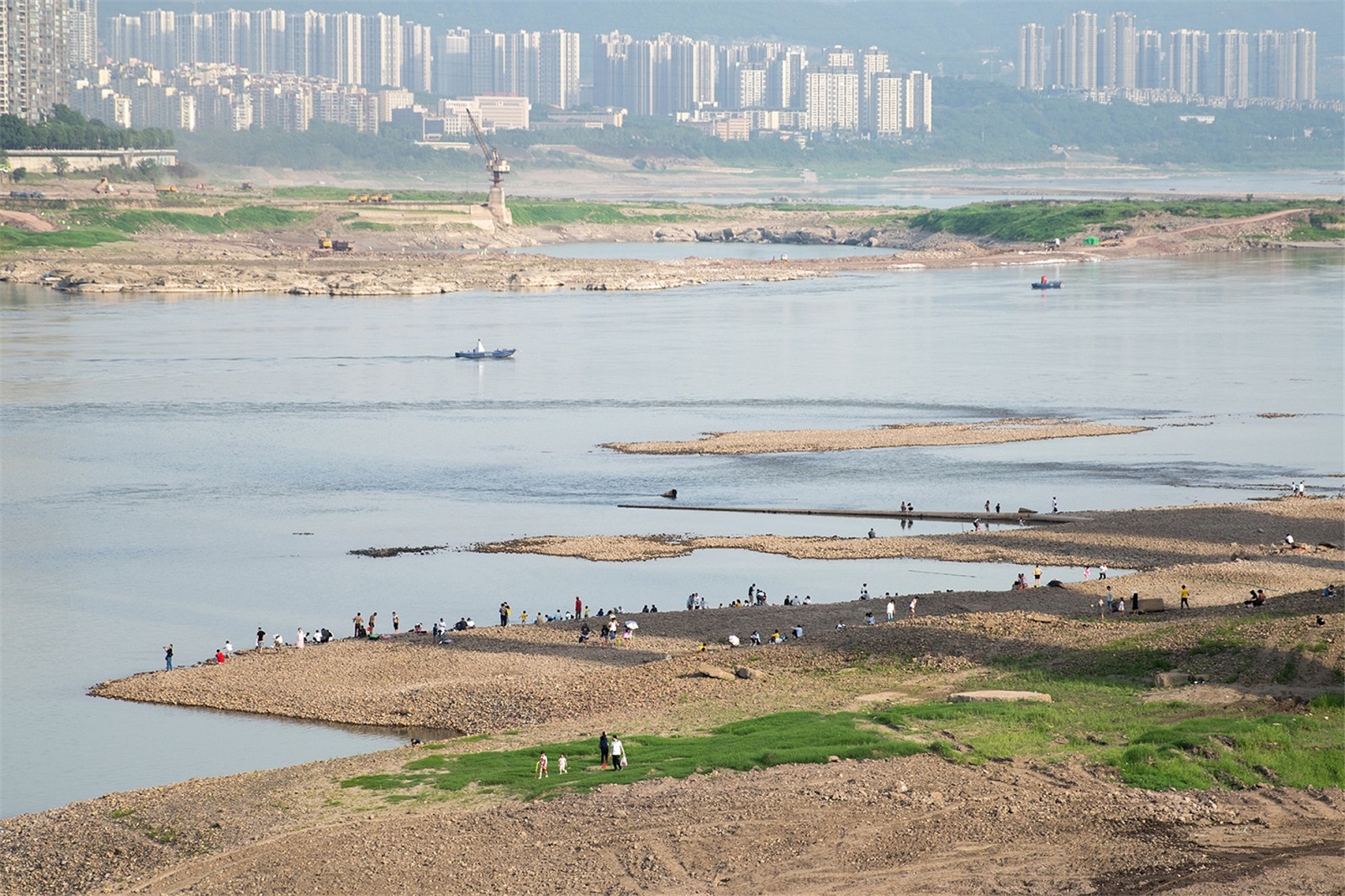
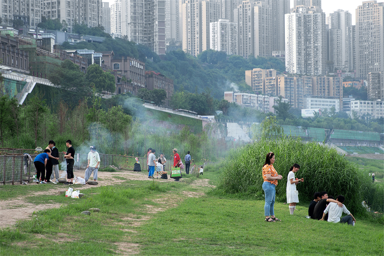
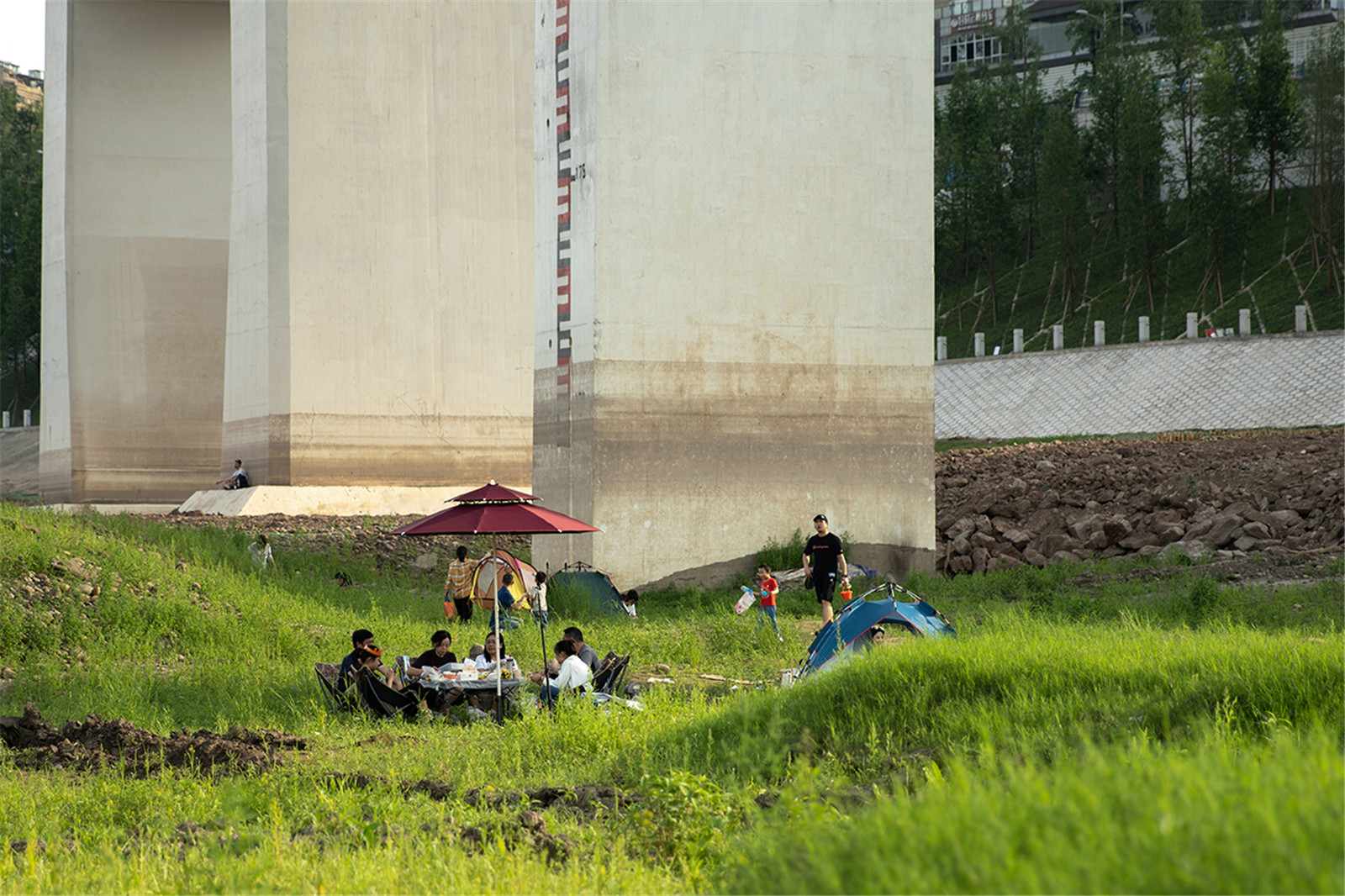
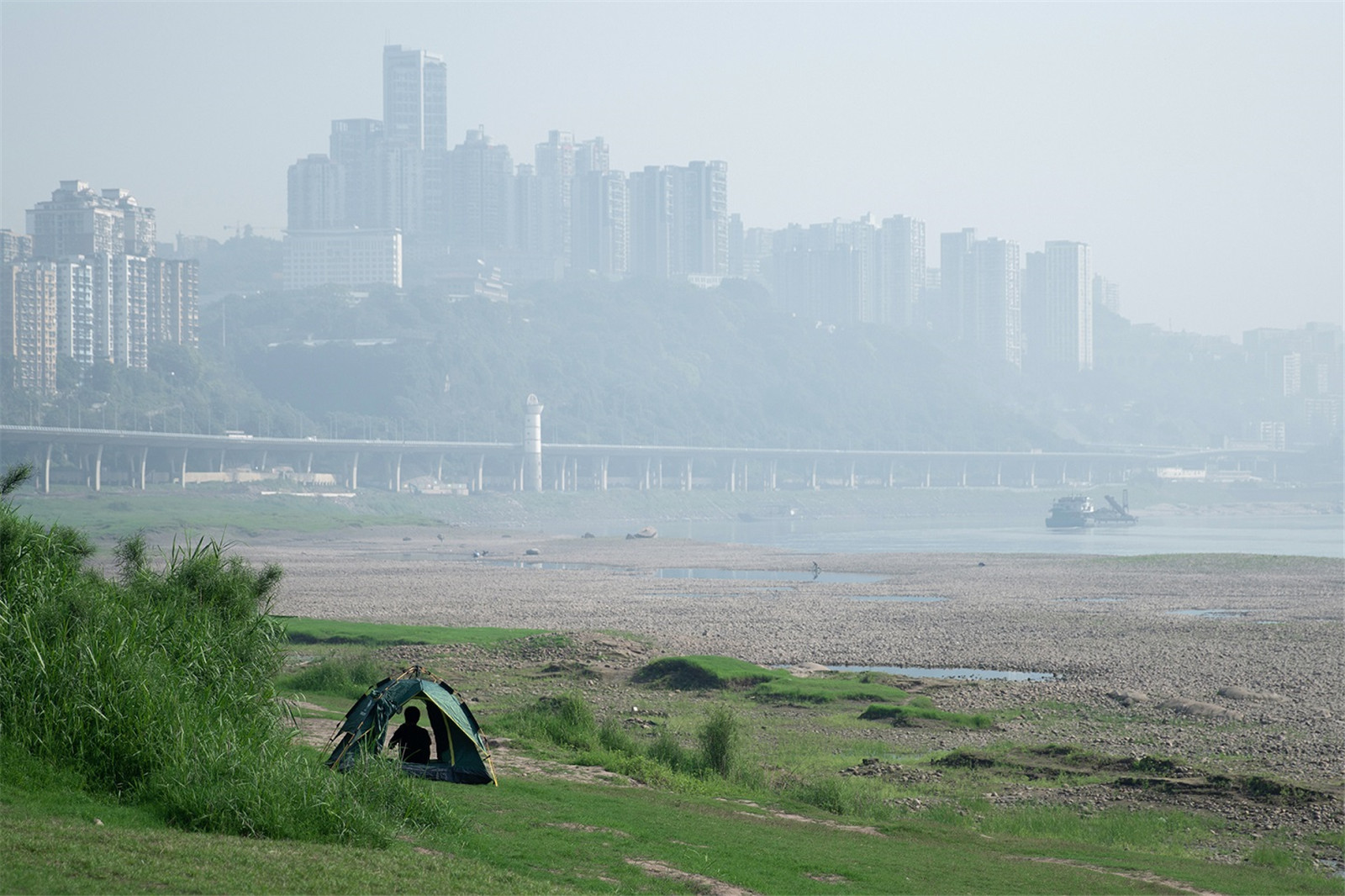
<175 m 是經(jīng)常被淹的區(qū)域����,且灘地范圍較大,該區(qū)域在不同年份往往因?yàn)樗坎煌纬刹煌娘L(fēng)貌�。不同于早期采用的人工干預(yù)的植物策略,設(shè)計(jì)師們采取了讓自然做功的方式���,保持其自然的進(jìn)程����,并留出自然進(jìn)化的可能性���。該區(qū)域在低水位期��,成為了市民活動(dòng)與游憩的場(chǎng)所。
<175 m is an area that is often flooded and most of it is beach This area tends to have various features due to the different water levels in different years. Instead of the interventions with artificial plants, this plan keeps the original status of the beach to maintain the natural process and remain the possibility of evolution. In the low-water-level stage, the area becomes a recreation and relax place.
▼保持自然進(jìn)程與進(jìn)化可能的灘地
keep the original status of the beach to maintain the natural process and remain the possibility of evolution


▼灘地成為市民活動(dòng)與游憩的場(chǎng)所
Beach becomes a place for activities and recreation


小結(jié):韌性濱水���,重新連接人與自然
Project Summary:Resilient Waterfront Reconnects Human And Nature
韌性濱水��,強(qiáng)調(diào)自然進(jìn)程與公共生活的相互適應(yīng)與進(jìn)化���。首先�,要建立起生態(tài)���、社會(huì)�����、空間的秩序�����,這是互相共存的前提�����;其次�,是在本地語境下���,滿足以人為本的公共需求�;最后,是打造獨(dú)一無二的場(chǎng)所精神�����。
Resilient waterfront landscape is the mutual adaptation and evolution of natural process and public life. First of all, it is necessary to establish the order of ecology, society and space, which is the premise of coexistence. Secondly, it is essential to meet the public needs by understanding the local context. Finally, it is required to build the unique spirit of the site.
項(xiàng)目信息
項(xiàng)目所在地(必填):重慶市?九龍坡區(qū)�����、渝中區(qū)
項(xiàng)目名稱(必填):重慶“兩江四岸”之九龍外灘
詳細(xì)地址:重慶市九濱路九龍灘
項(xiàng)目規(guī)模:91.24公頃(其中九龍坡區(qū)長(zhǎng)度2.1公里��,面積46.41公頃��;渝中區(qū)長(zhǎng)度2.1公里�����,面積44.82公頃)
設(shè)計(jì)公司:MYP邁柏/林同棪國(guó)際
施工單位:中國(guó)十九冶集團(tuán)有限公司
照明:北京新時(shí)空科技股份有限公司
垂直綠化:湖南尚佳綠色環(huán)境有限公司
委托方:重慶市城鄉(xiāng)建設(shè)委員會(huì)���、重慶市城市建設(shè)投資(集團(tuán))有限公司
建成時(shí)間:2021年
攝影師(或照片版權(quán)歸屬方):三棱鏡/MYP邁柏
Project location (required) : Jiulong District and Yuzhong District, Chongqing City
Project name (required) : The Kowloon Bund of the “two rivers and four banks” in Chong-qing
Detailed address: Jiulongtan, Jiubin Road, Chongqing
Project scale: 91.24 hectares (2.1 km in length and 46.41 hectares in the Jiulongpo District; 2.1 kilometers in length and 44.82 hectares in the Yuzhong District)
Design firm: MYP INC. /TYLIN international
Construction company: China 19th Metallurgical Group Co., Ltd.
Lighting: Beijing New Space Technology Co., LTD
Green walls: Hunan Shangjia Green Environment Co., Ltd
Client: Chongqing Housing and Urban Rural Construction Commission, Chongqing City Construction Investment Corporation Co., Ltd
Completed: 2021
Photographer (or copyright owner) : PRISM / MYP INC.
版權(quán)聲明:本文版權(quán)歸原作者所有�����,請(qǐng)勿以景觀中國(guó)編輯版本轉(zhuǎn)載����。如有侵犯您的權(quán)益請(qǐng)及時(shí)聯(lián)系,我們將第一時(shí)間刪除����。
投稿郵箱:info@landscape.cn
項(xiàng)目咨詢:18510568018(微信同號(hào))


 京公海網(wǎng)安備 110108000058號(hào)